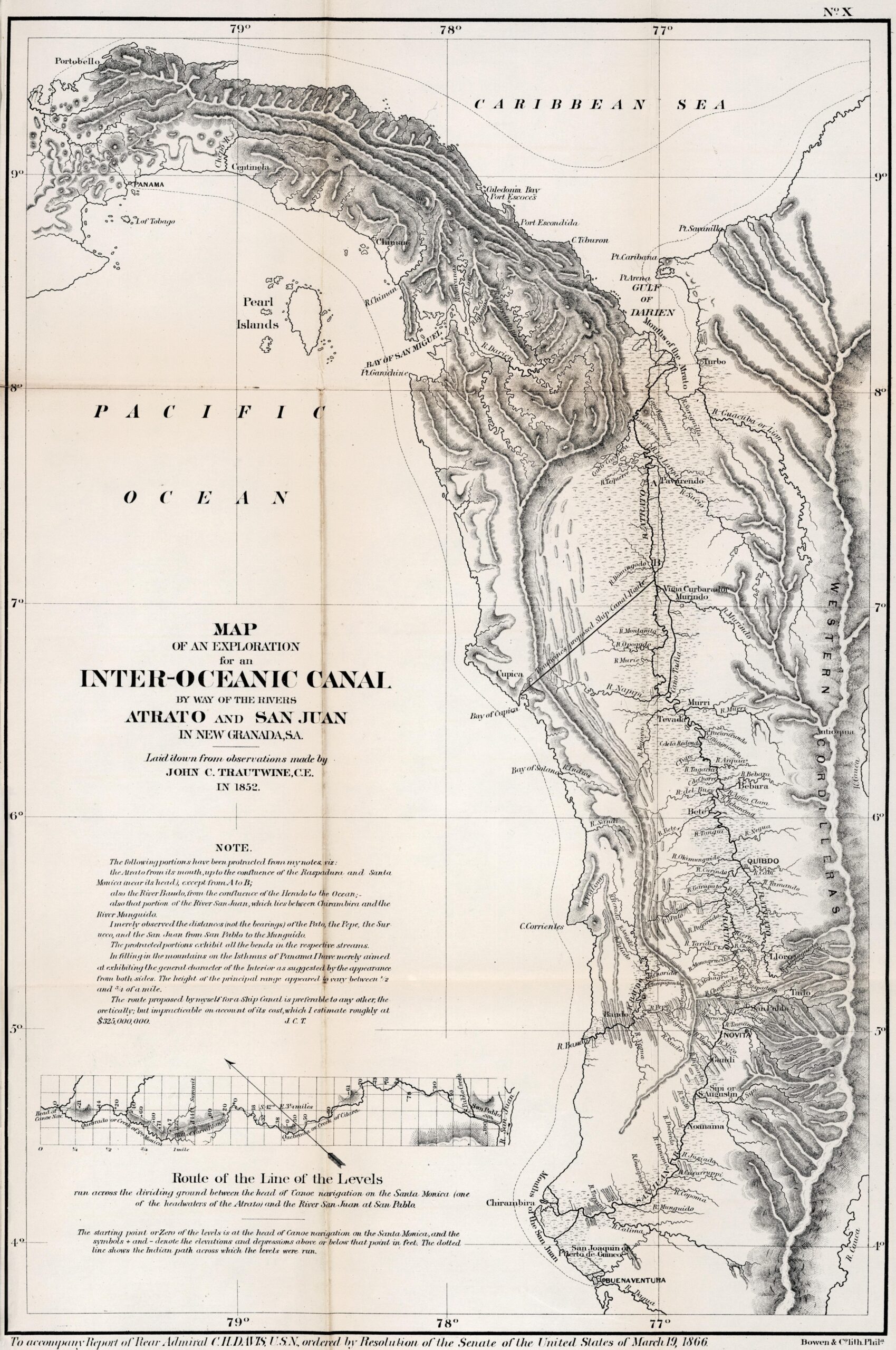
This map, drawn by the civil engineer John C. Trautwine in 1852, was published in 1866 in Washington as part of the...
Hydrological maps (22 maps)
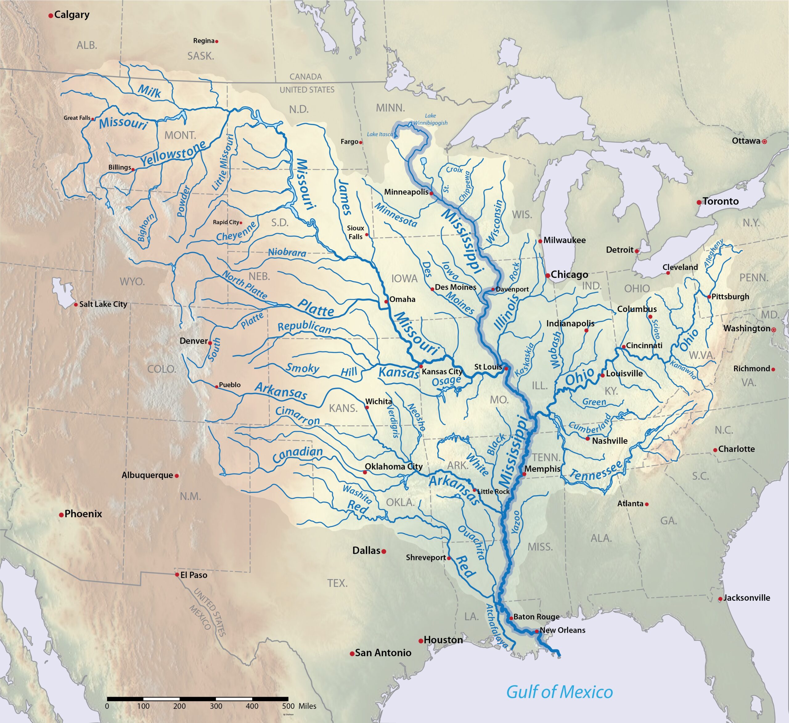
Map of the Mississippi River (2016)
This map, created by Shannon1 for Wikimedia Commons in 2016, shows the layout of the Mississippi River, its watershed and...

Average annual rainfall in Europe (2023)
This map was created by Perrin Remonté in 2023 as part of the #30DayMapChallenge initiative. The map shows the average annual rainfall in...

Historical Courses of the Mississippi, Plate 6 (1944)
This map forms part of the Geological Survey of the Lower Mississippi River Alluvial Valley, a report commissioned from the geologist…

Europe seen through a drop of water (2024)
This map, published by Perrin Remonté in 2024, shows Europe divided into two major hydrological basins. The entire... is shown in red.
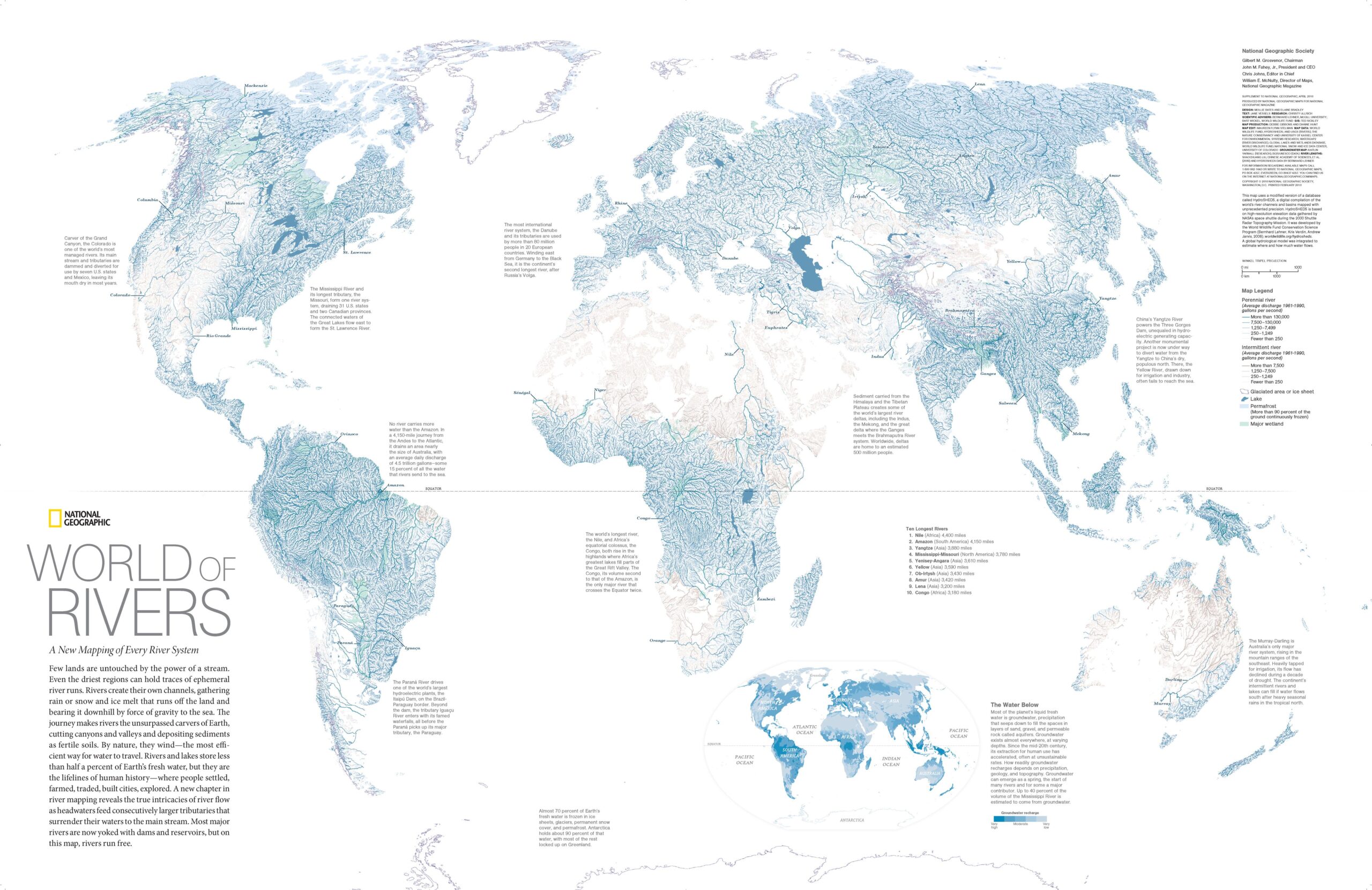
A World of Rivers (2010)
This map, published by National Geographic magazine in 2010, shows the world's most important freshwater bodies.
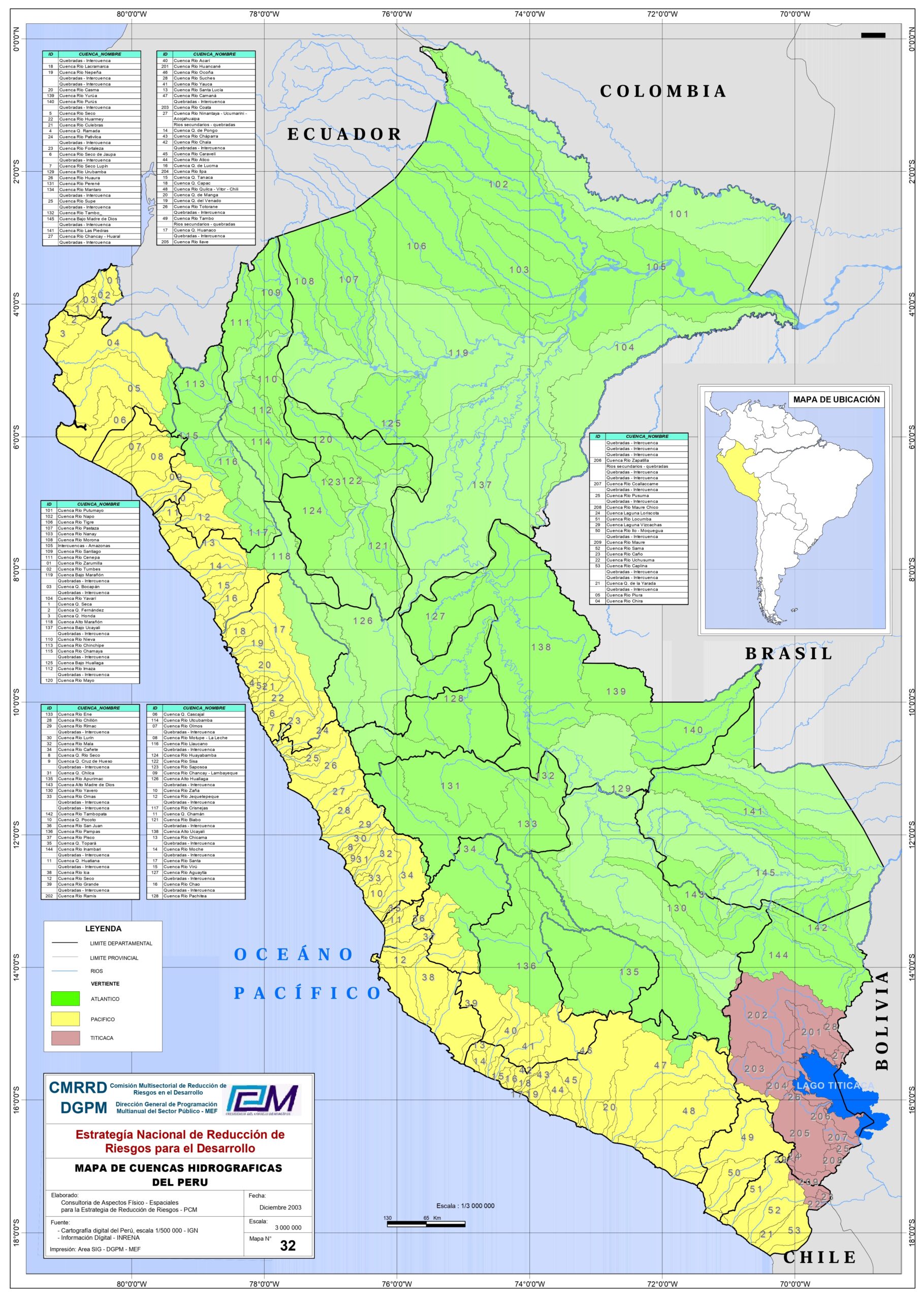
River basins of Peru (2003)
This map, drawn up in 2003 by a consultancy firm at the request of the Presidency of the Council of Ministers of Peru, shows...

Endorheic basins of the world (2024)
This map, published by Perrin Remonté in 2024, shows all the endorheic basins in the world. Endorheic basins are areas whose rivers...

Amazon River Basin (2024)
This map, published by Gernot Nikolaus in 2024, shows the Amazon River basin. On the map, you can...

Average annual rainfall in Guatemala (2023)
This map was elaborated by the Rafael Landívar University in 2023 with data compiled by the National Geographic Institute of...

Map of European river basins (2022)
This map, created by Adam Symington in 2022, shows all of Europe's rivers using data from WWF's HydroSHEDS project. For the...

Map of Africa's river basins (2023)
This map, created by Adam Symington in 2023, shows all the rivers in Africa with data from the WWF project...

Map of the Obi River (2018)
This map, created by Shannon1 for Wikimedia Commons in 2018, shows the course of the Obi River, its catchment area and...

River water discharge into the Mediterranean (2013)
This map, published by the Norwegian NGO GRID-Arendal in 2013, shows the main rivers of the Mediterranean and their discharge. In...

Map of the Colorado River, Argentina (2018)
This map, created by Shannon1 for Wikimedia Commons in 2018, shows the course of the Colorado River in Argentina, its catchment area…
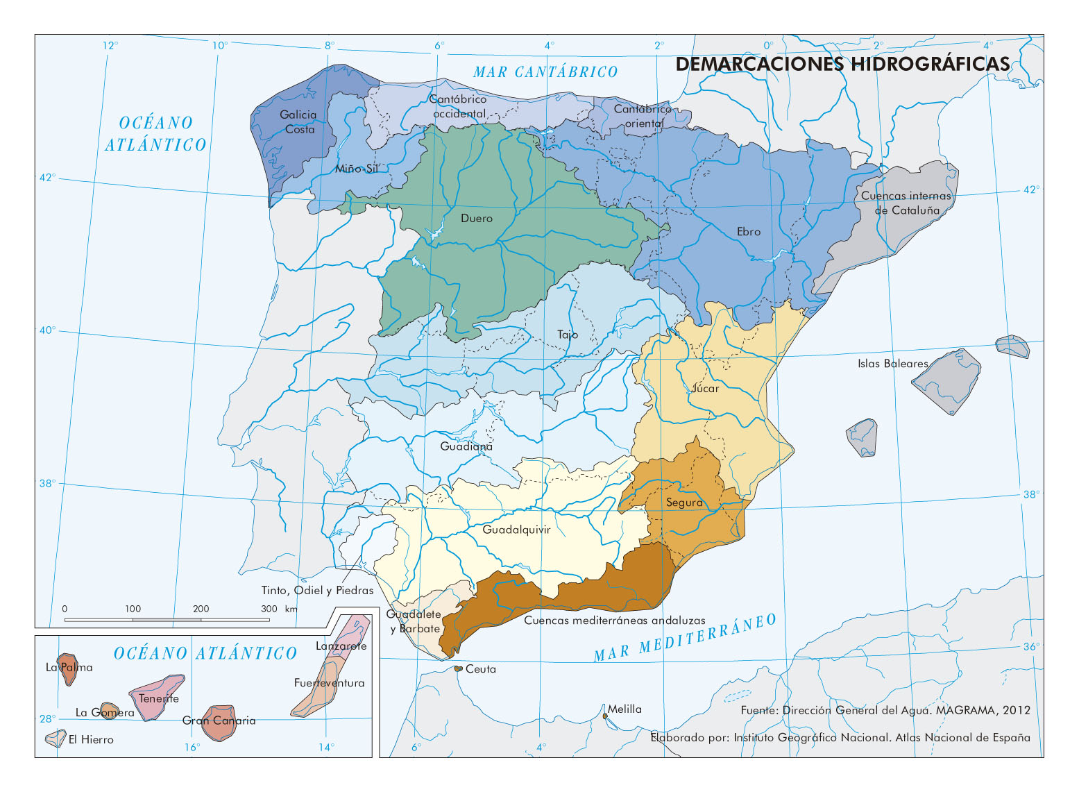
River basin districts in Spain (2012)
This map, part of the National Atlas of Spain, shows the river basin districts of Spain. River basin districts are regions...
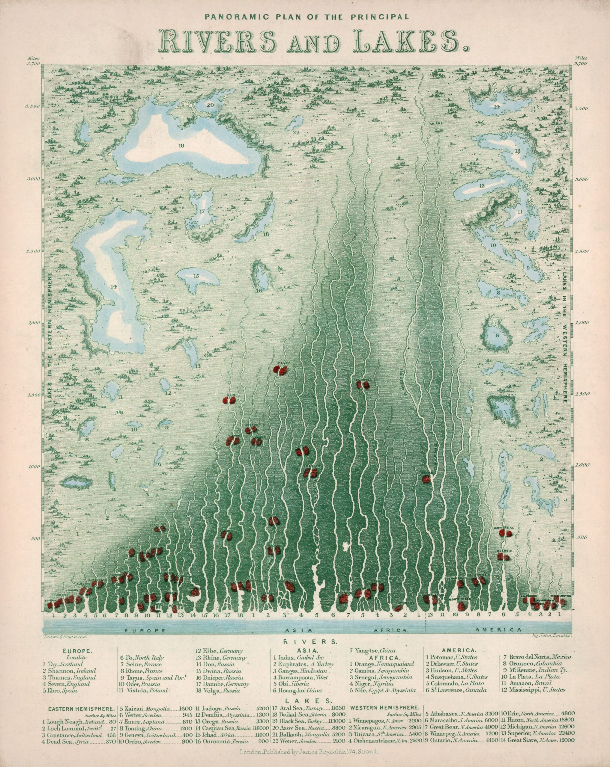
Panoramic map of the main rivers and lakes (1850)
This work, drawn by British cartographer John Emslie and published by James Reynolds in 1850, forms part of a...

Map of the Mekong River (2018)
This map, created by Shannon1 for Wikimedia Commons in 2018, shows the course of the Mekong River, its watershed, and its...
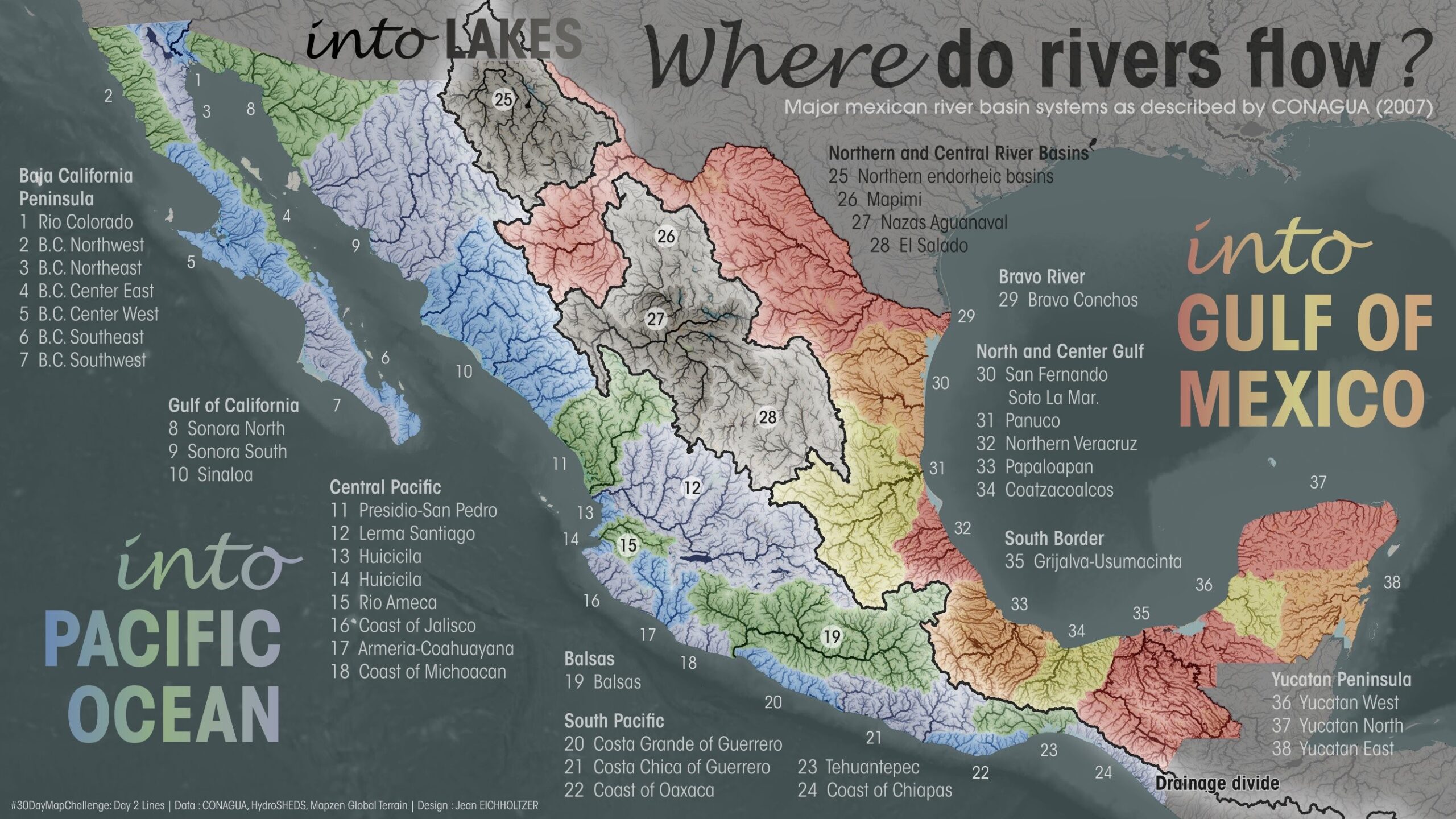
River basins of Mexico (2023)
This map was published by Jean Eichholtzer in 2023 as part of the #30DayMapChallenge initiative. The map shows the river basins of Mexico. All...
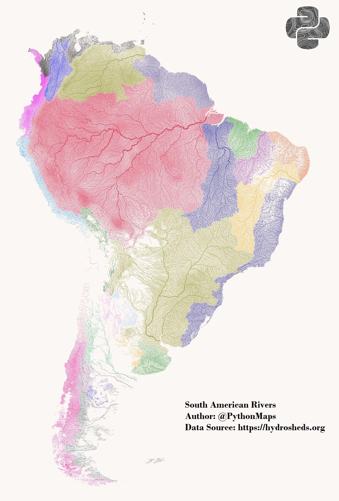
Map of South American river basins (2022)
This map, created by Adam Symington in 2022, shows all the rivers in South America with data from the WWF project...
 Español
 English (UK)