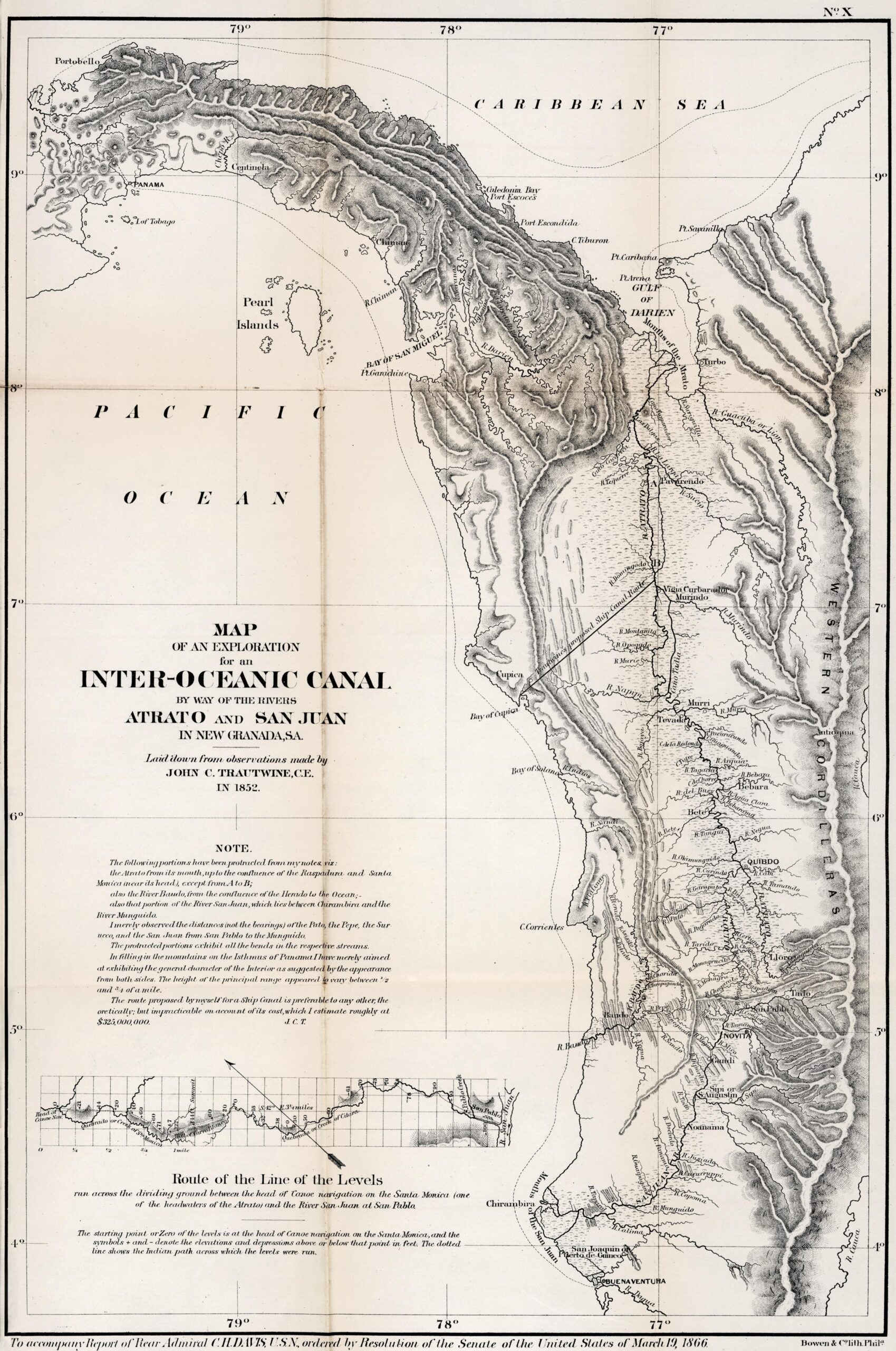
This map, drawn by civil engineer John C. Trautwine in 1852, was published in 1866 in Washington as part of a U.S. Senate study to evaluate possible canals and railways that could link the Atlantic and Pacific Oceans.
In the 1850s, the Atrato-San Juan route was one of the most studied routes to connect the two oceans. The Atrato River flows into the Caribbean, while the San Juan River flows into the Pacific. The headwaters of both rivers are close to each other, and as early as 1788, the parish priest Gabriel Arrachategui and his parishioners had already created the Raspadura Canal. This handmade canal, two metres wide, linked both basins, allowing canoes to pass between them.
Trautwine travelled the region and both rivers in detail for several months and, as a result, produced this detailed map of the present-day Chocó region of Colombia. In addition to the level of detail of the Atrato and San Juan rivers and their tributaries, the map also incorporates a proposed navigable ship canal from Cupica Bay to the Atrato River. Despite the proposal, the author's own note on the map, published in 1866, already included an estimated cost of $325 million, which made the proposal economically unfeasible.
Over the decades, this approach has lost weight in the face of the Nicaragua Canal and the Panama Canal, The latter was the first to be built.
Sources

