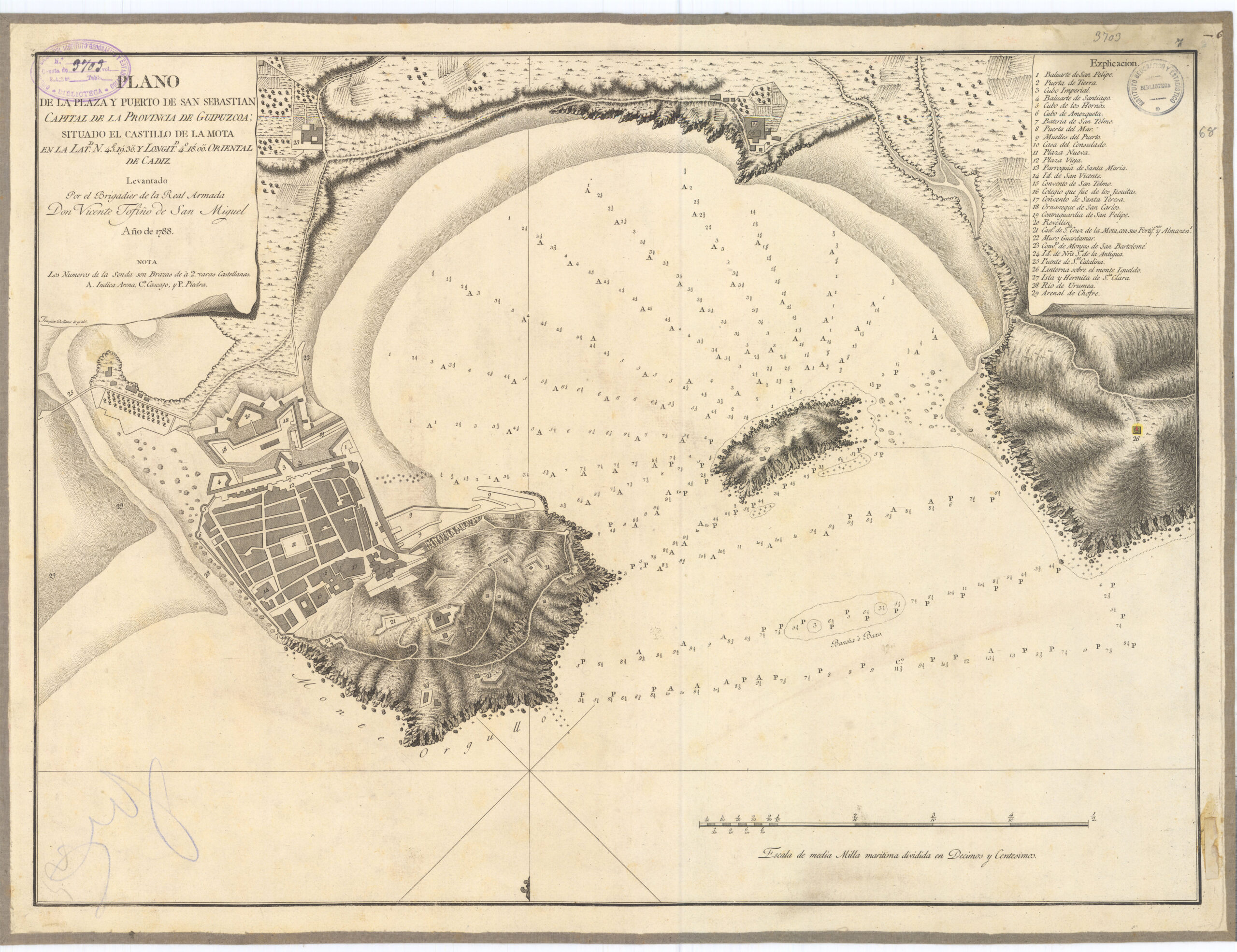
This map, created by Vicente Tofiño de San Miguel as part of his Maritime Atlas of Spain, shows La Concha Bay and the city of San Sebastián (or Donostia in Basque) as it was in 1788.
On the map, with south at the top, you can see the characteristic geographical features associated with the city. On the left is Mount Urgull, on top of which stands La Mota Castle. On the right-hand side, you can see Mount Igueldo with its lighthouse. Between the two mountains, in the middle of the sea, lies the island of Santa Clara, on which the chapel of the same name had already been built. With an entrance marked by these two mountains and the island, La Concha Bay appears, which in the southern part (at the top of the map) was already one of the most famous beaches in Spain.
The city, completely fortified, stretched out beneath Mount Urgull. Most of these walls disappeared or were demolished during the 19th century, given their limited functionality. Outside the city walls were the convents of San Bartolomé and Nuestra Señora la Antigua, both of which have now disappeared.
Sources

