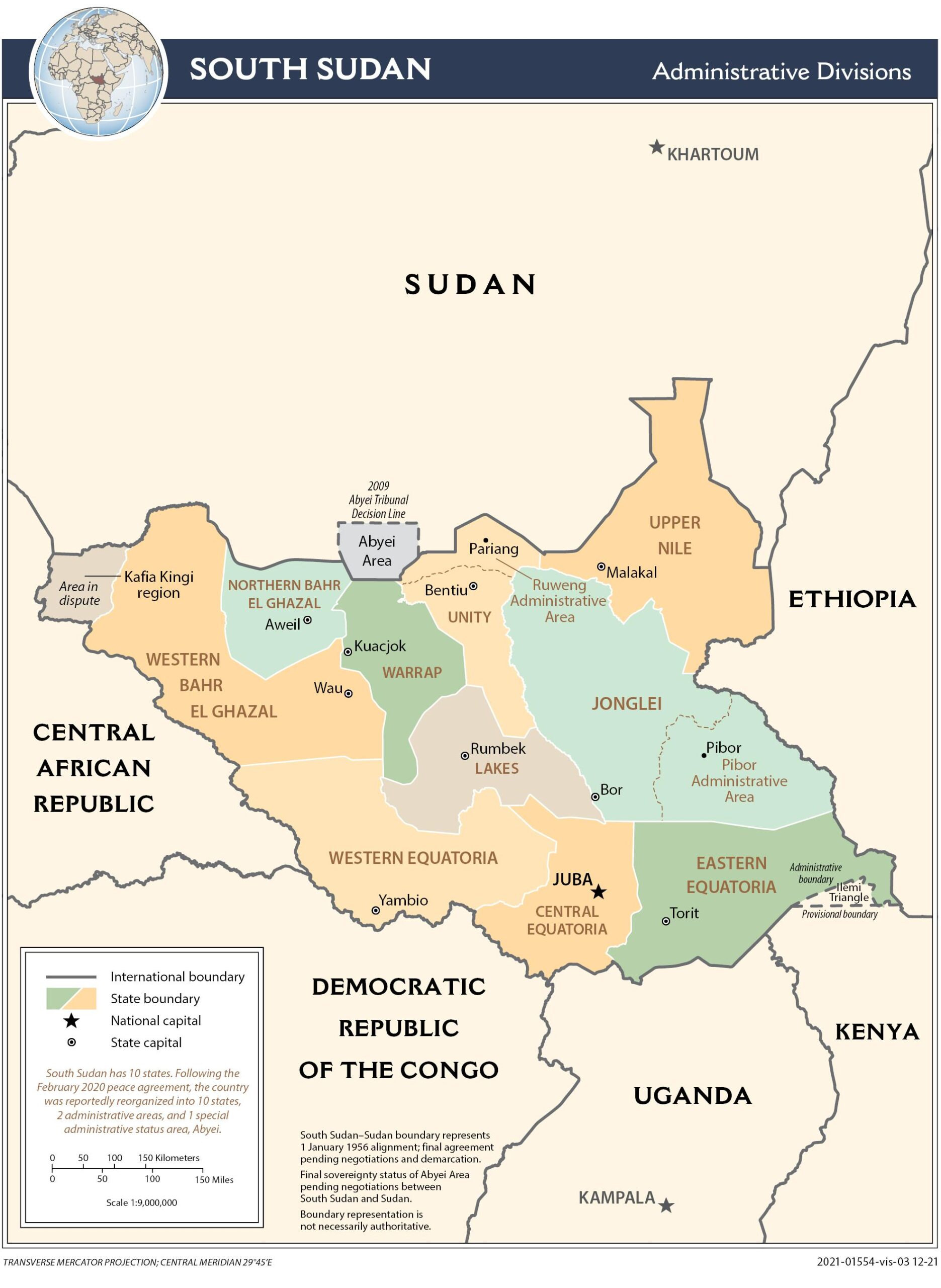
This map of South Sudan was edited by the CIA in 2021.
The map shows the territory of the African country, with the 10 constituent states painted in different colours. In addition, following the peace agreement in 2020, the country also has two administrative areas, Pibor and Ruweng, as well as a special area in Abyei, a region currently disputed by Sudan and South Sudan.
Sources

