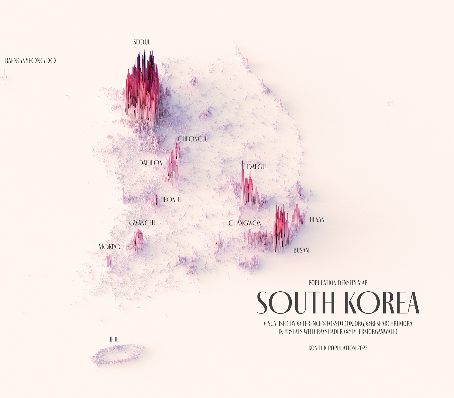
This illustration, created by Terence Teo, represents South Korea's population density on a three-dimensional map. To do this, Terence extracted the data available at Kontur Population with which it generates columns using a programme, with a height that represents the population density at each point.
This map of South Korea shows the different population peaks in Seoul, the capital, whose metropolitan area is home to half of the country's citizens, more than 25 million inhabitants. The illustration also shows peaks in other major cities, such as Busan, Daegu, Daejeon and Gwangju.
Sources

