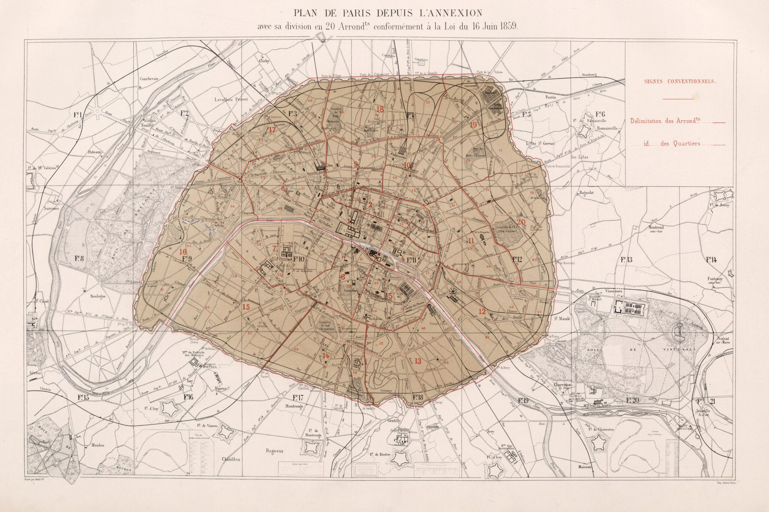
This map, created by Georges-Eugène Haussmann in 1859, shows the plan to divide Paris into 20 districts (districts) after the annexation of neighbouring communes in 1860.
In 1859, under Napoleon III, Paris began plans to annex the neighbouring towns of Grenelle, Vaugirard, Bercy, Charonne, Belleville, La Villette, La Chapelle, Montmartre, Les Batignolles, Passy and Auteuil. As a result, the city's administration was to change from the existing 12 districts to the 20 districts defined on Haussmann's map. The administrative division of Paris into 20 districts has been preserved from 1 January 1860, when the change came into effect, to the present day.
The map also shows the Thiers Wall, the name given to the wall built between 1841 and 1846 to defend the city. This wall remained standing until after the First World War, when it was destroyed as it no longer served its defensive purpose. Decades later, it was replaced by the Boulevard Périphérique, which still serves as the border between the city of Paris and its suburbs.
Sources

