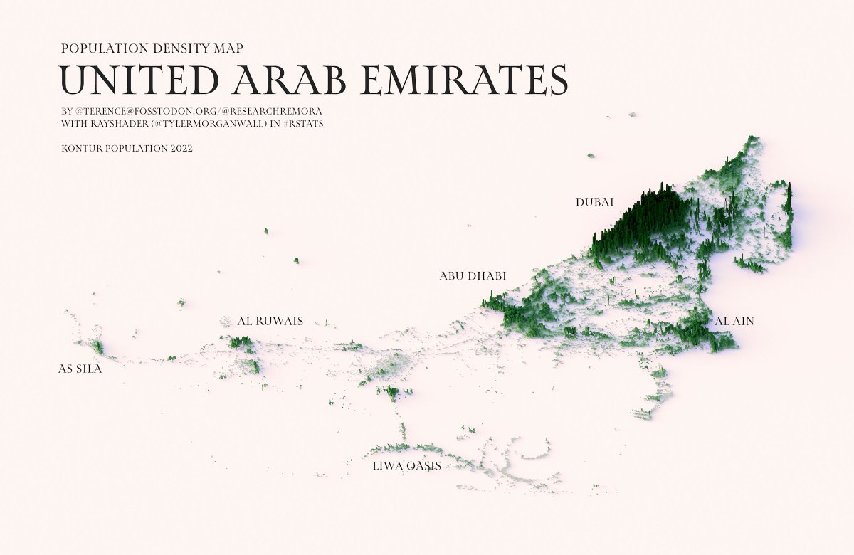
This illustration, created by Terence Teo, represents the population density of the United Arab Emirates on a three-dimensional map. To do this, Terence extracted the data available at Kontur Population with which it generates columns using a programme, with a height that represents the population density at each point.
This map of the United Arab Emirates shows the great importance of the Dubai metropolitan area, which also includes the cities of Sharjah and Ajman. This urban agglomeration accounts for more than 60% of the country's population. The map also shows the importance of the capital, Abu Dhabi, as the country's second largest agglomeration, followed by Al Ain, Al Ruwais, As Sila and Liwa Oasis, the only significant urban area located in the interior of the country.
Sources

