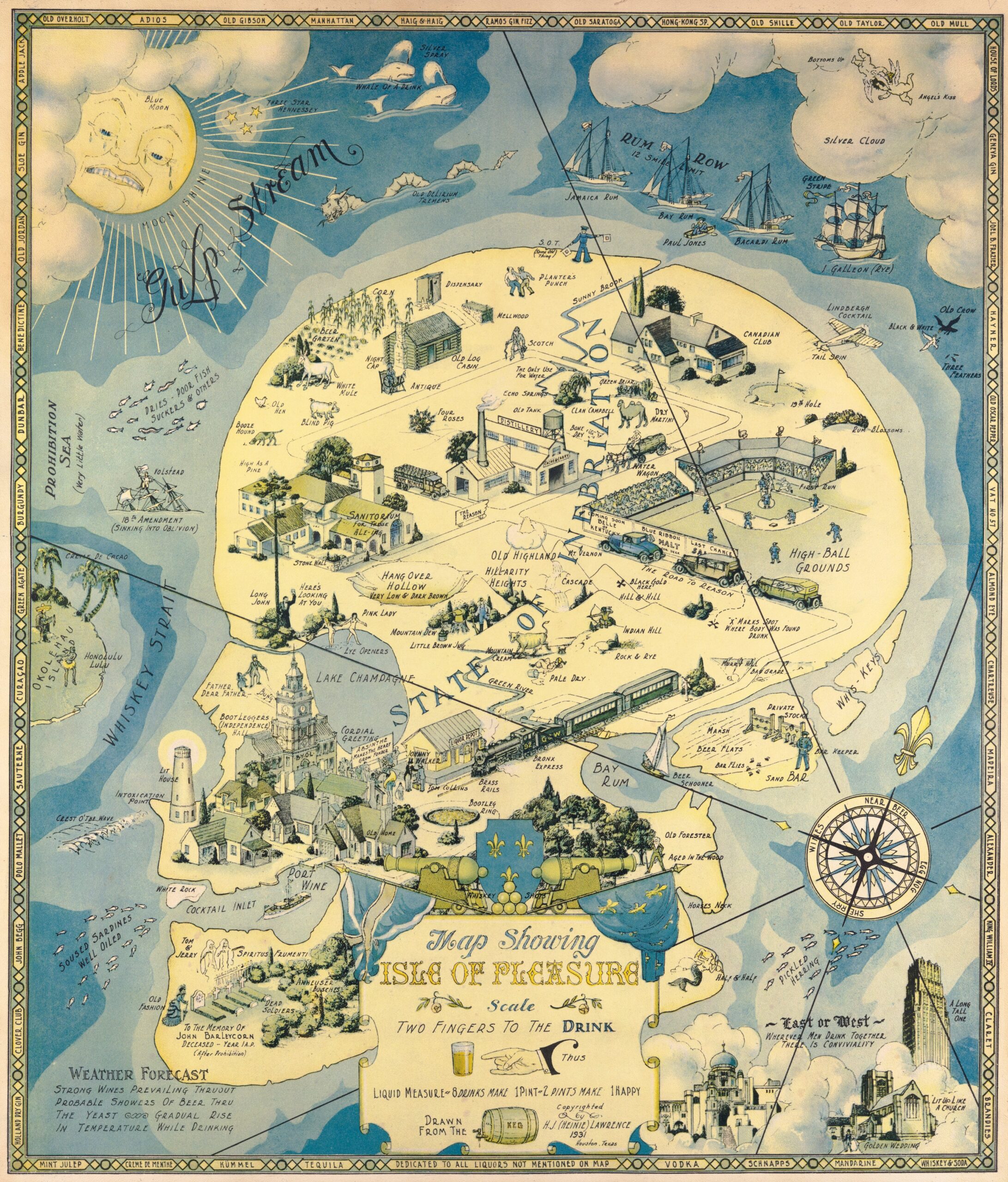
This illustration, drawn by the American architect Henry Jefferson Lawrence, nicknamed Heinie, was published in the United States in 1931, in the context of Prohibition.
Prohibition was established in the United States in 1920 by the 18th amendment to the US constitution. This law completely prohibited the production, importation, transportation and sale of alcohol, but not its consumption. This paradox allowed citizens to continue to drink all the alcohol they had purchased before 1920. Despite the vigilance, the measure turned out to be a widespread failure.
This piece is precisely a reference to the inefficiency of the dry law. With the title the island of pleasure, Lawrence depicts a skull on which he draws a world around alcohol. Among other geographical features, he depicts the Whiskey Strait, the Rum Bay, the Champagne lake or the Resaca Gully. All the elements seen in the map refer directly or indirectly to alcohol, brands, companies and strategies that the population maintained in order to continue having access to alcohol, such as the case of the Rum Row, which alludes to the smuggling of liquor from the Caribbean.
Two years after this map was published, in 1933, prohibition was repealed and the alcohol industry was re-legalised.
Sources

