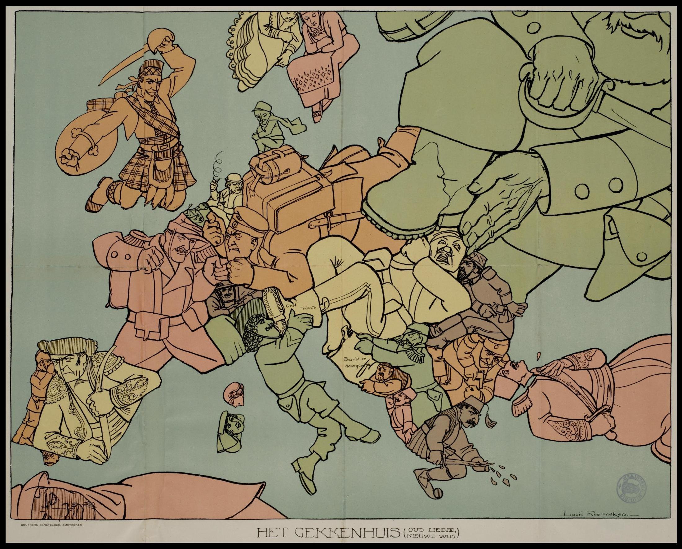
This satirical map was published in 1915 by Louis Raemaekers. In it, the Dutch artist depicts the different European countries as caricatured individuals confined within their territorial boundaries, glaring at and attacking their neighbours in a faithful representation of the clashes at the start of the First World War.
Raemaekers ventured into Belgian territory to witness first-hand the German atrocities in Belgium and subsequently depict them in his propaganda maps. The publication of these drawings seriously compromised the neutrality of the Netherlands, forcing the Dutch government, under German pressure, to prosecute the artist. Raemaekers fled to Great Britain, where he continued his illustrations against German oppression for the rest of the war.
Sources

