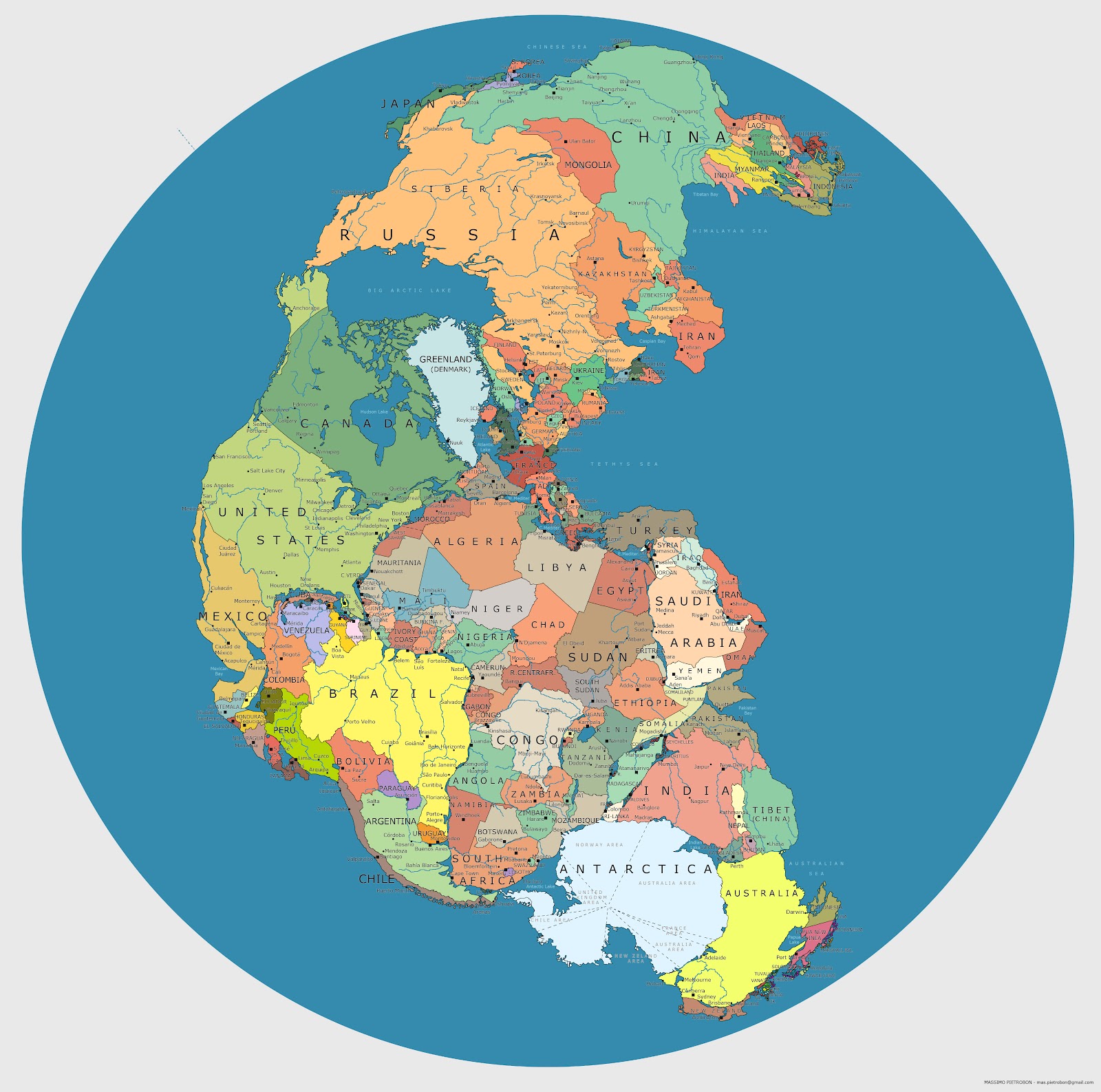
On this map, Massimo Pietrobon play with the political borders of the world in 2012 and the situation of the continents 335 million years ago, when they were all grouped together in the supercontinent of Pangea.
With this visualisation, and knowledge of the political map at the beginning of the 21st century, it is possible to better understand the major changes that plate tectonics has brought about over millions of years. Some of the most notable curiosities:
- The Iberian Peninsula was located next to present-day Canada, Greenland, the United Kingdom, France, and Algeria.
- The Indian subcontinent was separated from the rest of Asia (before the Himalayas were formed), bordering present-day Australia, Antarctica, Madagascar, and Somalia.
- The Middle East was also separated from the rest of Asia, dividing Iran into three zones: one next to Iraq and Saudi Arabia, another next to Turkmenistan and Afghanistan, and a third next to Azerbaijan and Armenia.
- The South Atlantic is also completely absent, with Brazil perfectly embedded in the Gulf of Guinea.
- The Caribbean also disappears, but with Colombia and Venezuela situated on the direct border with Mexico and the United States. As a result, all of Central America surrounds Colombia, Ecuador, and northern Peru.
There are numerous details, which can be seen in greater detail at Wikimedia Commons.
Sources
- Original publication of the map on Massimo Pietrobon's blog.
- Interview with Massimo Pietrobon in Geografía Infinita.
- Very high resolution prints from Pangea Política.

