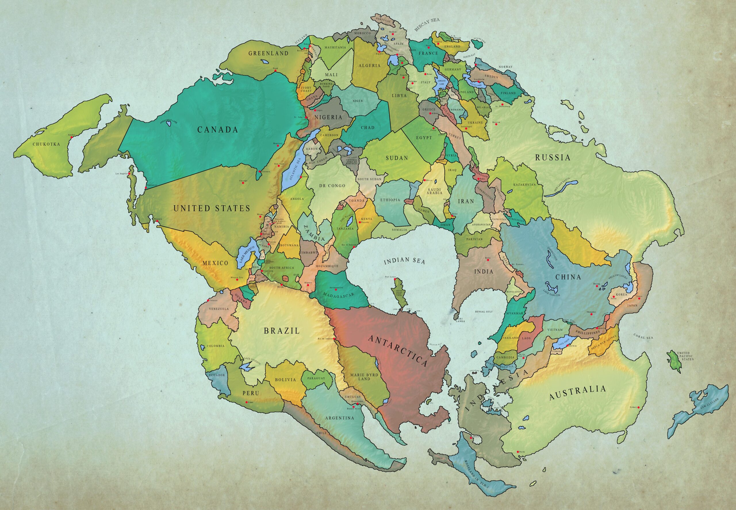
This map, created by Reddit user Coffete, The political borders in 2020 are shown based on the hypothetical situation of the continents in 250 million years, if the estimates of paleogeographer Christopher Scotese are correct.
This illustration clearly shows some of the changes that will take place:
- The Mediterranean Sea will close off, connecting North Africa with Southern Europe. A remnant in the form of a lake will remain in the Adriatic.
- The North Atlantic Ocean will also close, connecting eastern North America with the east coast of Asia. Two lakes will remain as vestiges, one corresponding to the Gulf of Mexico and the other to the coast off New England.
- The South Atlantic Ocean will disappear when Madagascar and Antarctica join South America.
- The Pacific Ocean will become a large continuous body of water surrounding the entire Pangea Ultima.
- The Indian Ocean will be almost completely closed off, leaving only one outlet to the Pacific Ocean between Indonesia and Antarctica.
- Australia, New Guinea, the Philippines and Japan will join Southeast Asia, closing off the South China Sea.
If you are interested, you can also consult another political map, but 355 million years ago with Pangaea.
Sources

