
This map, created in 2020 as part of the National Atlas of Spain (ANE), shows the annual insolation in...
Maps from 2020 (39 maps)
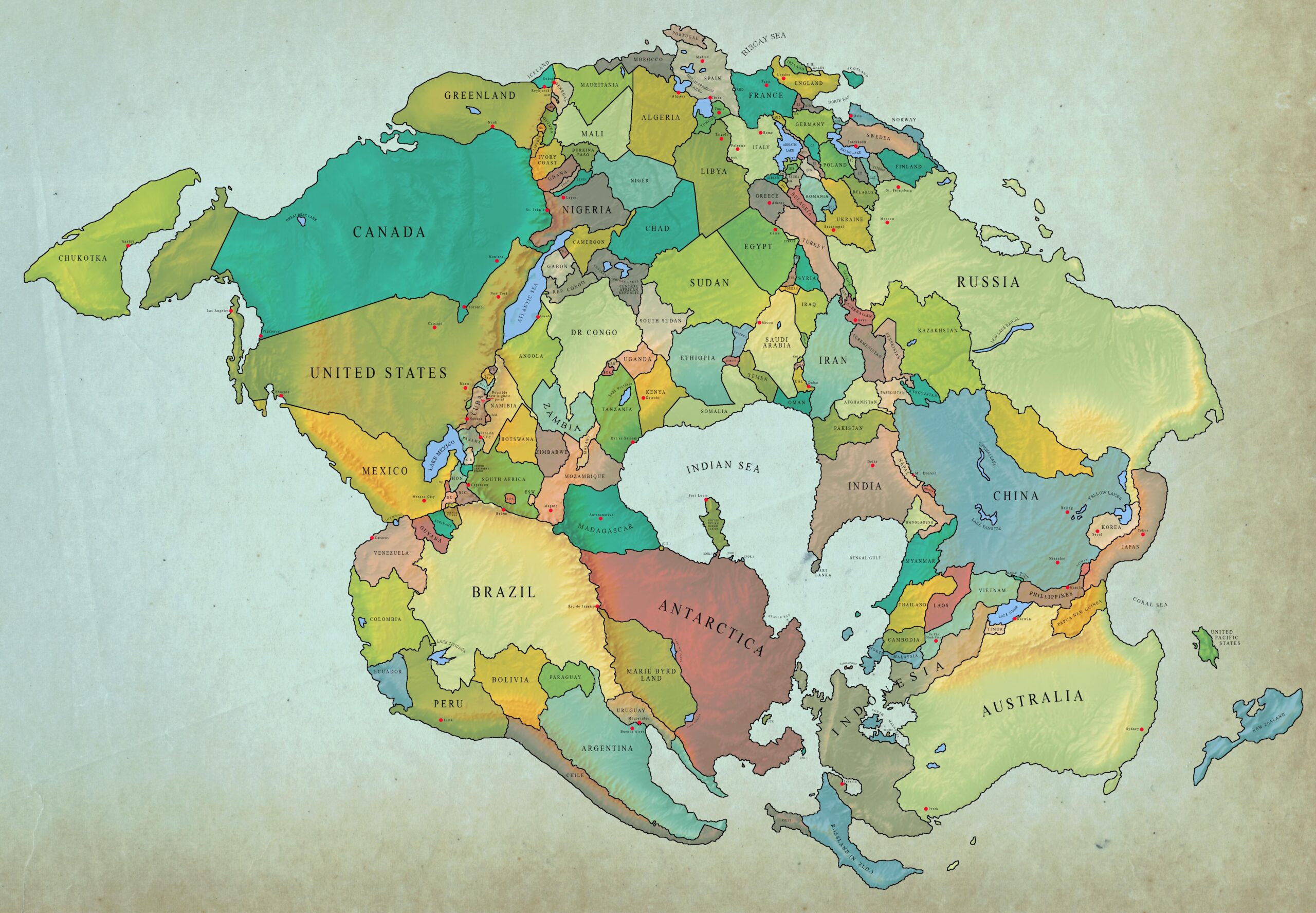
Political map of Pangea Última (2020)
This map, created by Reddit user Coffete, shows the political borders in 2020 on the...

Relief map of Kenya, by Miguel Valenzuela (2020)
This map, created by Miguel Valenzuela, shows the topography of Kenya. It uses three colours: green for the areas that are most…

Europe gridded (2020)
This map of Europe was posted by Frank Neumann on Reddit in 2020. The map represents each country in the...

Berlin: Map of buildings destroyed in the Second World War (1945)
This comprehensive infographic, created by Christian Schlippes and Babette Ackermann-Reiche for the Berliner Morgenpost, was published in 2020 to commemorate...

Road network of the Roman Empire (2020)
This map was published by Joe Davies in 2020 as part of the #30DayMapChallenge initiative. The Empire's road network...

School enrolment rate in Mexico (2020)
This map, published by Mexico's National Institute of Statistics and Geography (INEGI) in 2020, shows the index of...

Political map of the Maldives (2020)
This map, created by Reddit user Dragonite-2, shows the administrative organisation of the Maldives. The Maldives is a...

Relief map of France, by Miguel Valenzuela (2020)
This map, created by Miguel Valenzuela, shows the relief of France. It uses two colours: blue for the more mountainous areas and blue for the...
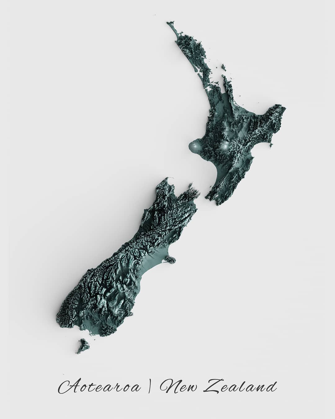
Relief map of New Zealand, by Miguel Valenzuela (2020)
This map, created by Miguel Valenzuela, shows the relief of New Zealand. To do this, it uses different shades of silver:…
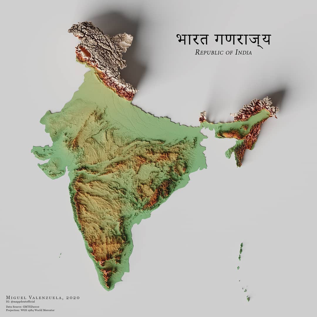
Relief map of India, by Miguel Valenzuela (2020)
This map, created by Miguel Valenzuela, shows the relief of India. It uses three colours: green for low-lying areas,...

Physical map of Colombia (2020)
This physical map of Colombia was created by Abel Gil Lobo for the website El Orden Mundial in 2021. The…
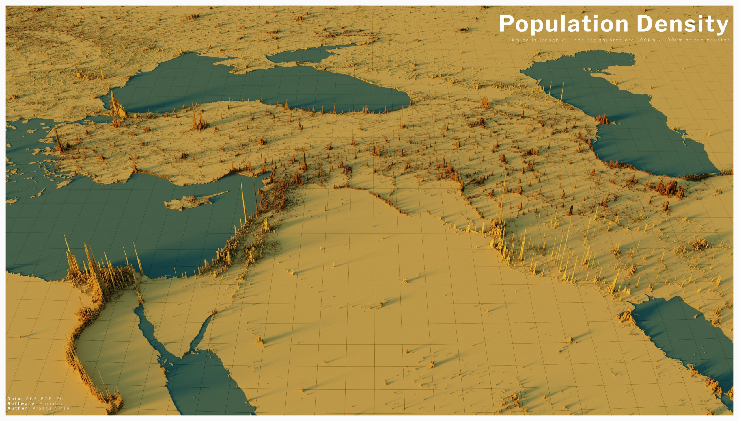
Population density in the Middle East (2020)
The author of this map is Alasdair Rae, founder of Automatic Knowledge, a website for creation and learning...
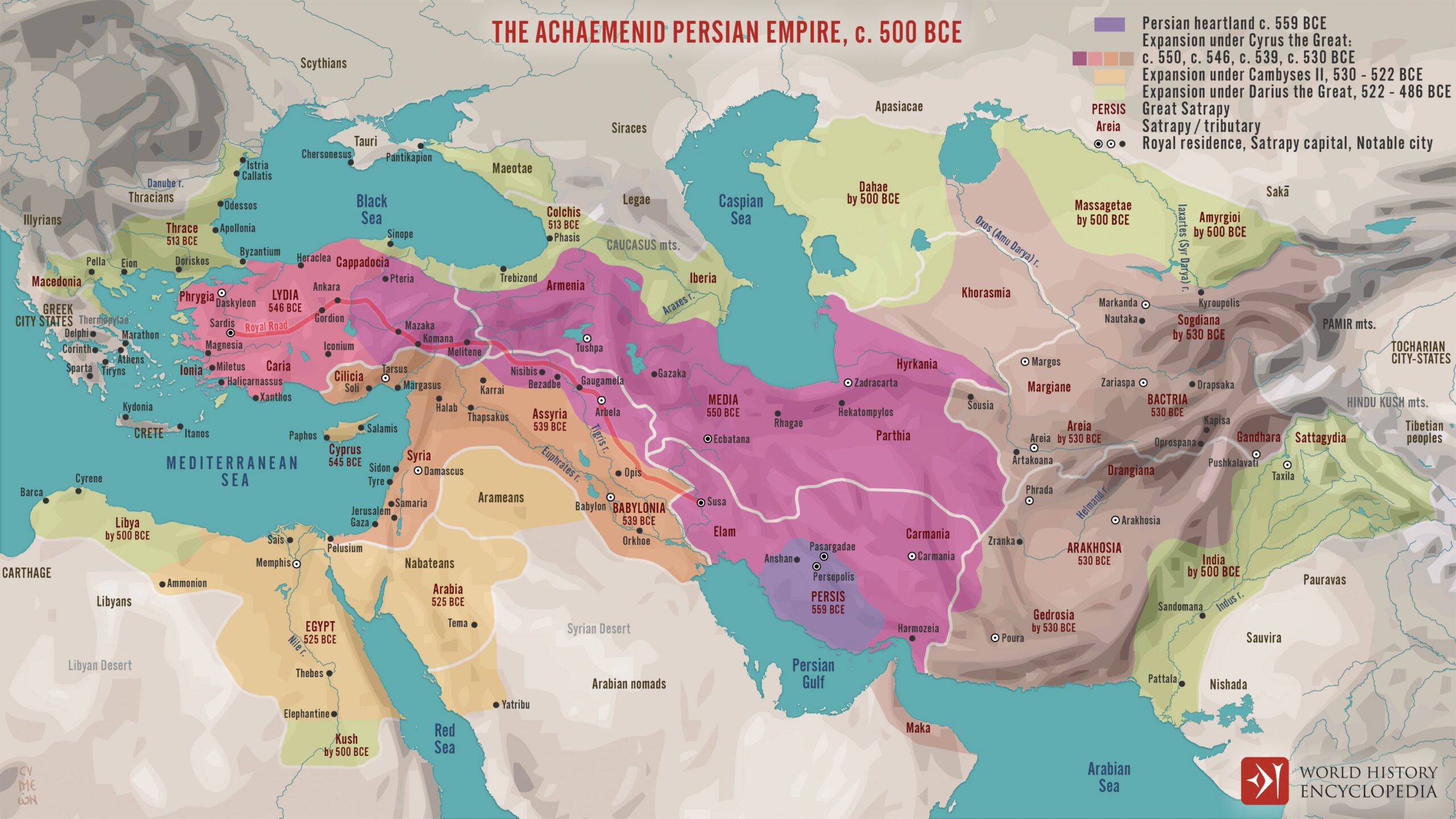
Map of the expansion of the Achaemenid Empire (500 BC)
This map, published by Simeon Netchev for World History Encyclopedia, depicts the expansion of the Achaemenid Empire between the years 559...

Political Map of Mexico (2020)
This map, produced by Álvaro Merino for The World Order, shows the territorial division of Mexico, with a total of 31 states, each with a...

Legality of alcohol consumption in India (2020)
This map, created by Ashris, shows the legality of alcohol in different states of India. India is one...

The desired destination for emigration from each country (2020)
This map, published by Remitly, shows the most desirable destinations for emigration in each country of...

Spending on the Christmas Lottery in Spain (2020)
This map, published in 2021 by Statista, shows the average expenditure per inhabitant of each autonomous community in the lottery...
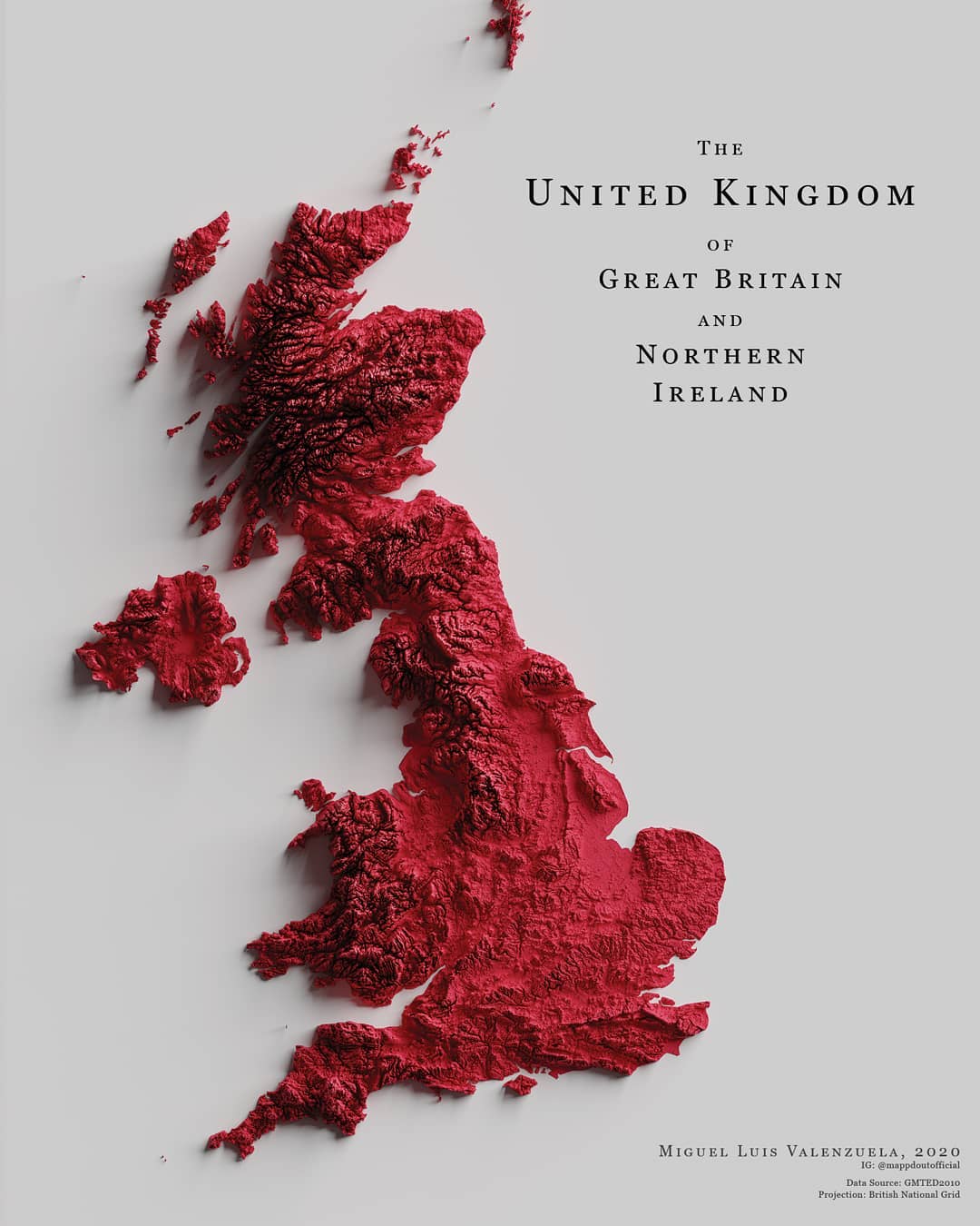
Relief map of the United Kingdom, by Miguel Valenzuela (2020)
This map, created by Miguel Valenzuela, shows the topography of the United Kingdom. To do this, he colours the whole country red and…

Extension of Arctic Ocean sea ice (1980–2020)
This map, published by Encyclopaedia Britannica, shows the retreat of Arctic sea ice between its minimum extent...
 Español
 English (UK)