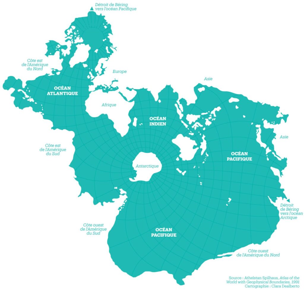
This map, created by Clara Dealberto, was published in Libération in 2018. The map is a world map that uses the projection designed by Athelstan Spilhaus in 1942 and published alongside the rest of his work in 1991 in his book. Atlas of the World with Geophysical Boundaries (Atlas of the world with its geophysical boundaries).
Unlike all previous representations of the world, Spilhaus's projection seeks to focus on the oceans and their interconnection. Thanks to this way of showing the world, it is easy to see how all the world's oceans are connected to each other. The continental masses form a virtually continuous whole, with only the Bering Strait providing a separation, which is why it is shown in two places: at the top left and at the bottom right.
If we start at the top of the map and follow a clockwise direction, we find the following coasts:
- Bering Strait (towards the Arctic Ocean).
- Northern Russia.
- Europe.
- Africa.
- South Asia.
- East Asia.
- Bering Strait (towards the Pacific Ocean).
- West coast of North America.
- West coast of South America.
- East coast of South America.
- East coast of North America.
- North coast of North America.
- Bering Strait (towards the Arctic Ocean).
Sources

