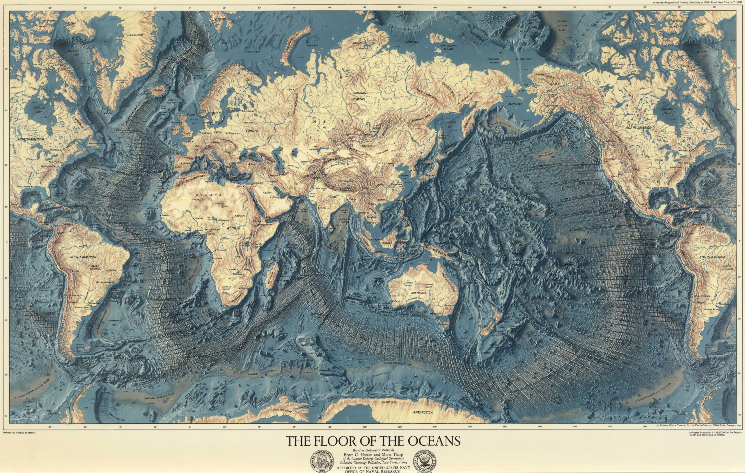
This world map was published in 1976 by Tanguy de Rémur for the American Geographical Society (American Geographical Society, AGS). The map compiles all the information published in the studies by Bruce Heezen and Mary Tharp on the ocean floor, which in turn had been published in National Geographic magazine between 1967 and 1971.
This map clearly shows how the different oceans are connected, as well as the ocean ridges that run through the Atlantic Ocean, the Indian Ocean and the eastern Pacific Ocean. It also shows how continental plates often extend beyond the coastline, as is evident throughout the Arctic Ocean or in Zealandia, around the New Zealand archipelago.
Here you can view the collection of four maps, painted by Heinrich Berann, which were originally published in National Geographic:
- Map of the Indian Ocean floor (1967)
- Map of the Atlantic Ocean floor (1968)
- Map of the Pacific Ocean floor (1969)
- Map of the Arctic Ocean floor (1971)
Sources

