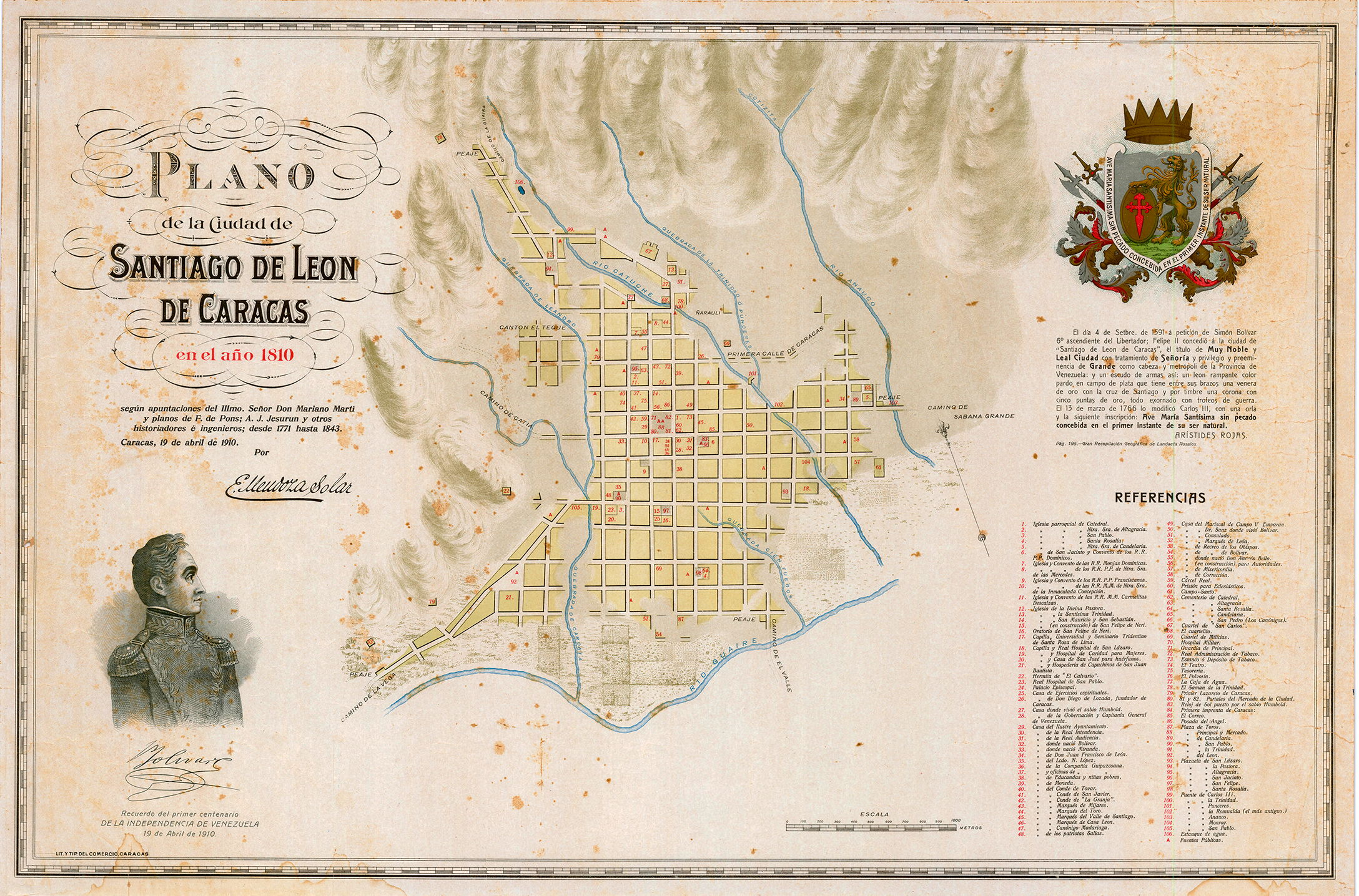
This map was published by Enrique Mendoza Solar on 19 April 1910, to commemorate the first centenary of Venezuela's independence. This process began on 19 April 1810, but was not completed until the signing of the declaration of independence on 5 July 1811.
Enrique Mendoza Solar's map shows what Caracas looked like in 1810. It shows how the old city was located entirely north of the Guaire River, as well as the many streams that still ran through the city. Of all of them, the Caroata stream, located furthest to the west, is the only one that is not currently underground.
The map uses the name under which the city was founded, Santiago de León de Caracas, which is still its official name. In addition, the map is slightly oriented towards the north-west, in order to make it more symmetrical and visual, even though the alignment of the streets is not exactly north-south.
Sources

