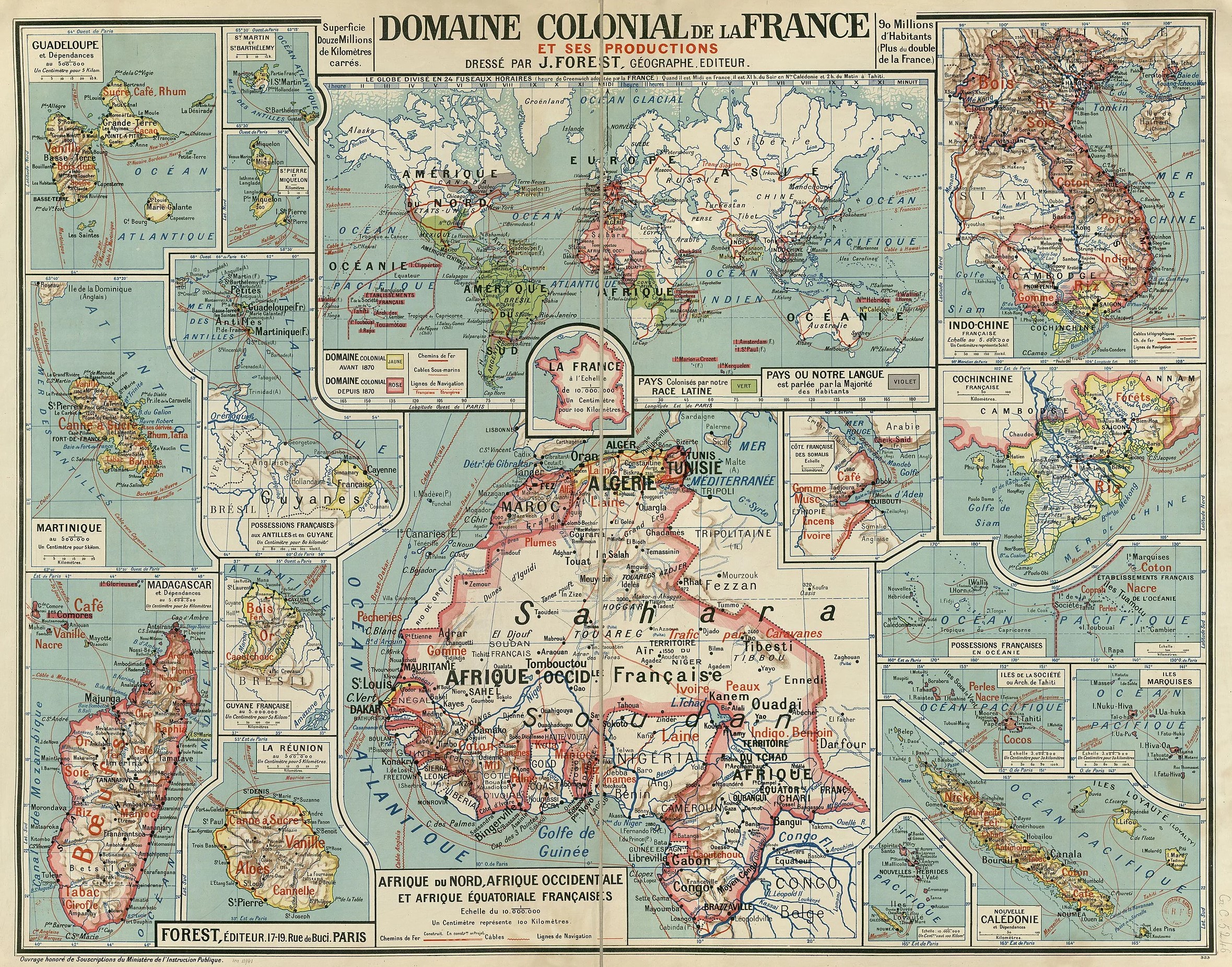
This map is one of two published by French cartographer Joseph Forest to represent France's colonial domains. The first was published in 1911, and this second one saw the light of day in 1930.
The map consists of a world map in the upper central part and a detail of continental France in the central part. The possessions that France had before 1870 are shown in yellow, and all the territory colonised up to the date of publication of the map, 1930, is shown in pink. All the regions of the world that had been colonised by other Latin countries, such as the possessions that were once Portuguese or Spanish, are also shown in green.
As a curious detail, and one that adds a greater propaganda touch to the map, regions where French is an important lingua franca are shown in grey. It is not surprising that much of Canada and Louisiana in the United States appear in this colour, but it is somewhat more daring that the state of California, part of Argentina and the entire Sydney area in Australia appear in this colour.
In addition, the illustration also includes seventeen other boxes detailing all of colonial France's possessions. From top to bottom and left to right:
- Guadalupe.
- Saint Martin and Saint Bartholomew.
- Saint Pierre and Miquelon.
- Martinique
- French possessions in the Caribbean.
- Madagascar.
- French Guiana.
- Meeting.
- French West Africa.
- Djibouti or Yibuti.
- Indochina (Vietnam, Laos, and Cambodia)
- Cochinchina (southern Vietnam)
- French possessions in Oceania.
- Tahiti.
- Marquesas Islands.
- New Hebrides (Vanuatu).
- New Caledonia.
Sources

