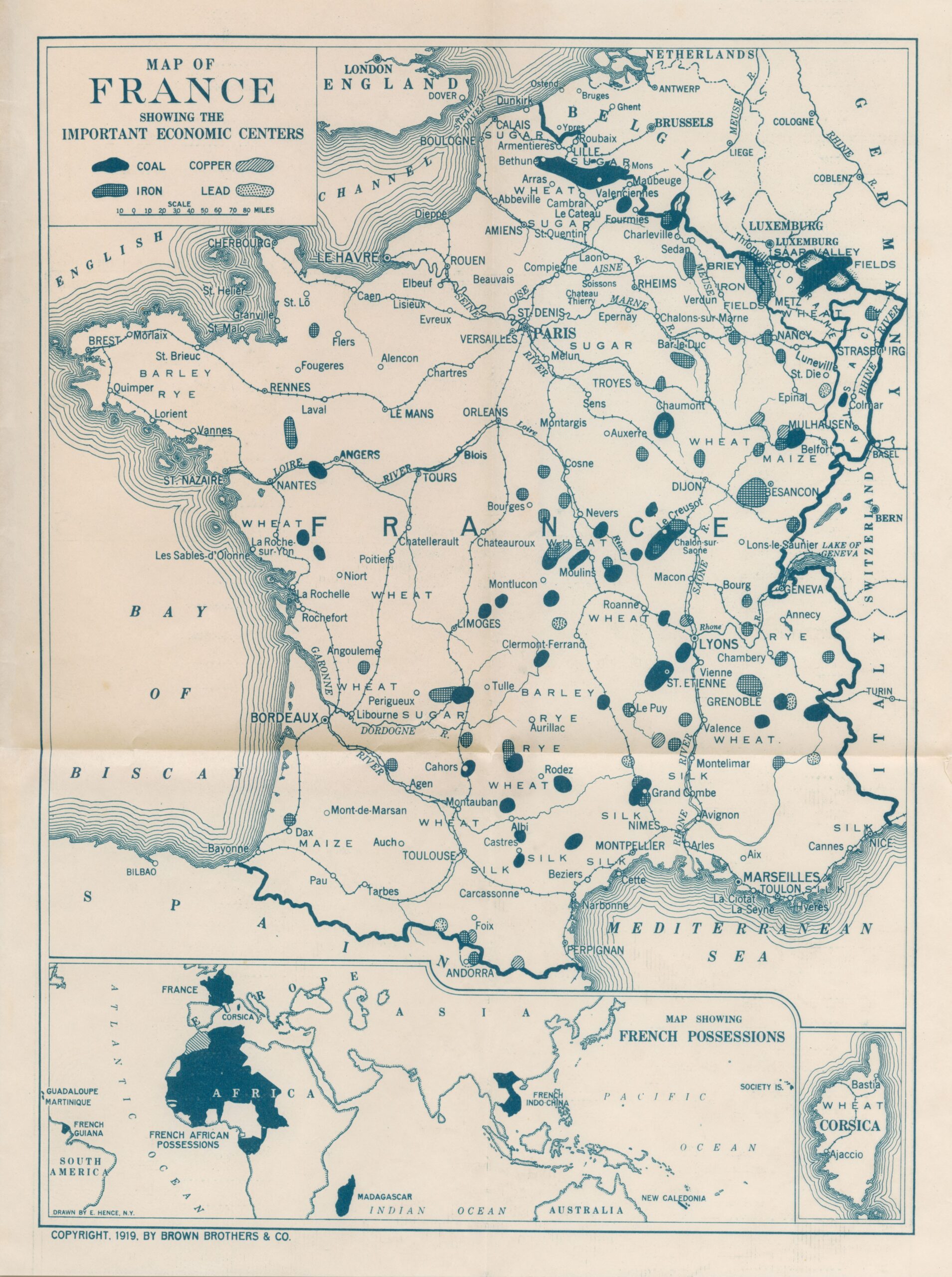
This map was published in 1919 by Brown Bros. & Co., an American financial institution, as part of a brochure on the situation in France after the end of the First World War.
Brown Bros. & Co. was a major American investment bank with many interests in France before, during and after the war. The brochure containing this map, with its strong propaganda content, was published in the United States to raise awareness among potential investors of the importance of helping France recover to its pre-World War I status.
The map shows the different economic centres of France, with particular emphasis on their raw materials. The colours show the country's main mining operations: coal (solid colour), iron (grid), copper (hatched) and lead (dotted). In addition, the map also shows the main transport networks, roads and railway lines, as well as the main crops in each region, including wheat, barley, rye and silk.
Finally, the map is also accompanied at the bottom by all of France's colonial possessions in the rest of the world, to highlight the country's importance as a necessary ally for the United States and a compelling reason to help them overcome the consequences of the war.
Sources

