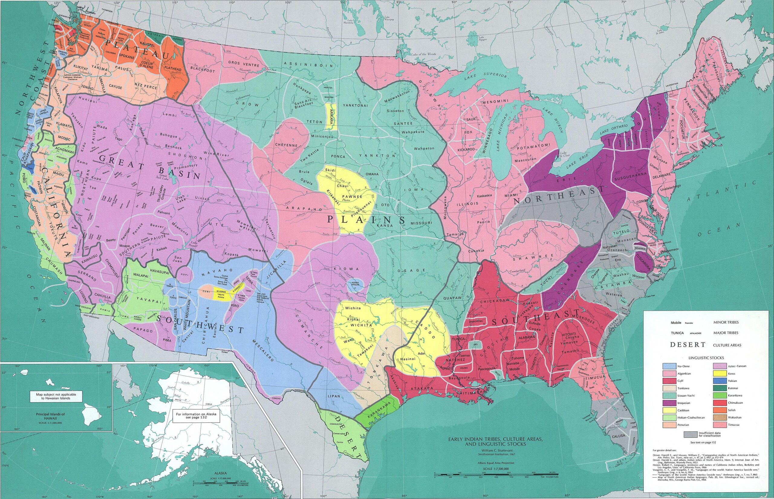
This map was published by William C. Sturtevant, an American anthropologist and ethnologist, in 1967. Sturtevant devoted his entire professional career to the study of Native American peoples, studying their languages and cultures, attempting to group them together for a more comprehensive study of the relationship between them.
In this map, William C. Sturtevant shows cultural and linguistic groups together, which do not overlap in all cases. Culturally, he groups the different native tribes into cultural areas, which are divided on the map by large grey lines. Among the main areas are the tribes of the Great Plains, the Southeast, the Northwest, the Great Basin, and the Southwest.
For the linguistic aspect, the author uses different colours to group languages, some of which, more than half a century later, still lack academic consensus. Among the most widespread linguistic groupings are the Azteco-Tanoan macrofamily (in purple), the Algonquian languages (in pink), the Sioux languages (in green) and the Gulf languages (in maroon).
Finally, the map is filled with hundreds of names representing the different tribes identified by Sturtevant's studies. Large tribal groups appear in capital letters, with their territory marked by white lines, and tribes with their own recognition within each tribal group appear in lowercase letters.
Sources
- National atlas. Indian tribes, cultures & languages: [United States]
- Handbook of North American Indians, Volume 1: Introduction

