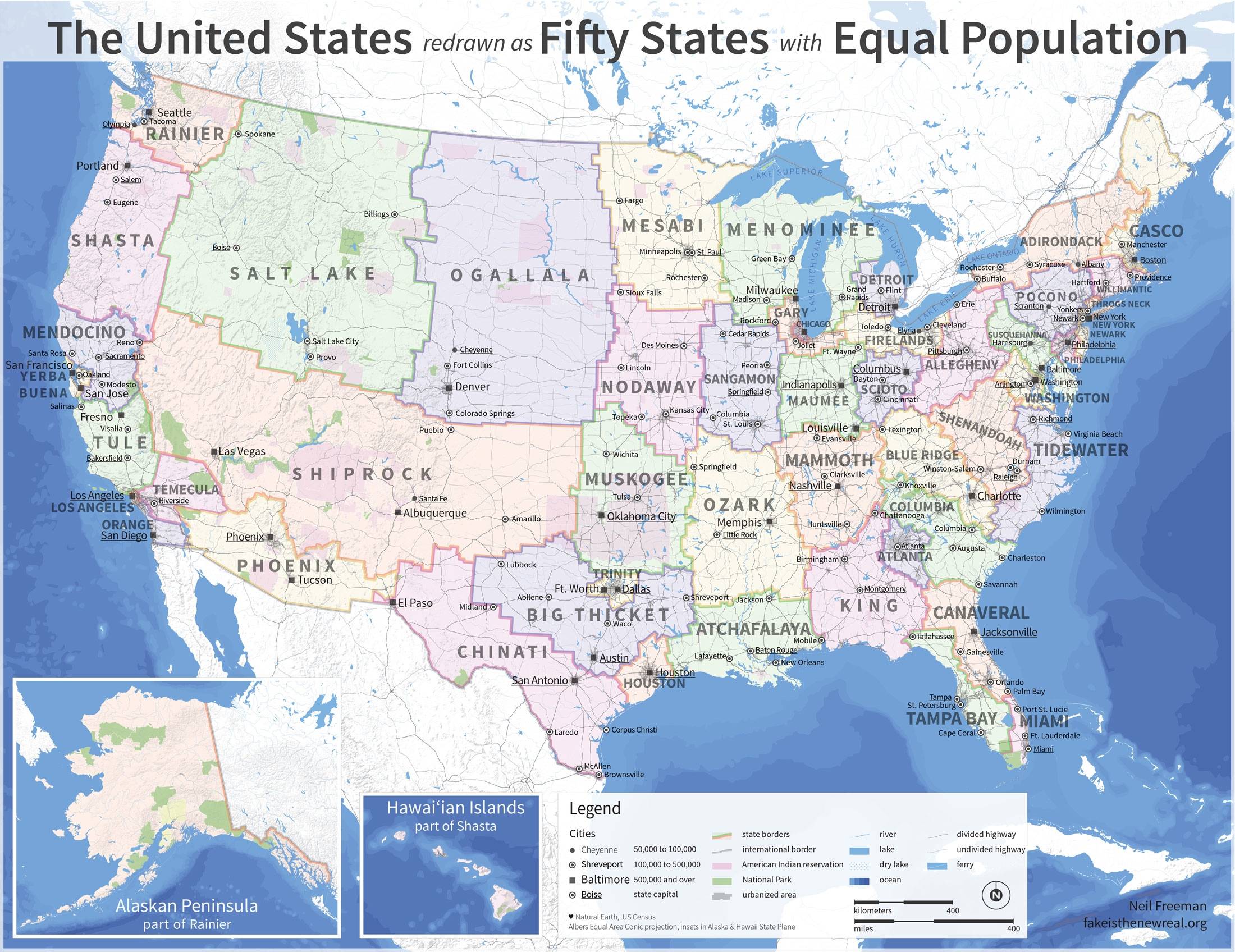
This map was created in 2012 by Neil Freeman to illustrate a possible electoral reform in the United States to give the entire population equal weight in presidential or legislative elections. To do this, Freeman replaces the 50 states with 50 other states with a similar population (between 6 and 7 million inhabitants).
This fictional game highlights the significant differences in population density across the United States. In the Midwest, there are large states such as Salt Lake, Ogallala and Shiprock, which together cover an area larger than eleven of the country's most extensive states.
On the other hand, the most populous states today (California, Texas, Florida, and New York) appear divided into three or four states with a much smaller area but a high population density. Large cities such as Chicago, Los Angeles, Houston, and New York appear as states in their own right, being the most populous states in this proposal.
The methodology for establishing the new states takes into account multiple factors to ensure viability, such as river basins, respect for natural borders, the influence of the most populous cities (as centres of attraction) and the need for compact and clean borders. The entire methodology and much more can be found in the sources below.
Sources
- Reforma del colegio electoral (cincuenta estados con población igualitaria)
- Very high resolution map

