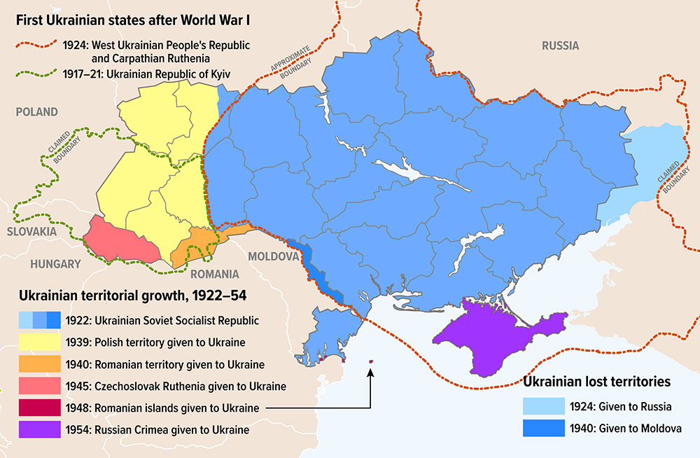
This map was created by Michael Osadciw from the University of Rochester as a resource for the university's news outlet, News Centre. The map visually depicts the territorial changes of Ukraine, as part of the Soviet Union, between 1922 and 1954.
By colours used.
- 1924 (Light blue): Territory transferred from Ukraine to Russia, all as part of the Soviet Union
- 1939 (Yellow): Territory conquered by the Soviet Union from Poland at the beginning of the Second World War and annexed to Ukraine.
- 1940 (Orange): Territory conquered by the Soviet Union from Romania and annexed to Ukraine.
- 1940 (Dark blue): Territory coinciding with present-day Transnistria, populated mainly by Moldovans and transferred from Ukraine to Moldova, all as part of the Soviet Union.
- 1945 (Pink): Territory transferred by the Soviet Union at the end of the Second World War from Czechoslovakia to Ukraine.
- 1948 (Maroon): Danube and Black Sea islands transferred from Romania to Ukraine.
- 1954 (Purple): Crimea ceded by Russia to Ukraine, both as part of the Soviet Union.
Sources

