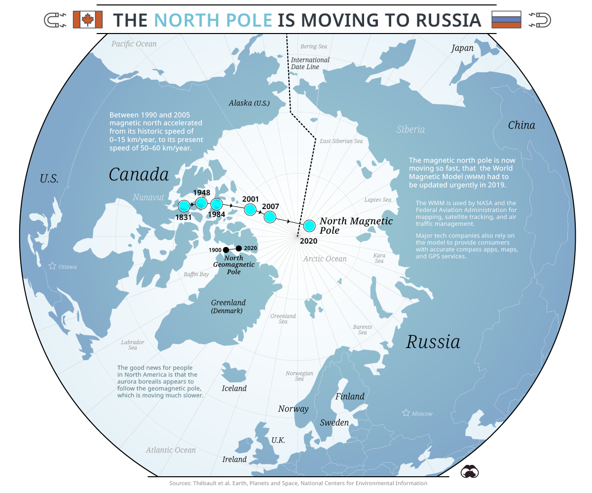
This map, created by the website Visual Capitalist, shows the changes in the magnetic north pole over the last two centuries. In 1831, it was located north of mainland Canada, in the territory of Nunavut, while in 2020 it is crossing the Arctic Ocean on its way to Russia.
Historically, the magnetic north pole moved only 10 or 15 kilometres per year, whereas in the last two decades its speed has accelerated to over 50 kilometres per year.
Magnetic poles are points where the Earth's electromagnetic field is completely vertical. North and south are not aligned at their respective antipodes, unlike the geomagnetic north pole, which is also shown on the map, north of Greenland, and has a much slower displacement.
Sources

