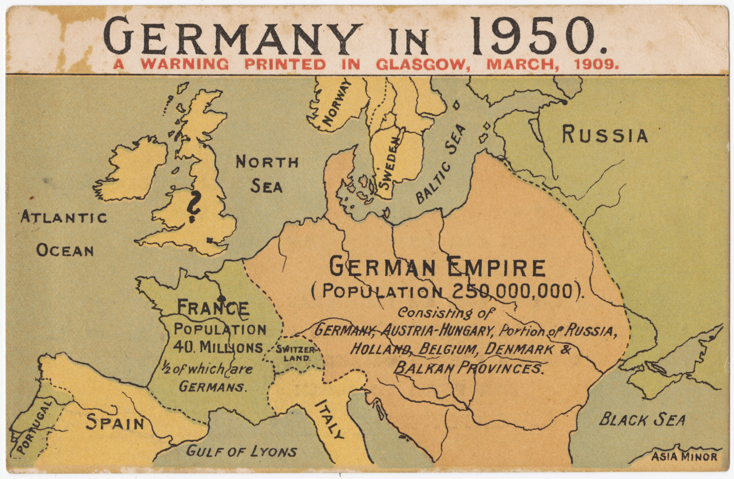
This map, by an unknown author, was first published in Glasgow, Scotland, in 1909 and distributed to members of the British Parliament in order to raise awareness about German expansionism. The map envisages a future, in 1950, in which Germany would have completely occupied the Austro-Hungarian Empire, the Netherlands, Belgium, Denmark, the Balkans and part of Russia.
In 1909, the United Kingdom was embroiled in debate over how to improve its navy to counter German rearmament. Furthermore, there is evidence that this same map has been used on at least two other occasions. In 1918, towards the end of the First World War, it was used to force a peace that would prevent Germany from causing further problems in Europe. The second time was in 1938, in the face of the rise of Nazism, as a warning of what would later become the Second World War.
Sources

