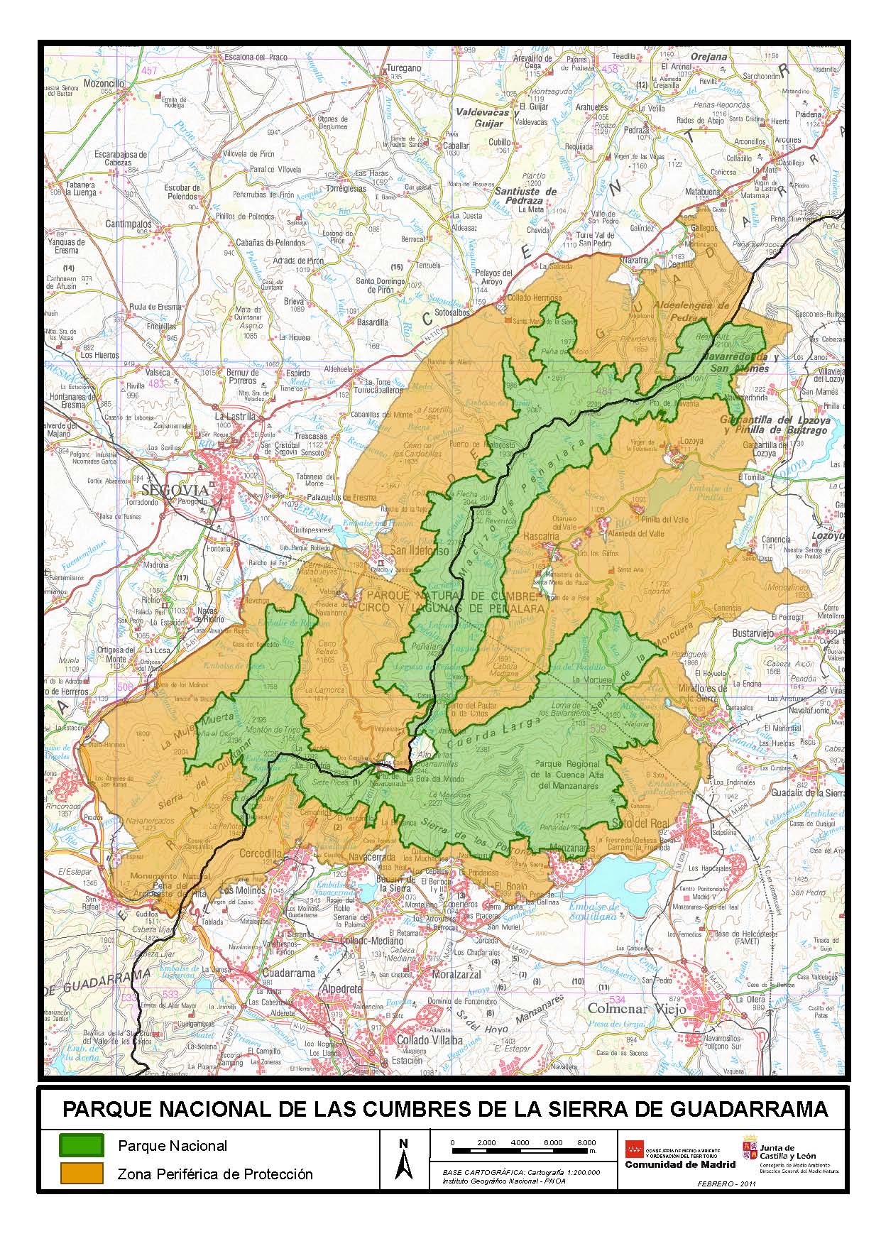
This map, published by the Community of Madrid and the Regional Government of Castile and León in 2011, shows the boundaries of the Sierra de Guadarrama National Park (in green), as well as its socio-economic area of influence (in orange).
The national park is divided almost equally between the provinces of Segovia and Madrid, with the following main mountain ranges:
- Peñalara massif, in the dividing zone between the two provinces.
- Dead Woman, in Segovia.
- Cuerda Larga, in Madrid.
- Sierra de la Morcuera, in Madrid.
- Sierra del Quintanar, in Segovia.
- Sierra de los Porrones, in Madrid.
The designation of National Park was officially established in 2013, covering a total area of 340 square kilometres.
Sources

