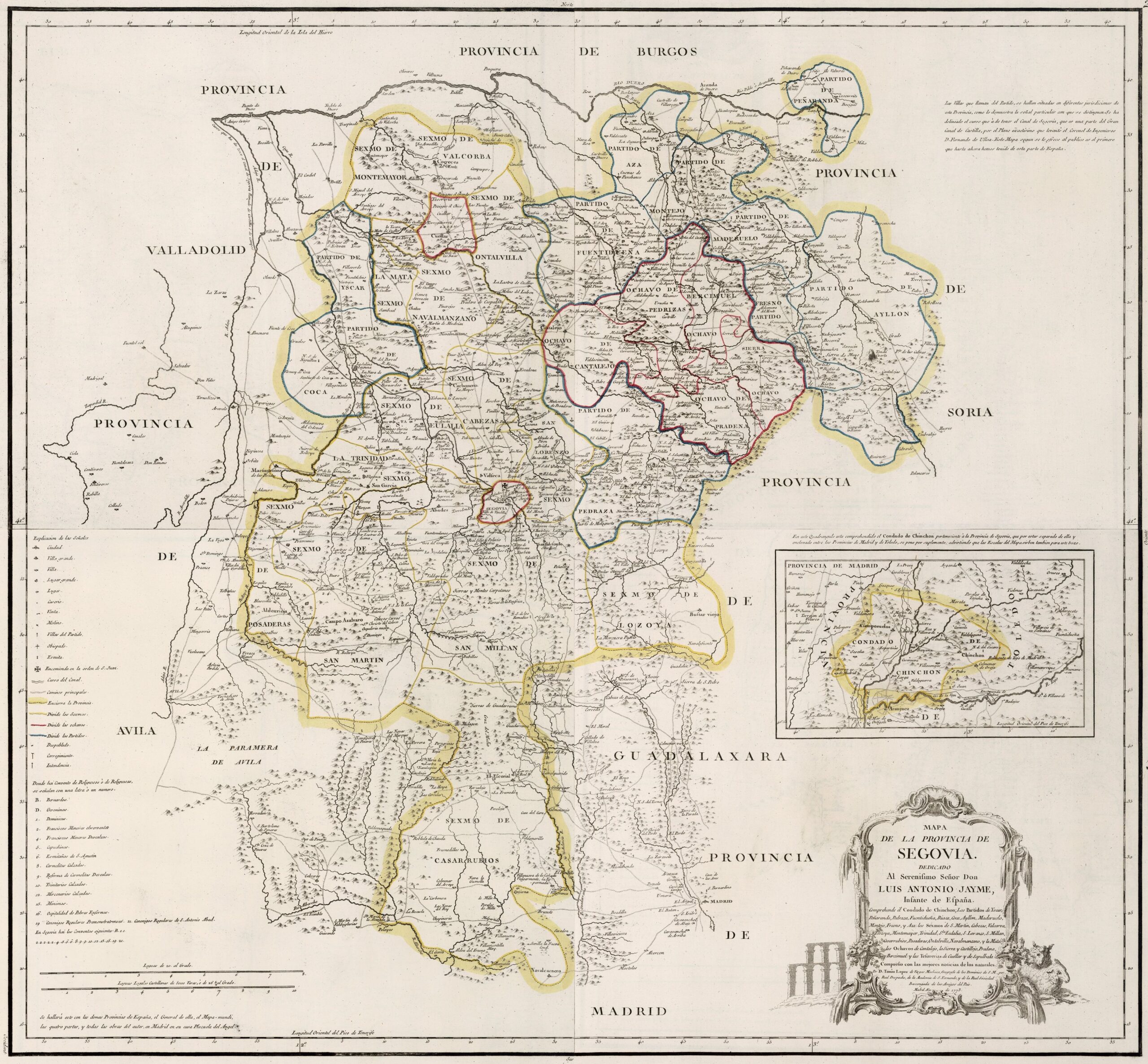
This map was created by Spanish cartographer Tomás López de Vargas Machuca in 1773 and published posthumously by his sons in the “Geographical Atlas of Spain” from 1804. The map depicts the province of Segovia with the territorial boundaries prior to Javier de Burgos's reform of the provincial administration in 1833.
The former province of Segovia bordered the northwest with the province of Valladolid, to the north with the province of Burgos, to the east with the province of Soria, to the southeast with the Guadalajara province, to the south with the province of Madrid and to the west with the province of Ávila.
The province appears divided into a complex territorial administration with roots in the repopulation of the 11th and 12th centuries:
- Community of the City and Land of Segovia, subdivided into the city and eight districts that made up the land: San Lorenzo, San Martín, Santa Eulalia, San Millán, La Trinidad, Cabezas, Posaderas, Lozoya and Casarrubios.
- Community of Villa y Tierra de Cuéllar, subdivided into the town and five districts that made up the land: Montemayor, Valcorba, Hontalbilla, Navalmanzano and La Mata.
- Community of the Town and Land of Sepúlveda, subdivided into the town and five ochavos that made up the land: Cantalejo, Pedrizas, Sierra, Bercimuel and Prádena.
- Parties from Íscar, Peñaranda, Pedraza, Fuentidueña, Riaza, Coca, Ayllón, Maderuelo, Montejo, Fresno and Aza.
- County of Chinchón.
Colours are used to demarcate the most common territorial entities: districts (blue), sexmos (yellow) and ochavas (red).
The province of Segovia extended to regions that are now part of the provinces of Madrid (Chinchón, Navalcarnero, El Escorial, Lozoya), Valladolid (Íscar, Cogeces, Viloria), Ávila (Aldeavieja), Guadalajara (Cantalojas) and Soria (Montejo, Torremocha).
You can read more about Tomás López and his atlas in this article from the newsletter: Tomás López and the first detailed atlas of Spain (1804).
Sources

