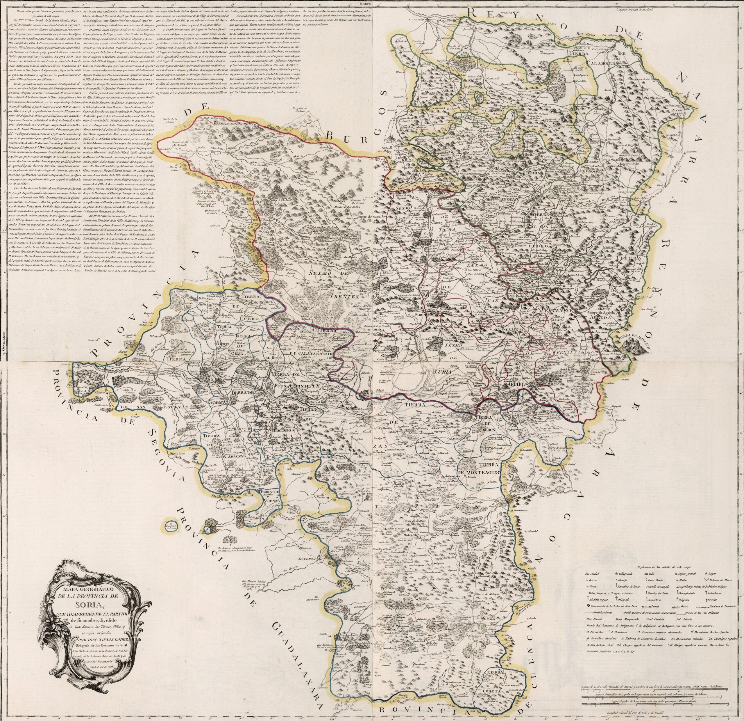
This map was created by Spanish cartographer Tomás López de Vargas Machuca in 1783 and published posthumously by his sons in the “Geographical Atlas of Spain” from 1804. The map depicts the province of Soria with the territorial boundaries prior to Javier de Burgos's reform of the provincial administration in 1833.
The former province of Soria bordered the northeast with the Kingdom of Navarre, to the east with the Kingdom of Aragon, to the south with the province of Cuenca, to the south-west with the Guadalajara province, to the east with the province of Segovia and to the northeast with the province of Burgos.
The province appears divided into a complex territorial administration with roots in the repopulation of the 11th and 12th centuries:
- University of the Land of Soria (in red), also known as the Community of Villa and Land of Soria, subdivided into the town and five districts that made up the land: Frentes, Tera, San Juan, Arciel Lubia.
- The lands of Rioja Baja (in green), which included five judicial districts: Yanguas, San Pedro, Agreda, Enciso, and Calahorra.
- The southern part of the province (in blue), divided into the Duchy of Medinaceli and twenty-one judicial districts: Alfaro, Atienza, Almazán, Aguilar, Berlanga, Burgo de Osma, Calatañazor, Caracena, Cobeta, Fuentes de Magaña, Fuentepinilla, Gormaz, Jubera, Magaña, Monteagudo, Osma, La Recompensa, San Esteban de Gormaz, Serón, Suellacabras and Ucero.
The province of Soria extended to regions that are now part of the provinces of Burgos (Monterrubio), La Rioja (Calahorra, Enciso, Mansilla) and Guadalajara (Atienza, Cobeta, Mazarete).
You can read more about Tomás López and his atlas in this article from the newsletter: Tomás López and the first detailed atlas of Spain (1804).
Sources

