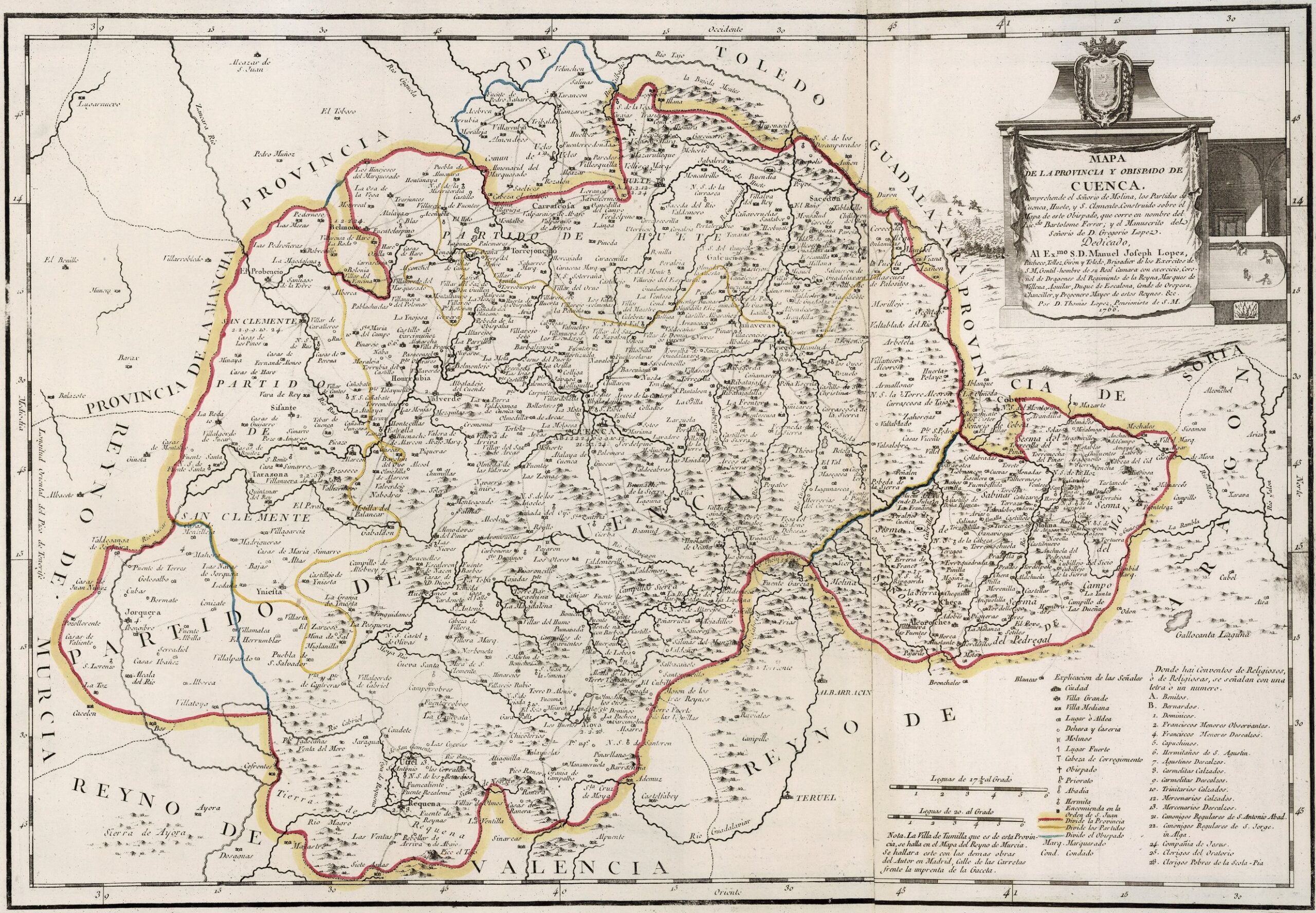
This map was created by Spanish cartographer Tomás López de Vargas Machuca in 1766 and published posthumously by his sons in the «Geographical Atlas of Spain» from 1804. The map shows the province of Cuenca with the territorial boundaries prior to the provincial administrative reform carried out by Javier de Burgos in 1833. It shows the difference between the boundaries of the bishopric of Cuenca, in blue, and the province of Cuenca, in red.
The former province of Cuenca bordered the northwest with the Guadalajara province, to the north with the province of Soria, to the northeast with the Kingdom of Aragon, to the east with the Kingdom of Valencia, to the southeast with the Kingdom of Murcia, to the south-west with the province of La Mancha and to the west with the province of Toledo.
The most notable feature of this map is its orientation. Unlike most maps in López de Vargas's Atlas Geográfico de España, this one is oriented with west at the top and therefore north on the right, south on the left, and east at the bottom.
The province is divided into three judicial districts: Cuenca, San Clemente and Huete. Tarancón and all the surrounding villages are outside the province, although within the bishopric. To the east, the province included the villages of Requena and Utiel, which did not become part of the Province of Valencia until the decree signed in 1851.
You can read more about Tomás López and his atlas in this article from the newsletter: Tomás López and the first detailed atlas of Spain (1804).
Sources

