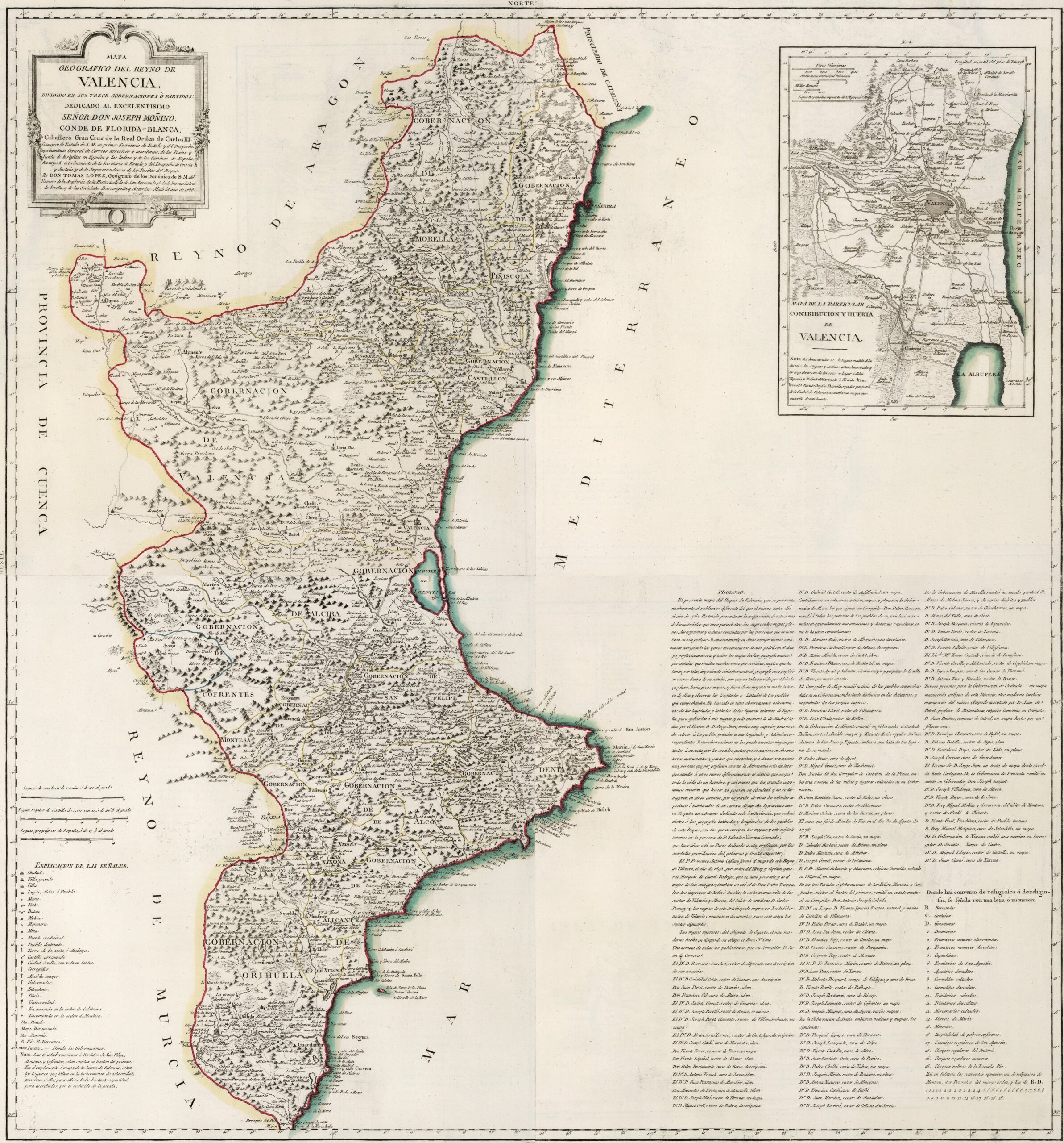
This map was created by Spanish cartographer Tomás López de Vargas Machuca in 1788 and published posthumously by his sons in the “Geographical Atlas of Spain” from 1804. The map depicts the Kingdom of Valencia with its territorial boundaries prior to the provincial administrative reform carried out by Javier de Burgos in 1833.
The Kingdom of Valencia comprised approximately the current Valencian Community, with the provinces of Alicante, Valencia and Castellón. In addition, it bordered to the north with the Principality of Catalonia, to the northwest with the Kingdom of Aragon, to the west with the Province of Cuenca, to the south-west with the Kingdom of Murcia and to the east by the Mediterranean Sea.
As part of the Nueva Planta decrees, in 1711 the territorial administration of Castile was imported and a division into 13 governorates was imposed, linked to their respective cities:
- Morella Town Council
- Peñíscola Town Council
- Castellón Provincial Council
- Government of Valencia
- Alcira Town Council
- Cofrentes Town Council
- San Felipe Government
- Governorate of Montesa
- Denia Town Council
- Alcoy Town Hall
- Xixona Town Council
- Alicante Provincial Council
- Orihuela Town Council
The map also includes a detailed view of the Huerta Valenciana on the right-hand side, which encompasses the city of Valencia and its surrounding area. Irrigation systems began to be established in this historic region during the Islamic period in the Middle Ages, when numerous irrigation channels, weirs and small dams were created, as shown in detail on the map.
You can read more about Tomás López and his atlas in this article from the newsletter: Tomás López and the first detailed atlas of Spain (1804).
Sources

