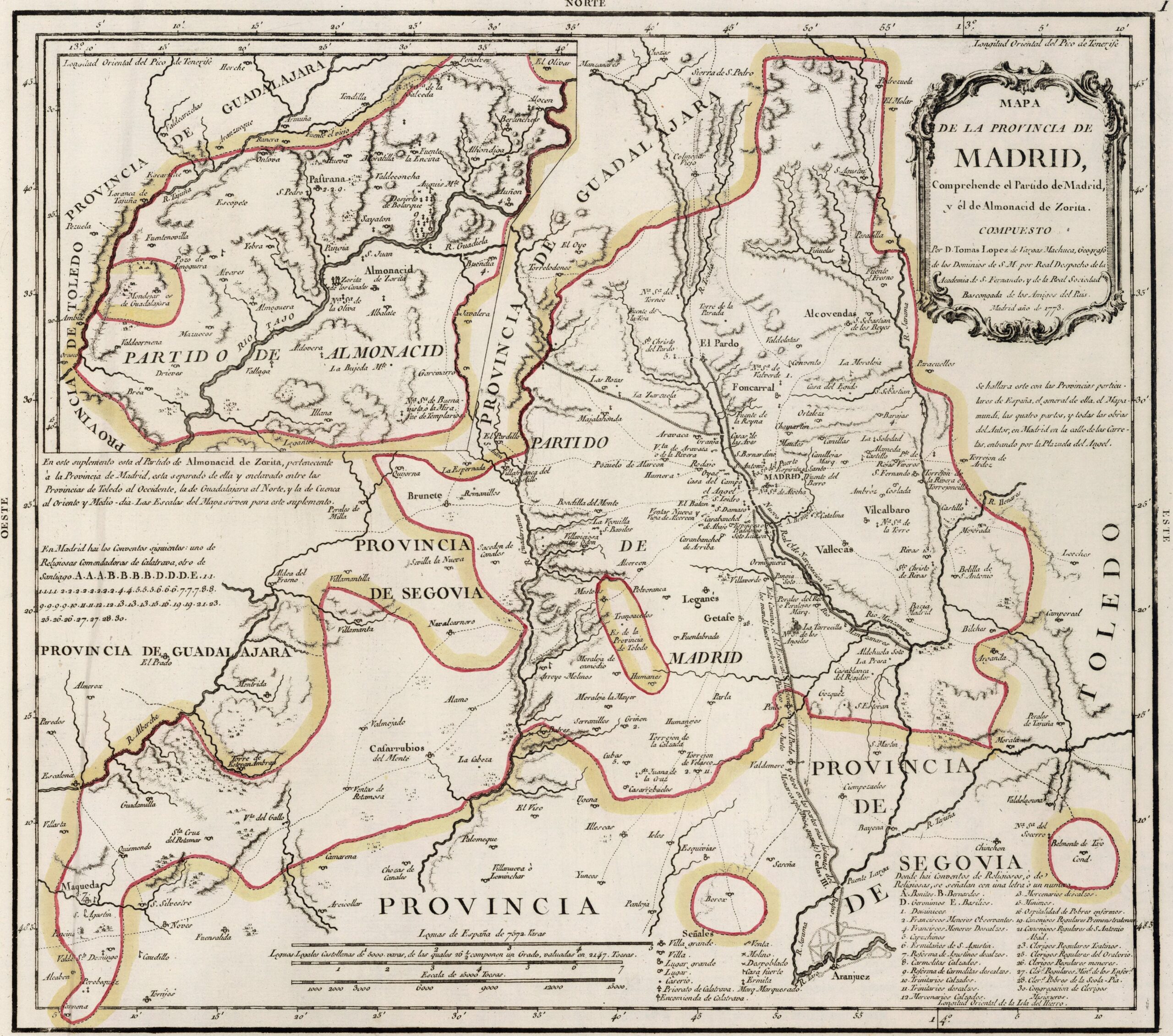
This map was created by Spanish cartographer Tomás López de Vargas Machuca in 1773 and published posthumously by his sons in the «Geographical Atlas of Spain» from 1804. The map depicts the province of Madrid with the territorial boundaries prior to Javier de Burgos's reform of the provincial administration in 1833.
The former province of Madrid bordered the northwest and southeast with the province of Segovia, to the west and northeast with the Guadalajara province and to the east and south with the province of Toledo.
It was one of the smallest provinces in Spain in 1773. This was partly because the province had no historical significance, but rather came into being following the appointment of Madrid as the capital of the kingdom. Little by little, territory that had previously belonged to the provinces of Guadalajara, Toledo and Segovia was annexed, but towns such as Chinchón, Móstoles, Alcalá de Henares, Navalcarnero, El Escorial, Torrejón de Ardoz and Aranjuez were still outside the provincial domain of Madrid.
In a box in the top left-hand corner, there is a reference to the Almonacid district, which is geographically located in the south of the province, near the city of Toledo.
You can read more about Tomás López and his atlas in this article from the newsletter: Tomás López and the first detailed atlas of Spain (1804).
Sources

