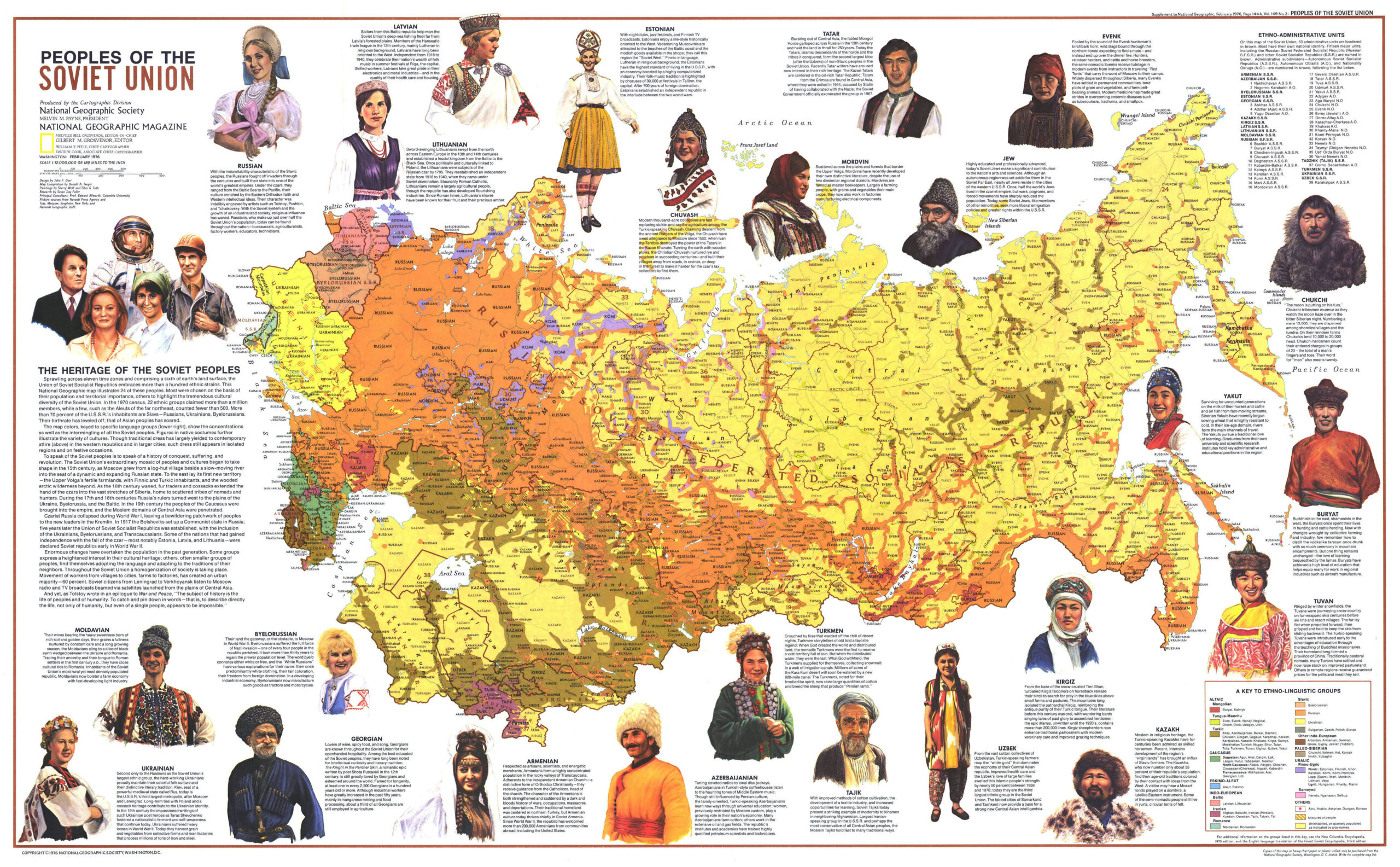
This ethnic map, published by National Geographic in 1976, shows the different peoples or nations that existed among the inhabitants of the Soviet Union.
The different colours highlight the major ethnic groups of the USSR, among which the following are noteworthy:
- Orange – Russians.
- Brown – Turkic peoples: Kazakhs, Kyrgyz, Tatars, Yakuts.
- Red – Mongols.
- Purple – Iranian peoples: Persians, Tajiks, Afghans
- Bright yellow – Ukrainians.
- Pale yellow – Unpopulated areas (mainly Siberia)
Among the different peoples, many of those who formed their own republic within the federation are shown, such as the Ukrainians, Moldovans, Belarusians, Lithuanians and Kazakhs. In many other cases, there were ethnic groups that had their own associated republic within Russia (brown dividing lines), such as the Chukchi of the Chukotka Autonomous Republic (in north-eastern Russia) or the Buryats of the Buryatia Autonomous Republic (next to Lake Baikal).
There are references to small communities of nations that had their own country outside the Soviet Union, such as Poles and Romanians in eastern Ukraine or Iranians and Afghans in southern Turkmenistan and Tajikistan.
This is one of the maps that shows the cultural and historical complexity of what the Soviet Union represented at the time and what Russia and some of the former Soviet republics still represent today.
Sources

