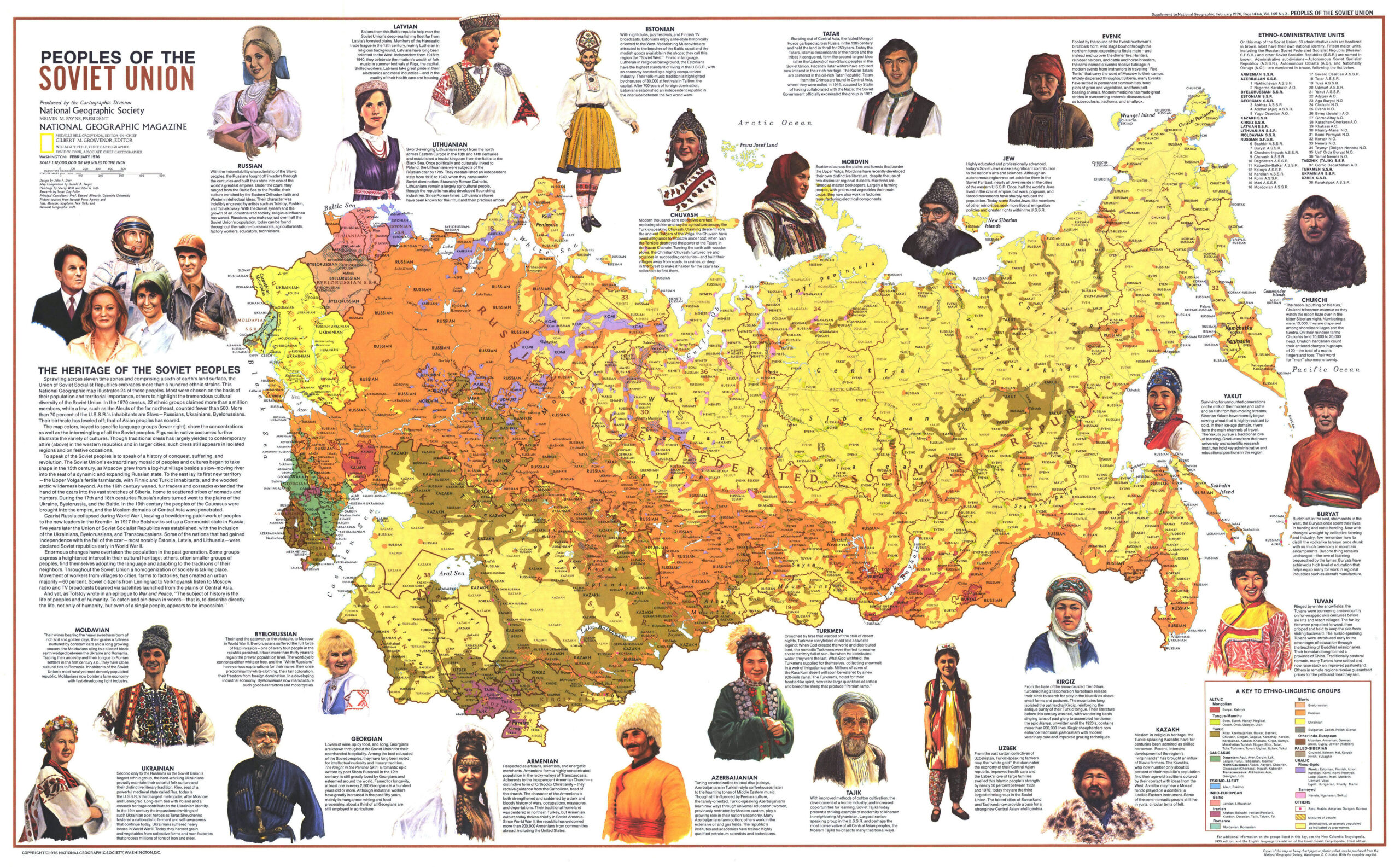
This ethnic map, published by National Geographic in 1976, shows the different peoples or nations that existed among the inhabitants...
Maps of Estonia (4 maps)
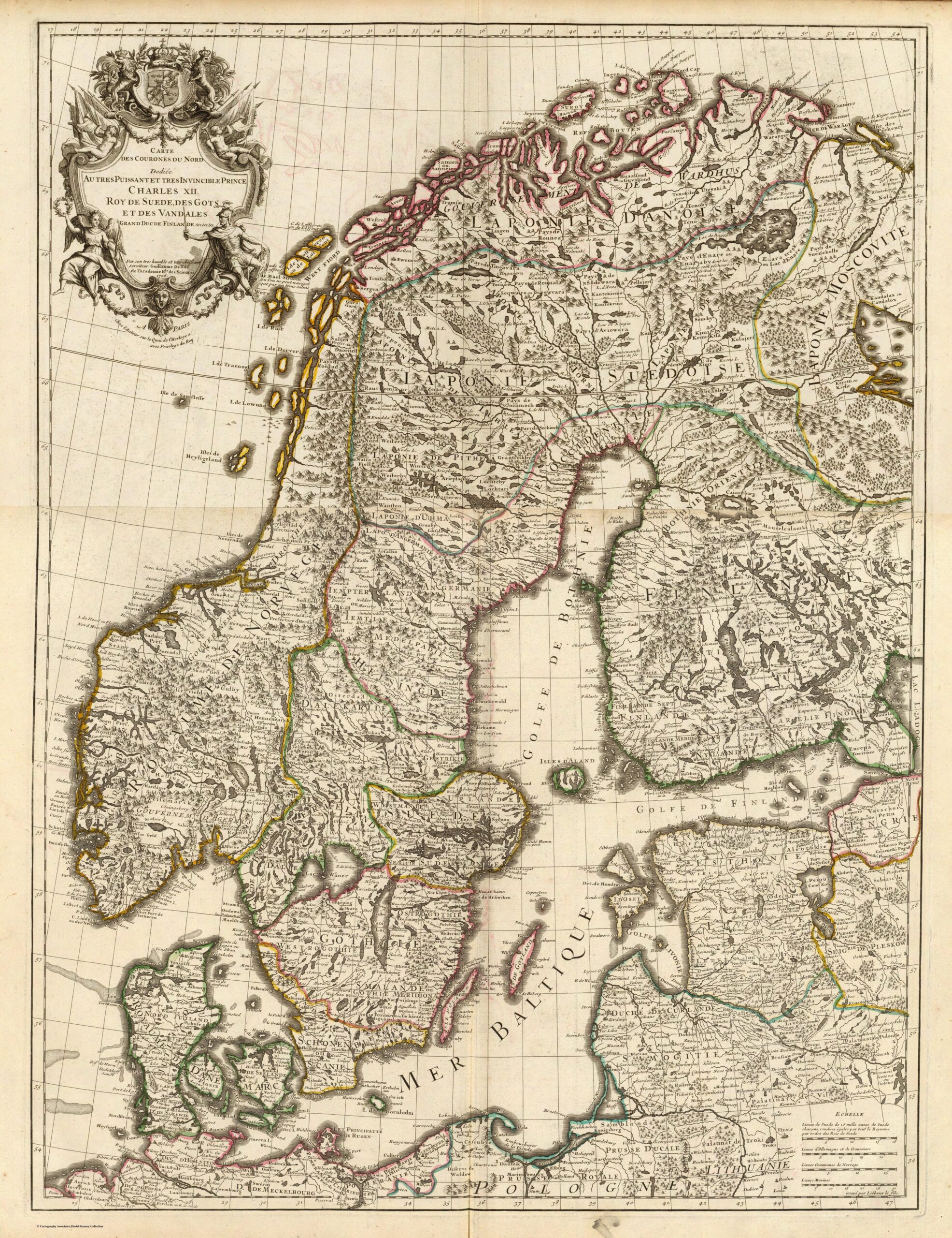
Map of the Northern Crowns (1706)
This map, drawn by the French cartographer Guillaume De l'Isle, was published in Paris with the privilege of the King of...

Physical and political map of Estonia (1999)
This map of Estonia was published by the CIA in 1999 and is currently held in the cartographic collection at...

The Baltic States (1926)
This map, published by Stanfords in 1926, forms part of Stanford’s London Atlas of Universal Geography. The map shows…
 Español
 English (UK)