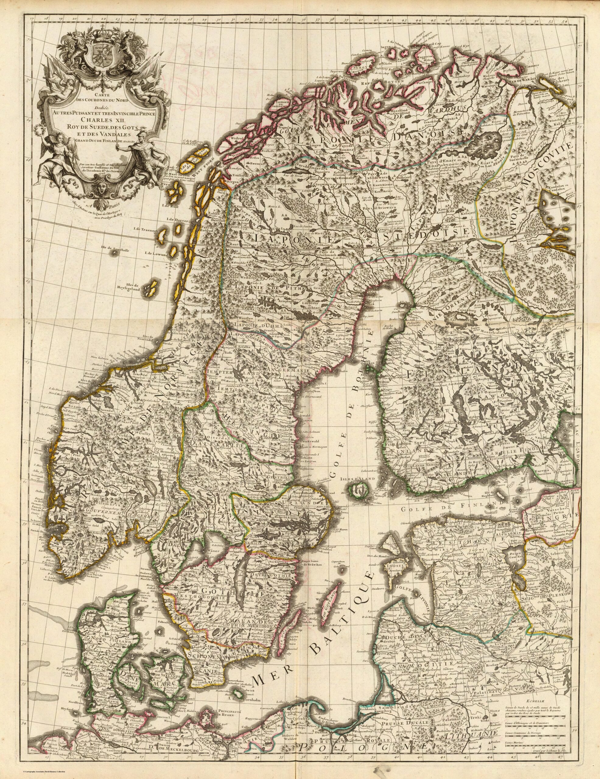
This map, drawn by the French cartographer Guillaume De l'Isle, was published in Paris with the privilege of the King of France in 1706. In 1731, this map was included in the Atlas de Géographie.
The map shows Scandinavia, Lapland, the Baltic Sea and all its surrounding coasts. The territorial divisions, which can be seen in different colours, show a collection of kingdoms, duchies and provinces in the region. At the top left is a cartouche with the name of the map and a dedication to Charles XII, King of Sweden, King of the Goths, King of the Vandals and Grand Duke of Finland.
The dedication shows how important Charles XII was in Europe at the beginning of the 18th century. By the age of 22, he had already won several victories in the Great Northern War, which had established the Swedish Empire as the great power of the Baltic Sea. By 1706, Charles XII had succeeded in making his empire's territory the whole of Sweden, Finland and the southern and eastern shores of the Baltic. This supremacy lasted only a few years, for after a defeat in 1709 the Swedish Empire's fortunes changed, eventually losing much of its territory at the end of the Great Northern War in 1721, three years after Charles XII died on the battlefield.
Artistically and cartographically, the map is an important piece of 18th-century cartography. The depiction of the Norwegian and Baltic coasts is more accurate than previous maps. In contrast, less explored regions, such as Lapland, are more inaccurate.
Sources

