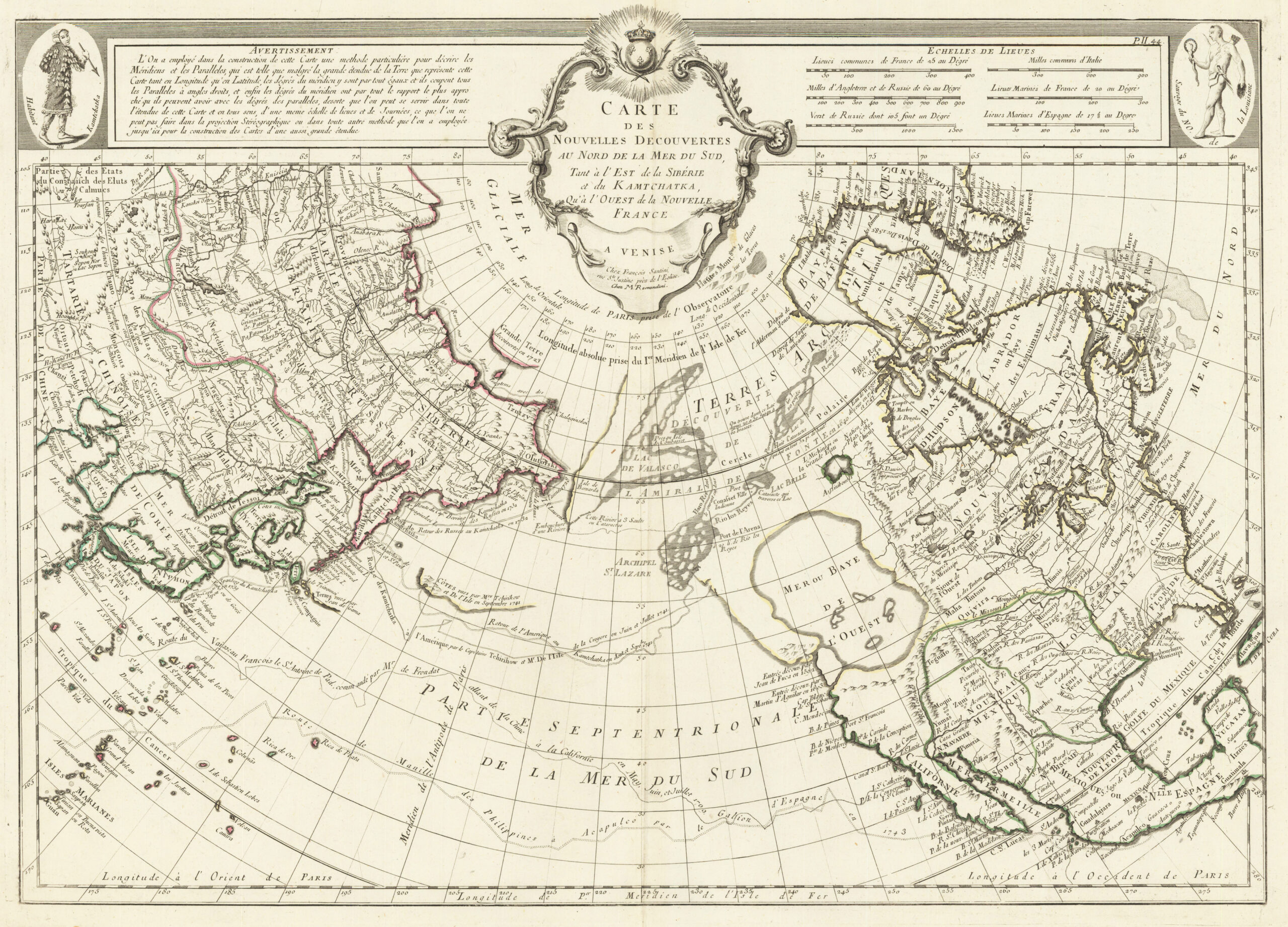
This map was drawn by François Santini and published by the Venetian publisher M. Remondini in 1776. The map is based on an earlier one commissioned by the French government from Philippe Buache and was published in 1753.
The great curiosity of this map is that it clearly and significantly represents the Western Sea, known in Spanish as the Mar del Occidente. This hypothetical sea appeared on several maps from the 16th and 17th centuries thanks to the writings of Admiral Bartolomé de Fonte and Juan de Fuca about their voyages. The supposed existence of this sea declined in the early 18th century, although it regained relevance with the publication of Philippe Buache's map.
This map by Francois Santini is also in French, like Buache's, but it also includes some interesting connotations. In the upper left corner is an image of a “Kamchatka inhabitant,” and in the upper right corner is an image of a “Louisiana savage.” This not-so-subtle differentiation was a way of justifying the French persecution of Native Americans, considering them inferior to other inhabitants of the planet.
Sources
- Map of New Discoveries North of the South Sea
- Map of New Discoveries North of the South Sea – Antiquariat Reinhold Berg eK Owner: R. Berg

