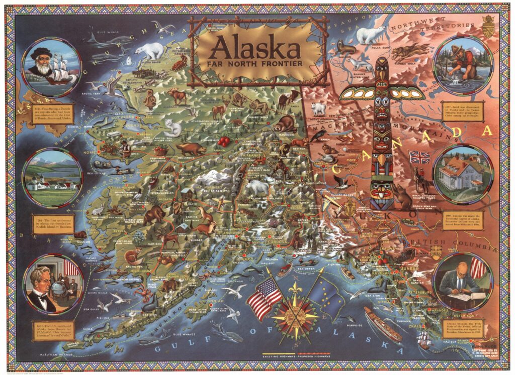
This pictorial map of Alaska was drawn by Klengston Rude and published in 1959, the year Alaska became the 49th state of the United States.
This map highlights the nature and infrastructure of the new state, including rivers, mountains, cities, glaciers, and roads. It also features a wide selection of animals that can be found throughout Alaska, such as different types of moose, bears, lynxes, goats, and seals.
On the left and right sides, six events are shown that the authors consider key in the history of Alaska:
- The discovery of Alaska by Vitus Bering in 1741.
- The first European settlement in Alaska, by Russia in 1784.
- The purchase of Alaska in 1867 by the United States.
- The discovery of gold in 1897.
- The move of the capital to Juneau in 1900
- The official incorporation of Alaska as the 49th state of the Union.
Sources

