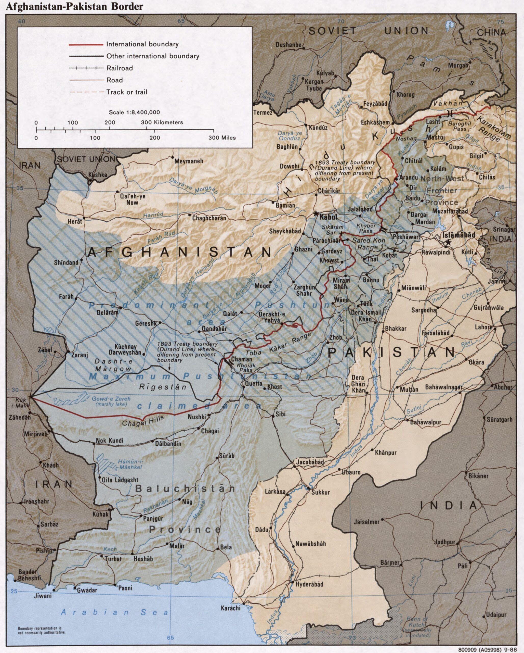
This map of Afghanistan and Pakistan was published by the CIA in 1988 and is currently held in the Map Division in Washington, part of the United States Library of Congress.
The Durand Line was drawn in 1893 as a result of the Gandamak Treaty. The aim of that treaty was not so much to determine a border per se, but rather to limit the influence of Emir Abdur Rahman Khan on the borders of the British Empire (dividing the Pashtun people in two).
Although this line remained functional for several decades, it became a source of tension in relations between Afghanistan and Pakistan when the British Empire abandoned the British Raj.
Sources

