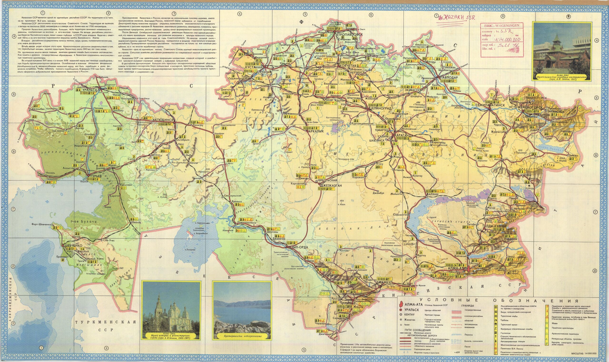
This map of Kazakhstan was published in 1988 by the GUGK (Main Directorate of Geodesy and Cartography, Head of Geodesy and Cartography Administration of the Soviet Union), with the intention of promoting tourism in the Soviet republic.
The map was in Russian, as it was intended for citizens of the USSR. The work is accompanied by only three images, which show what are presumably the three points of greatest interest in the country: two buildings in Almaty, the capital of Kazakhstan in 1988, and the Bujtarma River reserve.
The map also includes a detailed legend related to tourism, with all the yellow signs at the bottom right. Those accompanied by black lettering indicate practical locations for the trip, such as hotels, tourist agencies, or camping areas; those with green lettering are related to cultural and nature tourism, such as museums, national parks, or archaeological sites; in red, all tourism related to the history of the Soviet Union appears:
- Monuments to Lenin.
- Monuments and memorial sites dedicated to other important figures.
- Monuments to the class struggle and the revolutionary movement.
- Monuments and places associated with the Civil War and the fight against the Basmachi movement.
- Monuments to soldiers who died during the Great Patriotic War.
As a final note, the Basmachi movement was a struggle by the Muslim population against forced conscription that took place both during the Russian Empire and the Soviet Union. On the other hand, the Great Patriotic War is how World War II was known in the USSR, during the period from 1941 to 1945, when the Soviet Union entered the war against Germany.
Sources

