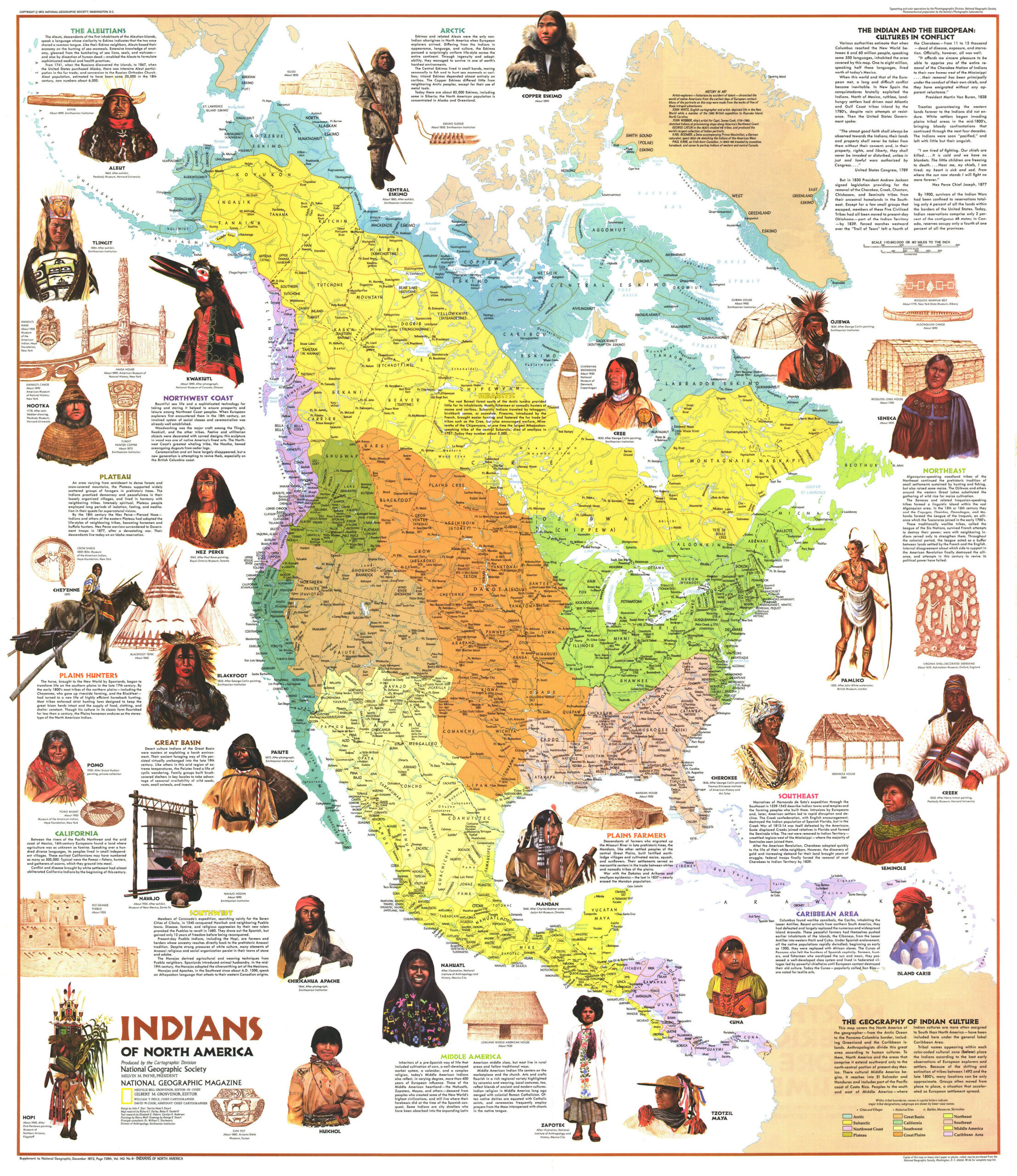
This ethnic map, designed by George Stuart and published by National Geographic in 1972, shows the different native peoples of North America prior to 1492.
As shown in the illustration, in the upper right-hand corner, before the arrival of Europeans in America, it is estimated that the entire continent had between 6 and 60 million inhabitants who spoke some 550 different languages. Due to colonisation and subsequent repression, the native population was reduced to very limited territories, often far from their homes.
The map seeks to represent all the villages, although their size and location are approximate, given the lack of sources. The native villages are grouped into twelve large families:
- Arctic, in blue (also includes the Aleutians).
- Subarctic, in yellow
- North-west coast, in purple
- Plateau, in olive green
- Great basin, in brown
- California, in green
- Southwest, in light yellow
- Great Plains, in orange (includes farmers and hunters).
- Northeast, in light green
- Southeast, in pink
- Mesoamerica, in yellow
- Caribbean area, in purple
The map also includes illustrations of some of the most representative peoples who survived into the 20th century, such as the Inuit, the Cherokee and the Zapotec.
Sources

