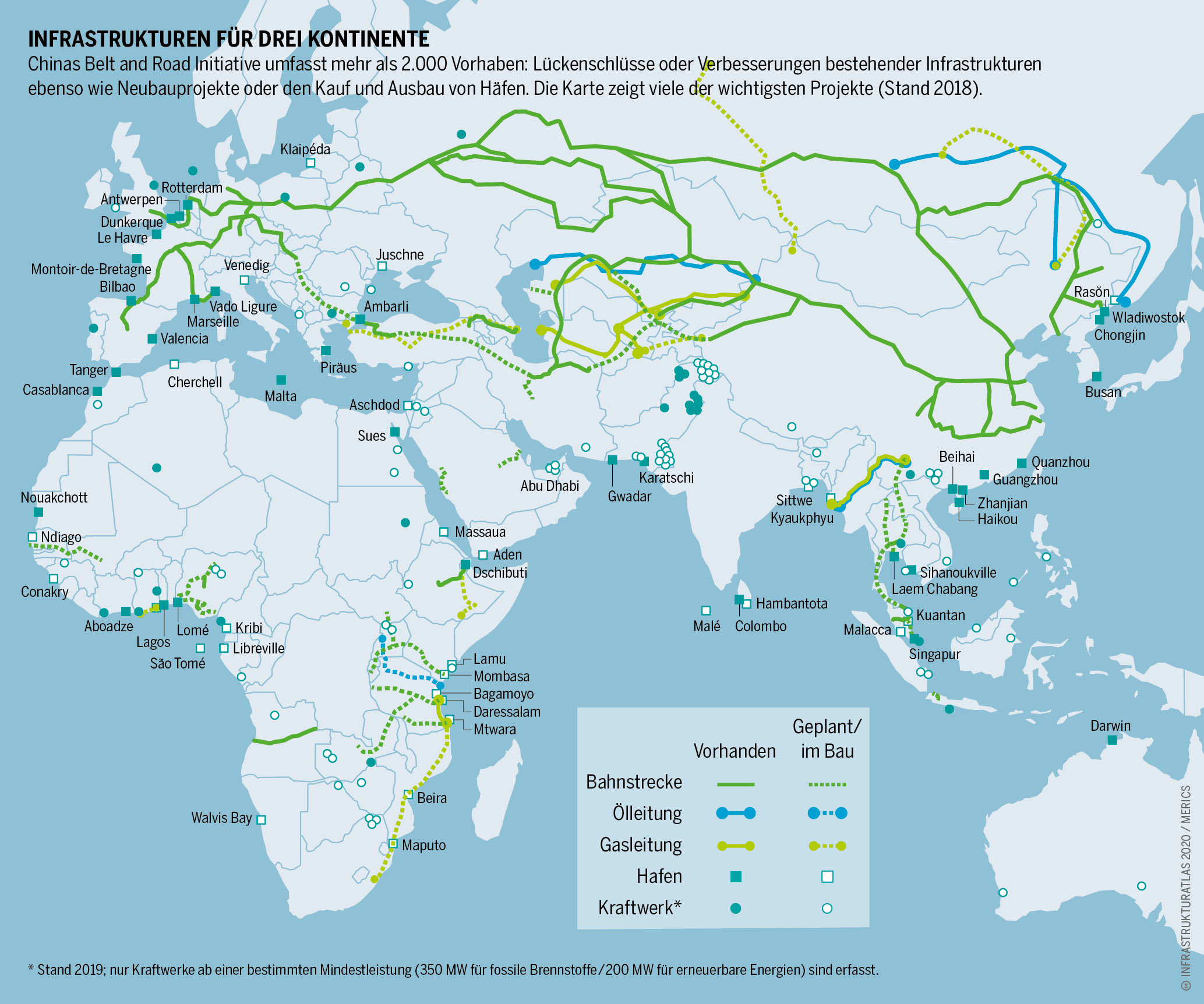
This map, published by Michael Brake in Infrastruktur Atlas (Infrastructure Atlas), shows the location of China's major international development project, the Belt and Road Initiative, popularly known as the New Silk Road.
It is an international cooperation and global infrastructure initiative launched by China in 2013 and is considered a key part of its international policy. The driving force behind this project is the great added value of trade in a prosperous and stable world.
The map shows the status of the New Silk Road in 2018, with the following legend:
- The solid lines show completed transport infrastructure, while the dotted lines show infrastructure that is planned or under construction:
- In green, the railway lines.
- In blue, the oil pipelines.
- In yellow, the gas pipelines.
- The filled icons show completed centres, while the empty ones show those that are planned or under construction.
- Square, the ports.
- Circles, power stations.
Sources

