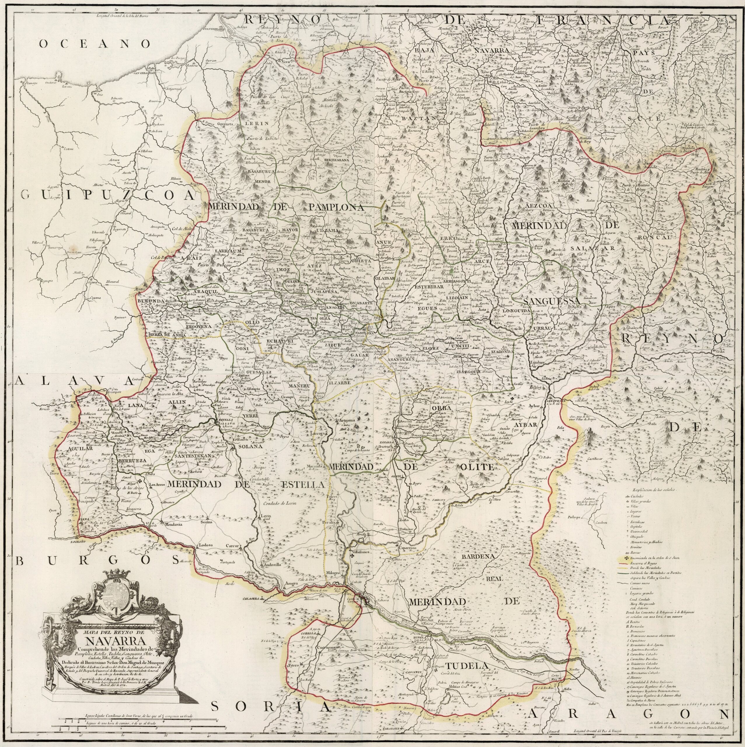
This map was created by Spanish cartographer Tomás López de Vargas Machuca in 1772 and published posthumously by his sons in the “Geographical Atlas of Spain” from 1804. The map depicts the Kingdom of Navarre with its territorial boundaries prior to the provincial administrative reform carried out by Javier de Burgos in 1833.
The Kingdom of Navarre roughly comprised the current Community of Navarre. It bordered France to the north, the Kingdom of Aragon, to the south with the province of Soria, to the south-west with the province of Burgos, to the west the province of Álava and to the north-west with the province of Guipúzcoa.
The kingdom was still divided into the four districts created in the 13th century: Pamplona, Estella, Tudela and Sangüesa (Sanguessa), to which the district of Olite was added in 1407. The map also includes references to the different valleys that still give their names to many of the municipalities in Navarre today.
As a curious fact, the map also refers to Lower Navarre or the land of Ultrapuertos. This region, currently part of France, was under the control of the Kingdom of Navarre from the early 13th century until the annexation of Navarre to the Kingdom of Castile in 1521 and the consequent abandonment of Lower Navarre due to the difficulty of defending it.
You can read more about Tomás López and his atlas in this article from the newsletter: Tomás López and the first detailed atlas of Spain (1804).
Sources

