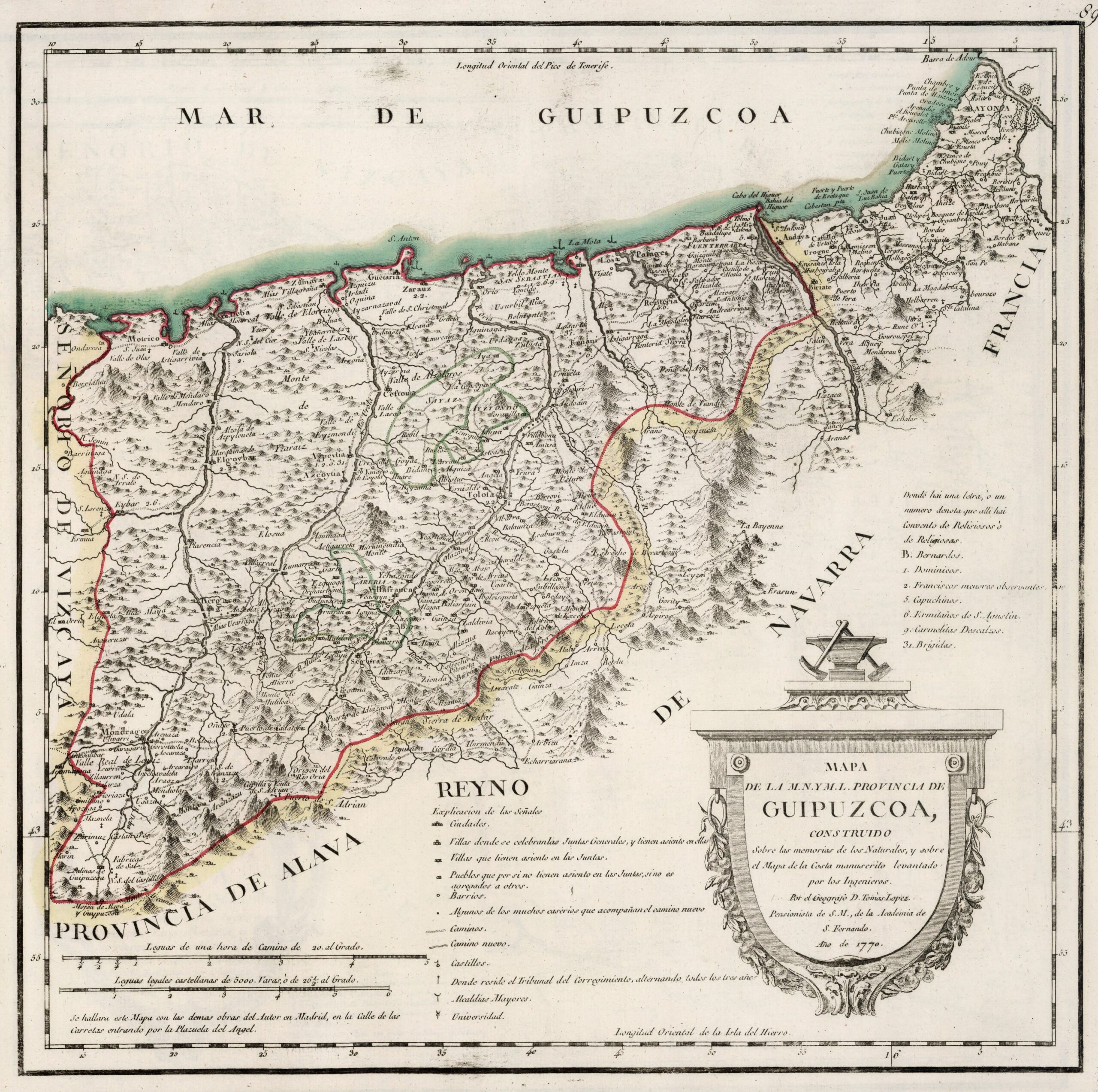
This map was created by Spanish cartographer Tomás López de Vargas Machuca in 1770 and published posthumously by his sons in the “Geographical Atlas of Spain” from 1804. The map depicts the province of Guipúzcoa with the territorial boundaries prior to the provincial administrative reform carried out by Javier de Burgos in 1833.
The former province of Guipúzcoa roughly comprised the territory occupied today. It was bordered to the north by the Cantabrian Sea (Sea of Guipúzcoa), to the east by France, to the south-east by the Kingdom of Navarre, to the south with the province of Álava and to the west with the Lordship of Biscay.
The province still preserved part of its medieval territorial administration, although it had adapted to the system of intendencies created by Philip V in 1720:
- 18 judicial districts, all of which corresponded to one of the historic towns with a seat on the council: San Sebastián, Tolosa, Azpeitia, Mondragón, Vergara, Deva, Motrico, Elgoibar, Fuenterravía, Getaria, Cestona, Hernani, Zumaya, Eybar, Elgueta, Berástegui, Anzuola and Besáin.
- Three major municipalities (marked in green on the map): Arería, Sayaz, and Aiztondo.
- Two valleys: Léniz and Oyarzun.
- 5 unions: Santa Cruz de Arguisano, Ainsu, Aizpurua, Bozue Mayor and Río Oria.
You can read more about Tomás López and his atlas in this article from the newsletter: Tomás López and the first detailed atlas of Spain (1804).
Sources

