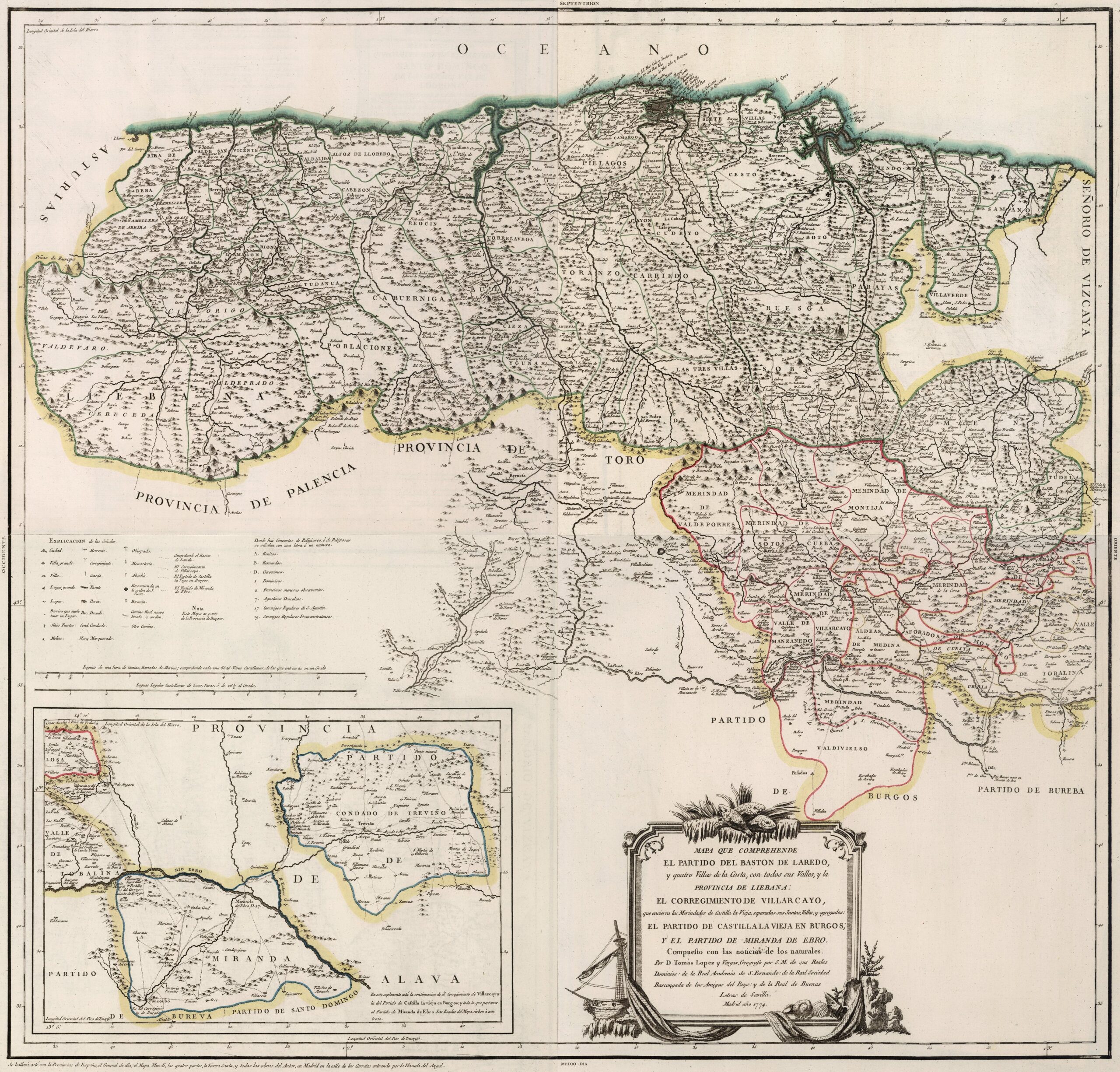
This map was created by Spanish cartographer Tomás López de Vargas Machuca in 1774 and published posthumously by his sons in the “Geographical Atlas of Spain” from 1804. The map depicts the northern part of the Province of Burgos with the territorial boundaries prior to the provincial administrative reform carried out by Javier de Burgos in 1833.
The vast expanse of the former Province of Burgos included territories that currently belong to the Province of Cantabria. Noteworthy are the Province of Liébana, in the mountainous area to the east of the map, and the Partido del Bastón de Laredo, which was the 18th-century entity that administratively grouped together the Hermandad de las Cuatro Villas, including San Vicente de la Barquera, Santander, Laredo and Castro-Urdiales. The map also includes the County of Treviño, an enclave within the Province of Álava, and the District of Miranda.
The province of Burgos extends southwards, beyond the boundaries shown on this map, and these territories also border on the Principality of Asturias to the west, the province of Palencia and the Toro province in the south-west, and the Lordship of Biscay to the east.
During the last quarter of the 18th century, there were multiple attempts by these territories to separate from the province of Burgos and achieve administrative independence. The valleys of the mountainous area established the Province of Cantabria in 1778, although without the accession of Laredo, Santander and Castro-Urdiales. In 1799, the main coastal towns also joined the province, which was renamed the Province of Santander, with its capital in the city of Santander.
You can read more about Tomás López and his atlas in this article from the newsletter: Tomás López and the first detailed atlas of Spain (1804).
Sources

