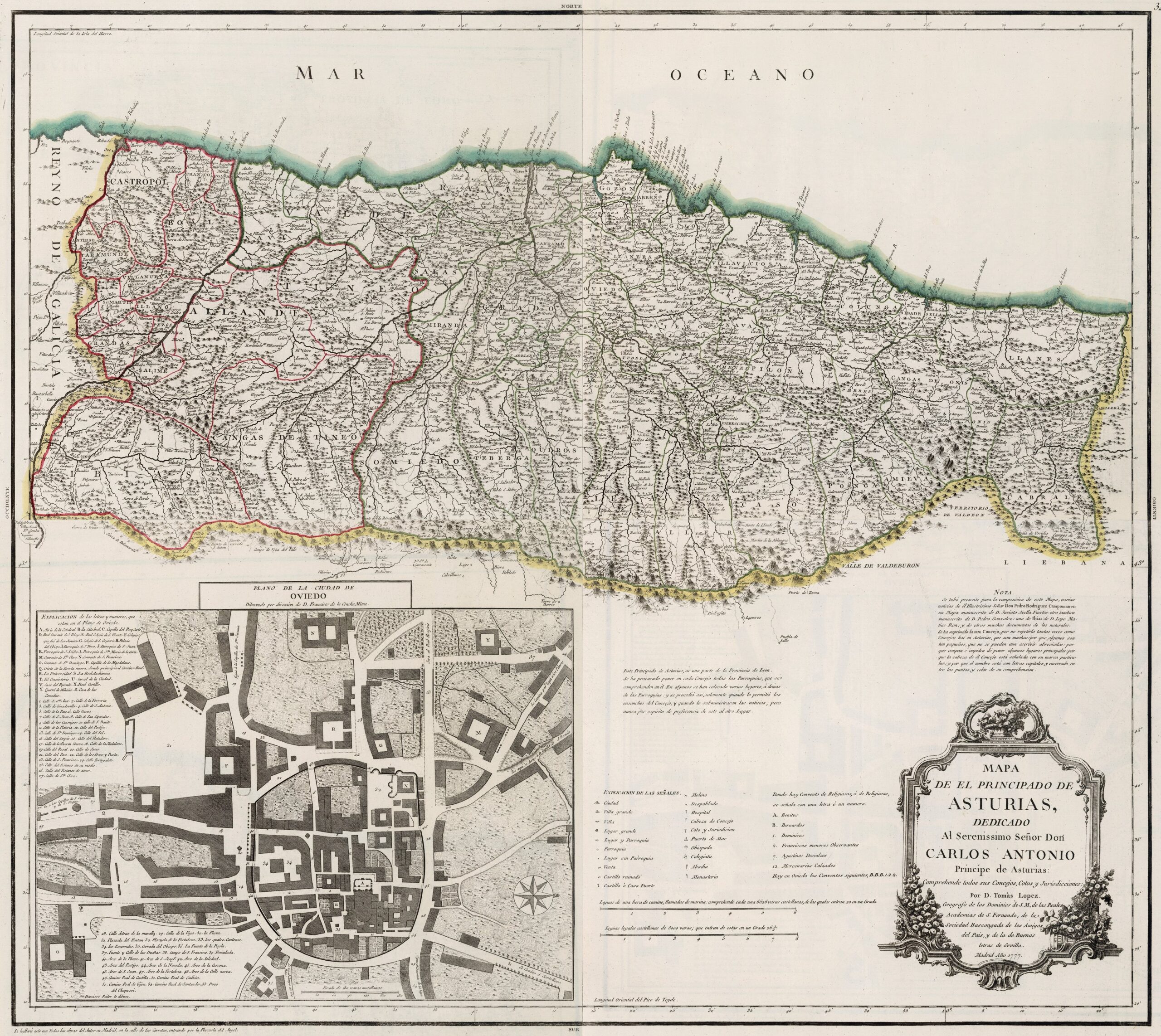
This map was created by Spanish cartographer Tomás López de Vargas Machuca in 1777 and published posthumously by his sons in the “Geographical Atlas of Spain” from 1804. The map depicts the Principality of Asturias with its territorial boundaries prior to the provincial administrative reform carried out by Javier de Burgos in 1833.
The Principality of Asturias bordered the Kingdom of Galicia, as shown on the map, in addition to the Staff of Laredo and the Province of Liébana to the east and the Province of Palencia to the southeast. To the south was the Province of León, However, as the author points out in a text in the centre of the map, the Principality of Asturias was administratively part of the Province of León, at least since 1750, as documented in the Catastro de Ensenada (Ensenada Cadastre).
The province is divided into a complex territorial administration with 66 subdivisions into councils, districts and jurisdictions. The area of the former Principality of Asturias corresponded to the current one, with the exception of Peñamellera and Ribadedeva, which were part of the Province of Burgos.
The map also includes a plan of the city of Oviedo, showing the entire walled enclosure with the nine entrance arches marked with numbers from 40 to 48. This wall was demolished during the 19th and 20th centuries in various phases to expand the city and remove physical barriers between neighbourhoods.
You can read more about Tomás López and his atlas in this article from the newsletter: Tomás López and the first detailed atlas of Spain (1804).
Sources

