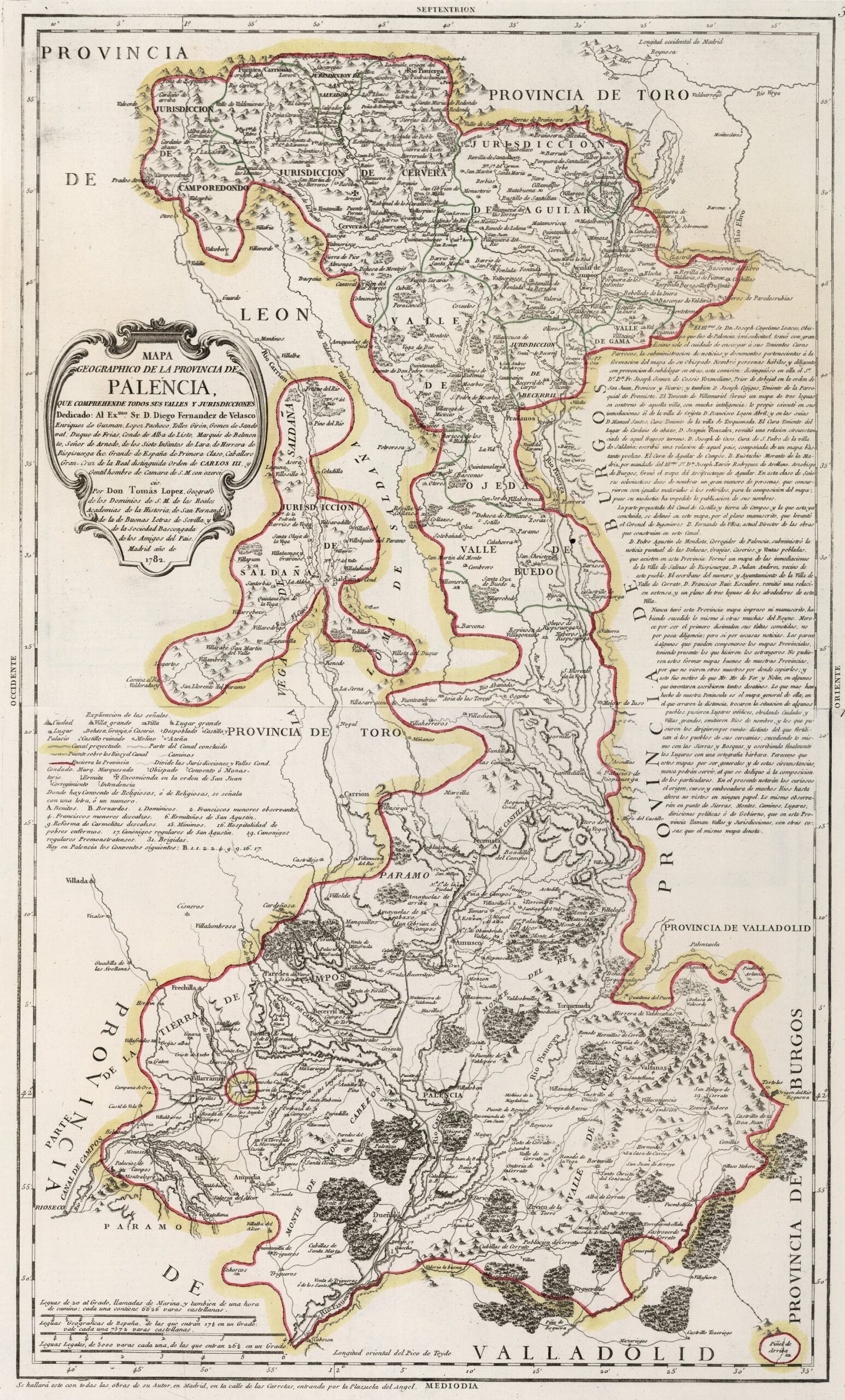
This map was created by Spanish cartographer Tomás López de Vargas Machuca in 1782 and published posthumously by his sons in the “Geographical Atlas of Spain” from 1804. The map depicts the province of Palencia with the territorial boundaries prior to the provincial administrative reform carried out by Javier de Burgos in 1833.
The former province of Palencia was created in 1656 when the District of Palencia separated from the Province of Toro, which then consisted of only three districts: Carrión match, Reynosa match y Bullfighting match. Due to this past, the boundaries of the province of Palencia were complex, with the Reynosa match to the north, the Province of Burgos to the east, the Province of Valladolid to the east and south, the Carrión match to the west and the Province of León to the north-west.
With the territorial reorganisation of 1833, the province of Palencia gained part of the territory that at the end of the 19th century belonged to all the neighbouring provinces.
This map is unique in that it shows the extent of the Canal de Castilla, the great engineering feat of the 18th century. The drawing shows the parts of the canal that were already in operation in 1782, as well as those that were planned for future construction. The three branches of the canal can be clearly seen:
- Northern branch line, from Olea in the north to La Y, near the city of Palencia.
- Campos branch line, from the Y junction towards Rioseco, in the west.
- Southern branch line, from the Y junction to Cabezón, in the south.
The drawing also shows the different administrative subdivisions of the province, with multiple jurisdictions and valleys.
You can read more about Tomás López and his atlas in this article from the newsletter: Tomás López and the first detailed atlas of Spain (1804).
Sources

