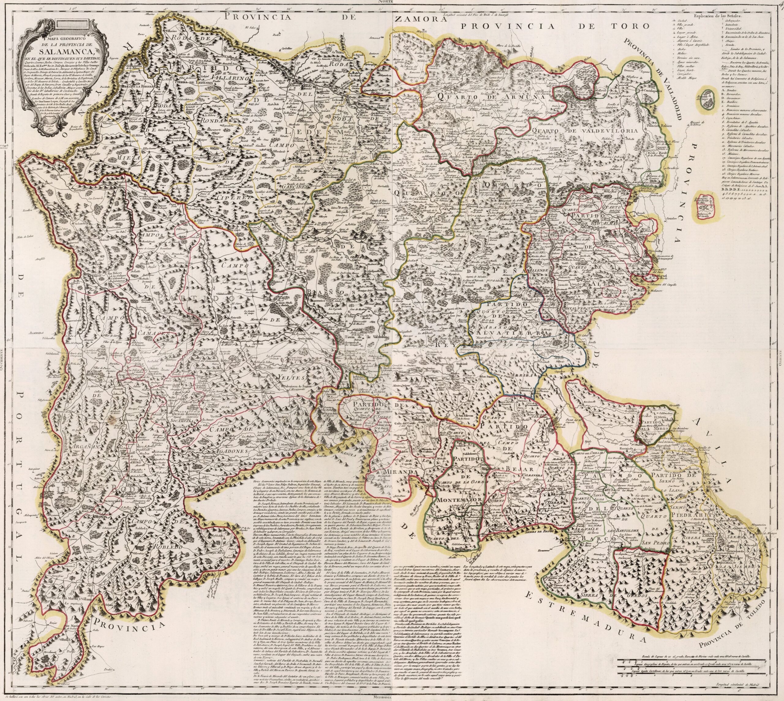
This map was created by Spanish cartographer Tomás López de Vargas Machuca in 1783 and published posthumously by his sons in the “Geographical Atlas of Spain” from 1804. The map depicts the province of Salamanca with the territorial boundaries prior to Javier de Burgos's reform of the provincial administration in 1833.
The former province of Salamanca bordered the province of Zamora to the north and the Bullfighting match, to the northeast with the province of Valladolid, to the east with the province of Ávila, to the southeast with the province of Toledo, to the south with the province of Extremadura and to the west with the Kingdom of Portugal.
The administrative division was complex, although it had a certain coherence, with a main division into districts and these, in turn, into subdivisions with different names:
- Alba de Tormes match, with three quarters: Almar River Quarter, Allende del Río Quarter, and Cantalverque Quarter
- Ávila Boat Party, with five quarters: Orillar Quarter, San Pedro Quarter, Santa Lucía Quarter, Aravalle Quarter, San Bartolomé Quarter.
- Béjar match, with four quarters: Campo Quarter, Valvaneda Quarter, Sierra Quarter, and Abajo Quarter.
- Township and District of Ciudad Rodrigo, with five fields: Campo de Camaces, Campo de Argañán, Campo de Yeltes, Campo de Agadones and Campo de Robledo.
- Ledesma match, with five districts: Villarino, Mieza, Cipérez, Campo, and Garcirrey.
- Miranda del Castañar match, with two quarters: Cuarto de la Sierra and Cuarto de lo Llano.
- Peeping Tom Party, without internal divisions.
- Montemayor match, with two rooms: Ojeda Room and River Room.
- Piedrahíta match, with three districts: Sexmo de lo Llano, Sexmo de la Ribera and Sexmo de la Sierra.
- District and Municipality of Salamanca, with four quarters: Armuña Quarter, Valdeviloria Quarter, Peña Rey Quarter and Baños Quarter.
- Salvatierra de Tormes match, with two rooms: the Upper Room and the Lower Room.
The province also had two exclaves that became part of other provinces after the territorial reorganisation of 1833: Narros del Castillo, which became part of the province of Ávila, and Bobadilla del Campo, which became part of the province of Valladolid.
You can read more about Tomás López and his atlas in this article from the newsletter: Tomás López and the first detailed atlas of Spain (1804).
Sources

