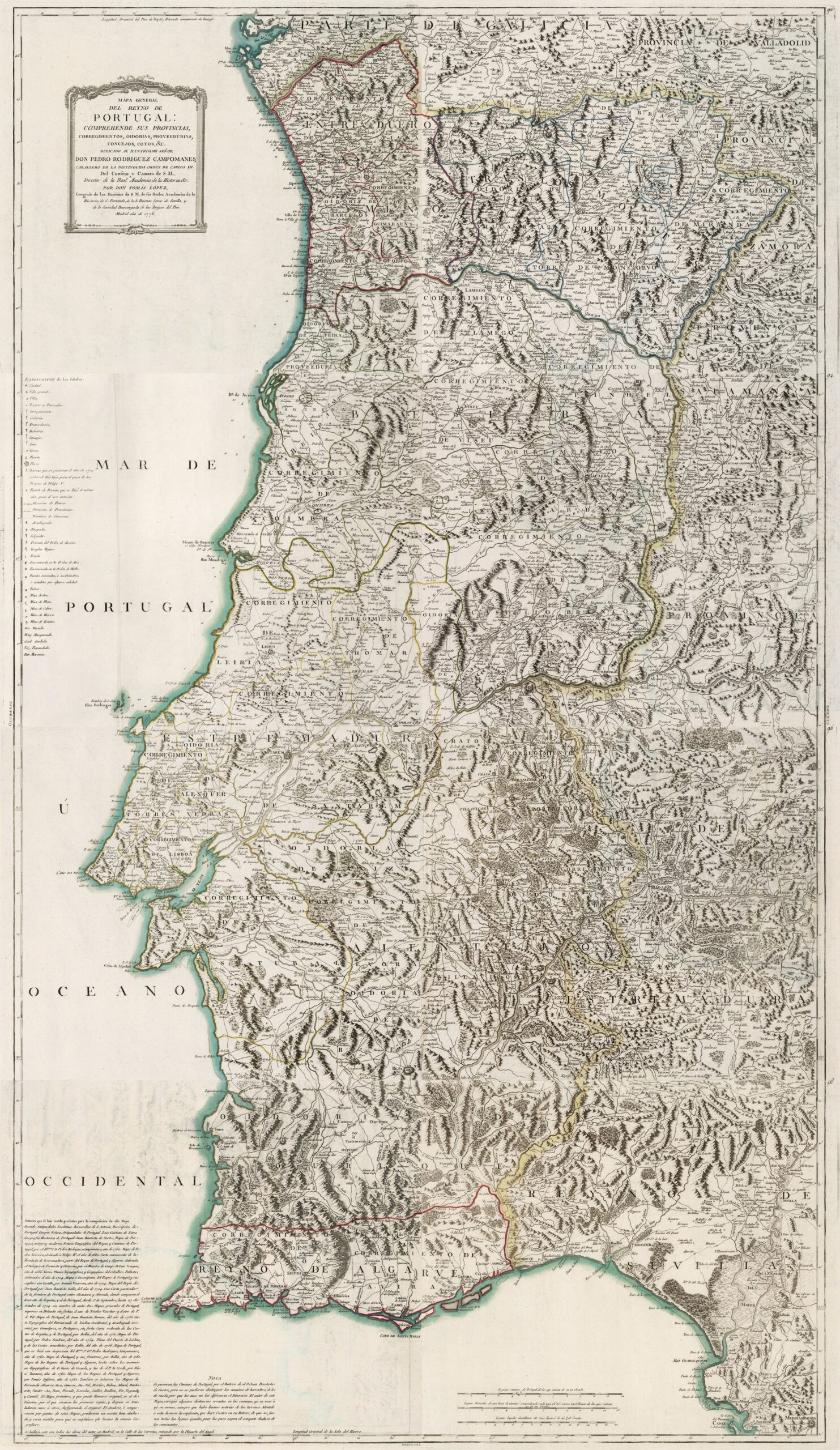
This map was created by Spanish cartographer Tomás López de Vargas Machuca in 1778 and published posthumously by his sons in the “Geographical Atlas of Spain” from 1804. The map depicts the Kingdom of Portugal, which, despite not being part of Spain, is geographically very closely related to the rest of the Iberian Peninsula.
The Kingdom of Portugal had the same extent as it does today, with the exception of the city of Olivenza and its surrounding territory east of the Guadiana River, which passed from Portugal to Spain in 1801. At that time, it bordered the Kingdom of Galicia and the province of Valladolid, to the north, and to the east with the Zamora province, the province of Salamanca, the province of Extremadura and the Kingdom of Seville.
Portugal had a complex territorial organisation, although since the 14th century there had been a division into six official regions which essentially served a military purpose:
- Between Douro and Minho – Between Duero and Miño
- Between Douro and Mondego – Behind the mountains
- Beira – Beira
- Extremadura – Extremadura
- Between Tejo and Odiana – Alentejo
- Algarve – Kingdom of Algarve
These regions were further subdivided into a variable set of districts, oidorias, proveedurias, councils and reserves.
You can read more about Tomás López and his atlas in this article from the newsletter: Tomás López and the first detailed atlas of Spain (1804).
Sources

