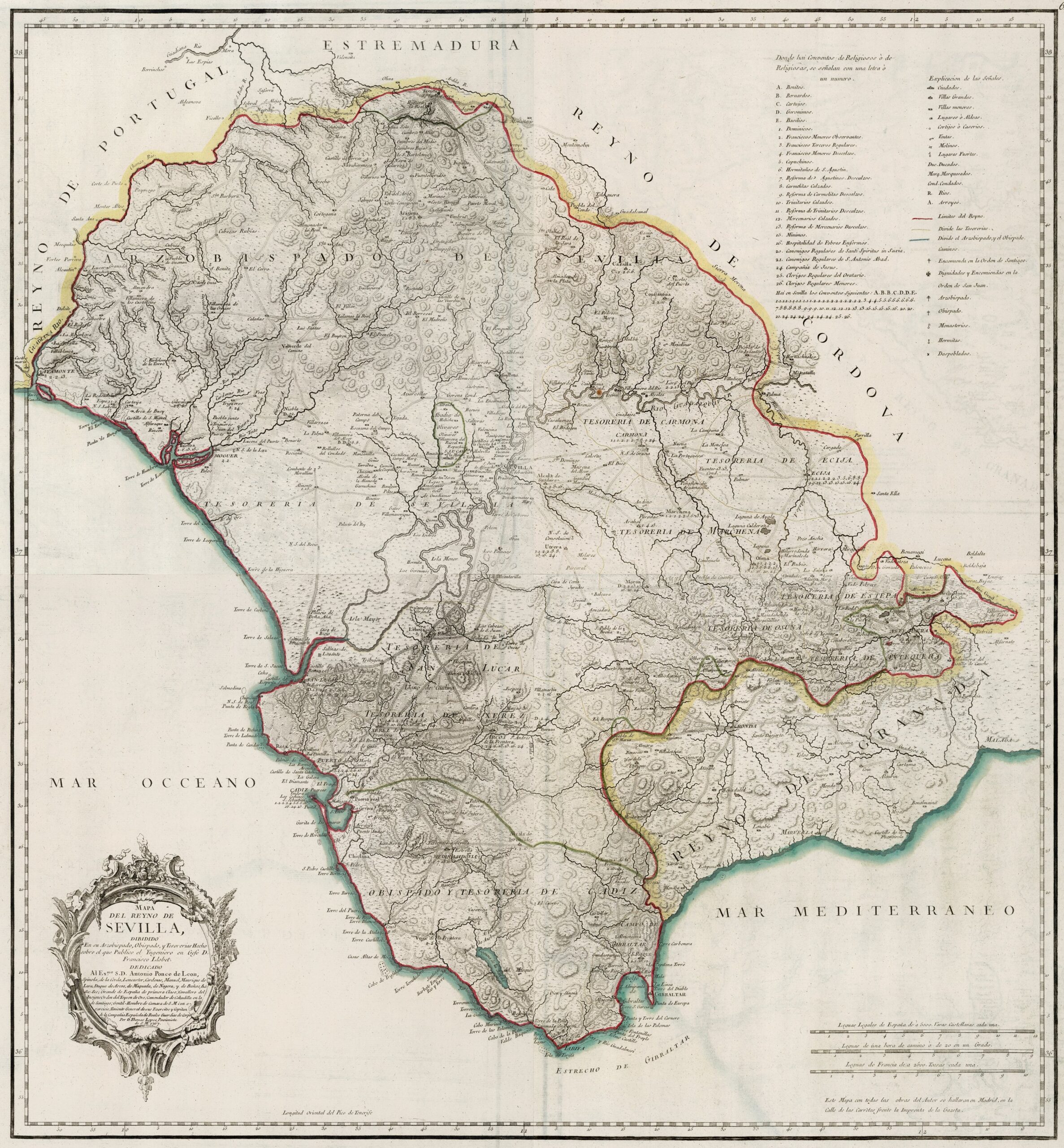
This map was created by Spanish cartographer Tomás López de Vargas Machuca in 1767 and published posthumously by his sons in the “Geographical Atlas of Spain” from 1804. The map depicts the Kingdom of Seville with the territorial boundaries prior to Javier de Burgos's reform of the provincial administration in 1833.
The Kingdom of Seville comprised, approximately, the current provinces of Huelva, Seville, and Cádiz. Furthermore, it bordered to the west with the Kingdom of Portugal, to the north with the province of Extremadura, to the northeast with the Kingdom of Córdoba, to the southeast with the Kingdom of Granada and to the south by the sea.
The administrative division of the kingdom comprised ten treasuries:
- Archbishopric and treasury of Seville
- Bishopric and treasury of Cádiz
- Treasury of Jerez de la Frontera
- Treasury of Sanlúcar de Barrameda
- Treasury of Écija
- Carmona Treasury
- Osuna Treasury
- Estepa Treasury
- Marchena Treasury
- Antequera Treasury.
This map curiously includes Gibraltar within the Treasury of Cadiz, despite the fact that the Rock became part of the United Kingdom after the Treaty of Utrecht in 1713.
You can read more about Tomás López and his atlas in this article from the newsletter: Tomás López and the first detailed atlas of Spain (1804).
Sources

