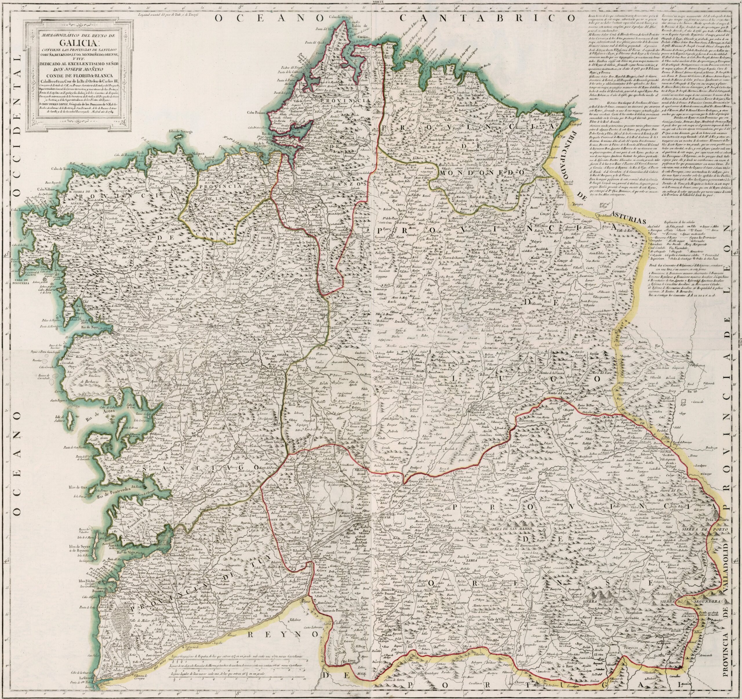
This map was created by Spanish cartographer Tomás López de Vargas Machuca in 1784 and published posthumously by his sons in the “Geographical Atlas of Spain” from 1804. The map depicts the Kingdom of Galicia with its territorial boundaries prior to the provincial administrative reform carried out by Javier de Burgos in 1833.
The Kingdom of Galicia had coastlines to the north and west, bordered to the south by the Kingdom of Portugal and to the east with the province of Valladolid, the province of León and the Principality of Asturias.
This map shows how the kingdom was still divided into its seven historical provinces:
- Province of Orense
- Province of Lugo
- Province of Mondoñedo
- Province of Betanzos
- Province of La Coruña
- Province of Santiago
- Province of Tuy
It is important to emphasise that the Kingdom of Galicia was the territorial unit equivalent to the Castilian provinces, while the Galician provinces corresponded more to the judicial districts of the Castilian provinces. In any case, the designation of province is not unique to Galicia, as it is also found in the case of province of Liébana and the province of Vierzo.
With the administrative reform, Galicia retained its status as a region of Spain and became composed of four provinces: the province of La Coruña, the province of Pontevedra, the province of Lugo and the province of Orense. The latter also gained part of the territory that until 1833 had belonged to the provinces of León and Valladolid.
You can read more about Tomás López and his atlas in this article from the newsletter: Tomás López and the first detailed atlas of Spain (1804).
Sources

