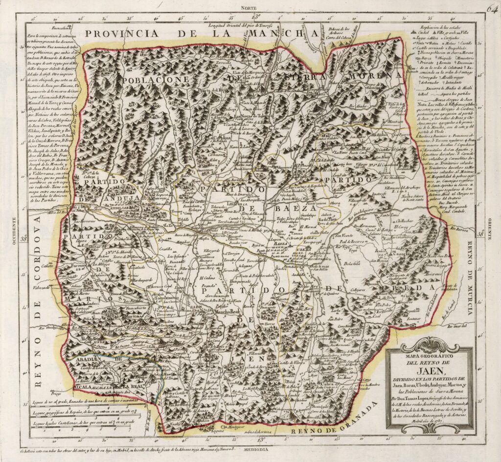
This map was created by Spanish cartographer Tomás López de Vargas Machuca in 1787 and published posthumously by his sons in the “Geographical Atlas of Spain” from 1804. The map depicts the Kingdom of Jaén with the territorial boundaries prior to Javier de Burgos' provincial administration reform in 1833.
The Kingdom of Jaén comprised approximately the current province of Jaén. It also bordered the province of La Mancha, to the east with the Kingdom of Murcia, as with the Kingdom of Granada and to the west with the Kingdom of Córdoba.
The administrative division of the kingdom comprised five judicial districts:
- Jaén match
- Baeza match
- Úbeda match
- Andújar match
- Martos match
The map also includes the Abbey of Alcalá la Real, an ecclesiastical institution that existed separately from the other bishoprics and enjoyed a certain degree of administrative independence, although nominally within the Kingdom of Jaén.
In addition, the map also shows the Towns of Sierra Morena at the top of the kingdom. This is a new administrative district, founded in 1784 and completely separate from the Kingdom of Jaén, with the same administrative capacity. This new administrative division was created during the reign of Charles III with the aim of ensuring the safe transit of people and goods between Madrid and the various cities of Andalusia.
You can read more about Tomás López and his atlas in this article from the newsletter: Tomás López and the first detailed atlas of Spain (1804).
Sources

