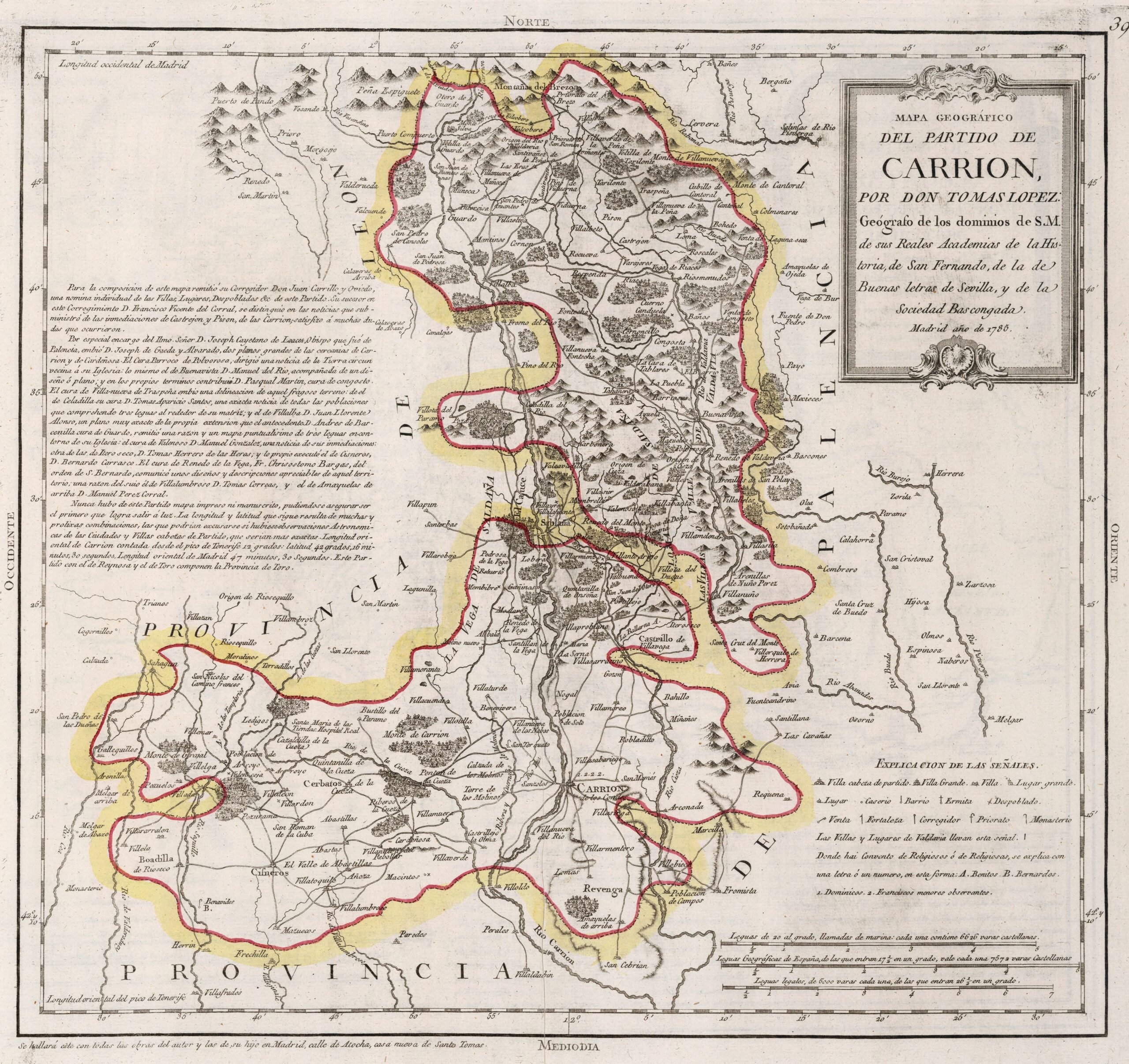
This map was created by Spanish cartographer Tomás López de Vargas Machuca in 1785 and published posthumously by his sons in the “Geographical Atlas of Spain” from 1804. The map shows the district of Carrión with the territorial boundaries prior to the provincial administrative reform carried out by Javier de Burgos in 1833.
At the end of the 18th century, the Carrión district was one of the three constituent districts of the former Province of Toro, along with the Bullfighting match and the Reynosa match. The three areas are completely isolated from each other, which is why Tomás López mapped them independently, as he notes on the map itself. It was bordered to the north and east by the Province of León and to the south and west with the Province of Palencia.
With the territorial reorganisation of 1833, the Province of Toro disappeared and the District of Carrión became part of the Province of Palencia.
You can read more about Tomás López and his atlas in this article from the newsletter: Tomás López and the first detailed atlas of Spain (1804).
Sources

