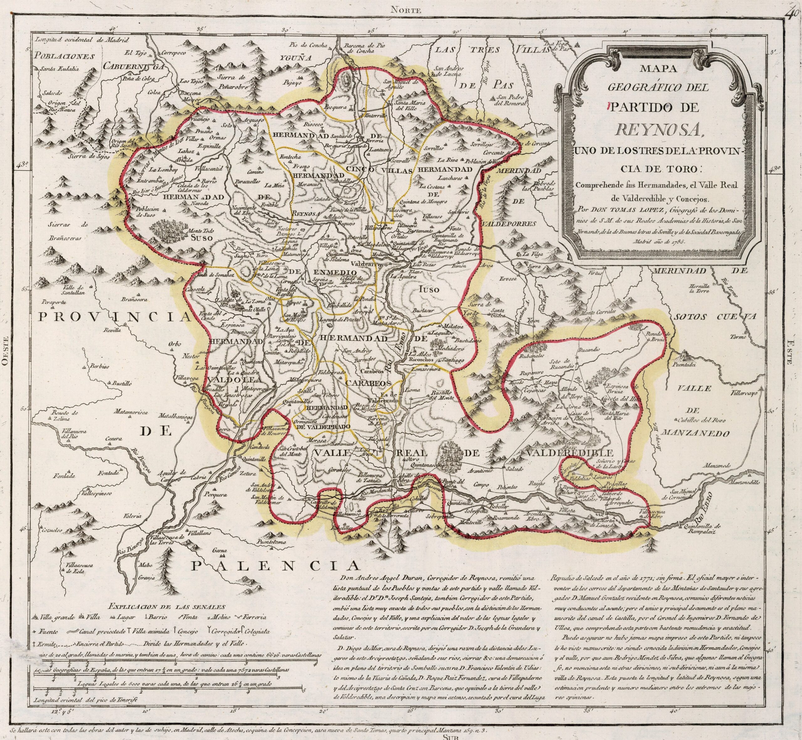
This map was created by Spanish cartographer Tomás López de Vargas Machuca in 1785 and published posthumously by his sons in the “Geographical Atlas of Spain” from 1804. The map depicts the district of Reynosa with the territorial boundaries prior to the reform of the provincial administration by Javier de Burgos in 1833.
At the end of the 18th century, the Reynosa District was one of the three constituent districts of the former Province of Toro, along with the Bullfighting match and the Carrión match. The three settlements are completely isolated from each other, which is why Tomás López mapped them independently, as he notes on the map itself. It bordered the south-west with the Province of Palencia and the rest was embedded next to the Staff of Laredo and the Province of Liébana.
This district was divided into the Royal Valley of Valderredible and seven brotherhoods: Enmedio, Suso, Cinco Villas, Iuso, Vadolea, Carabeos, and Valdeprado.
With the territorial reorganisation of 1833, the Province of Toro disappeared and the District of Carrión became part of the Province of Cantabria.
You can read more about Tomás López and his atlas in this article from the newsletter: Tomás López and the first detailed atlas of Spain (1804).
Sources

