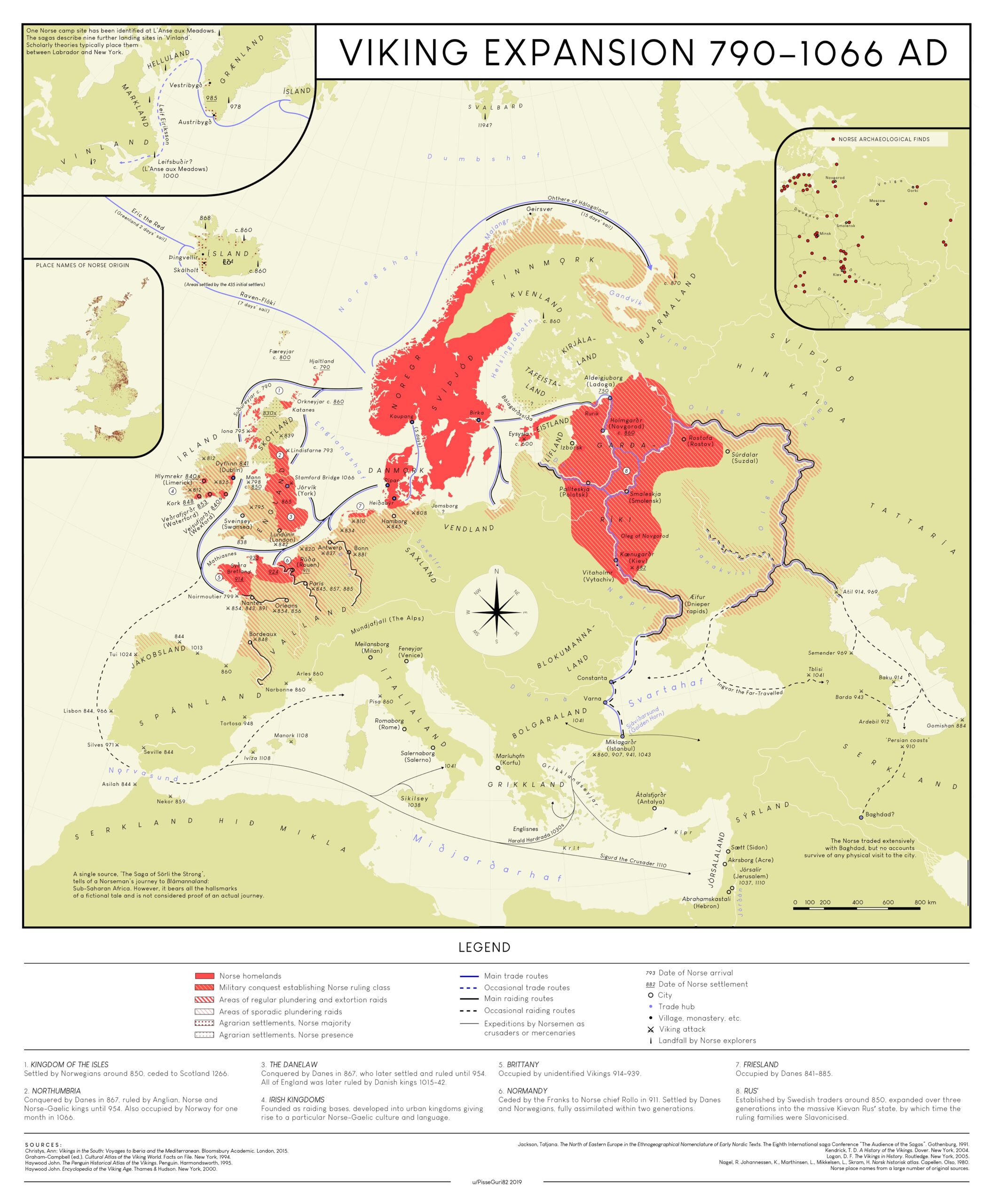
This map, created by Anders Kvernberg in 2019, shows Viking expansion between 790 and 1066.
The map uses colour coding to indicate the nature of the Viking presence in each region:
- The regions of origin of the Vikings, present-day Denmark, Sweden, and Norway, are shown in solid red.
- In red with small white lines, the regions conquered by the Vikings where they established themselves as ruling classes.
- Red diagonal lines (of varying thickness) indicate the areas that were raided by the Vikings with varying frequency.
- Red dots (of varying thickness) indicate the areas where the Vikings established agricultural settlements.
The map also shows the main trade routes (in blue) and plundering routes (in black), as well as the dates on which they reached different locations in Europe, the Middle East and North America.
Sources
- I couldn't find a detailed map of the Viking expansion, so I made one. (OC)
- Very high resolution map

